Marker Logo
THE HISTORICAL
MARKER DATABASE
“Bite-Size Bits of Local, National, and Global History”
Manistique in Schoolcraft County, Michigan — The American Midwest (Great Lakes)
 

Carl D. Bradley
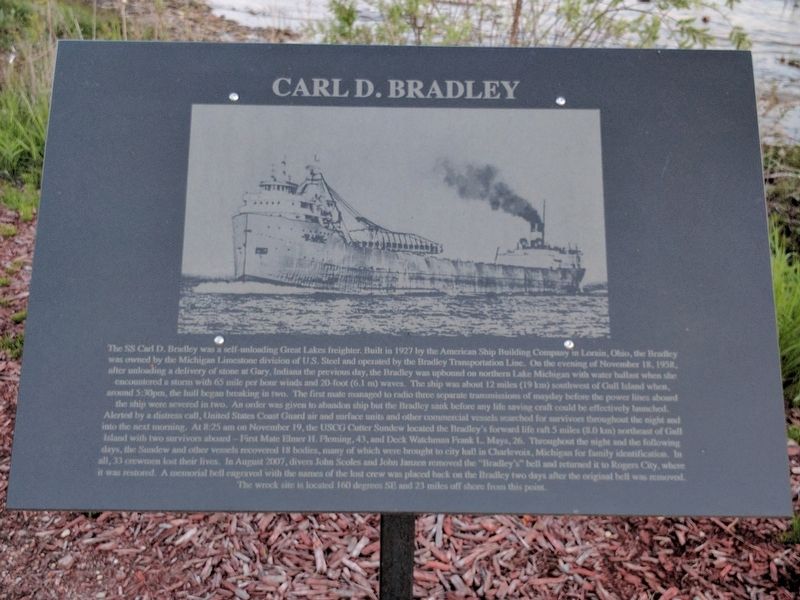
 
 
Carl D. Bradley Marker image. Click for full size.
Photographed by Joel Seewald, May 31, 2017
1. Carl D. Bradley Marker
Inscription. The SS Carl D. Bradley was a self-unloading Great Lakes freighter. Built in 1927 by the American Ship Building Company in Lorain, Ohio, the Bradley was owned by the Michigan Limestone division of U.S. Steel and operated by the Bradley Transportation Line. On the evening of November 18, 1958, after unloading a delivery of stone at Gary, Indiana the previous day, the Bradley was upbound on northern Lake Michigan with water ballast when she encountered a storm with 65 mile per hour winds and 20-foot (6.1 m) waves. The ship was about 12 miles (19 km) southwest of Gull Island when, around 5:30pm, the hull began to break in two. The first mate managed to radio three separate transmissions of mayday before the power lines aboard the ship were severed in two. An order was given to abandon ship but the Bradley sank before any life saving craft could be effectively launched. Alerted by a distress call, United States Coast Guard air and surface units and other commercial vessels searched for survivors throughout the night and into the next morning. At 8:25 am on November 19, the USCG Cutter Sundew located the Bradley's forward life
Paid Advertisement
Click or scan to see
this page online
raft 5 miles (8.0 km) northeast of Gull Island with two survivors aboard — First Mate Elmer H. Fleming, 43, and Deck Watchman Frank L. Mays, 26. Throughout the night and the following days, the Sundew and other vessels recovered 18 bodies, many of which were brought to city hall in Charlevoix, Michigan for family identification. In all, 33 crewmen lost their lives. In August 2007, divers John Scoles and John Janzen removed the "Bradley's" bell and returned it to Rogers City, where it was restored. A memorial bell engraved with the names of the lost crew was placed back on the Bradley two days after the original bell was removed. The wreck site is located 160 degrees SE and 23 miles off shore from this point.
 
Erected 2014.
 
Topics and series. This historical marker is listed in these topic lists: DisastersWaterways & Vessels. In addition, it is included in the Lost at Sea series list. A significant historical month for this entry is August 2007.
 
Location. 45° 56.776′ N, 86° 14.12′ W. Marker is in Manistique, Michigan, in Schoolcraft County. It is on Lakeshore Drive (U.S. 2), on the left when traveling west. Marker is in Carl
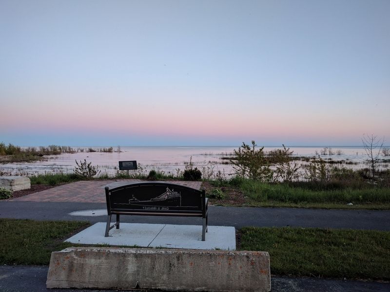
Carl D. Bradley Marker and Bench image. Click for full size.
Photographed by Joel Seewald, May 31, 2017
2. Carl D. Bradley Marker and Bench

D. Bradley Memorial Park, about 0.1 mile from the intersection of Lakeshore Drive and Veterans Drive. Touch for map. Marker is in this post office area: Manistique MI 49854, United States of America. Touch for directions.

Regionally, this marker is on Michigan’s Upper Peninsula. It is also in the American Midwest and on the Great Lakes. Globally, it is in North America, the Great North Woods, the Western Hemisphere, the Western World, and the Anglosphere. Historically, it finds itself in what was once the Northwest Territory.

Other nearby markers. At least 8 other markers are within walking distance of this marker: Manistique Boardwalk (about 400 feet away, measured in a direct line); Near-Shore Sawdust and Wood Chip Deposits (approx. 0.4 miles away); Manistique Water Tower (approx. 0.4 miles away); The Manistique Lighthouse (approx. 0.4 miles away); a different marker also named Manistique Boardwalk (approx. 0.7 miles away); Living Memorial to the Soldiers and Sailors (approx. 0.9 miles away); Schoolcraft County World War Honor Roll (approx. 0.9 miles away); Schoolcraft County Veterans Memorial (approx. 0.9 miles
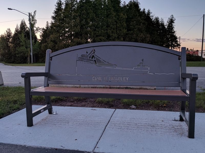
Carl D. Bradley Memorial Bench image. Click for full size.
Photographed by Joel Seewald, May 31, 2017
3. Carl D. Bradley Memorial Bench
away). Touch for a list and map of all markers in Manistique.
 
Also see . . .
1. SS Carl D. Bradley. Wikipedia article about the ship. (Submitted on June 5, 2017, by Joel Seewald of Madison Heights, Michigan.) 

2. Carl D Bradley. Underwater video of the sunken ship. (Submitted on June 5, 2017, by Joel Seewald of Madison Heights, Michigan.) 
 
 
Credits. This page was last revised on November 27, 2024. It was originally submitted on June 5, 2017, by Joel Seewald of Madison Heights, Michigan. This page has been viewed 1,257 times since then and 118 times this year. Photos:   1, 2, 3. submitted on June 5, 2017, by Joel Seewald of Madison Heights, Michigan.

m=104092

CeraNet Cloud Computing sponsors the Historical Marker Database.
This website earns income from purchases you make after using our links to Amazon.com. We appreciate your support.
Paid Advertisement
Jul. 11, 2026