Mining Methods
Lackawanna Valley Industrial Highway
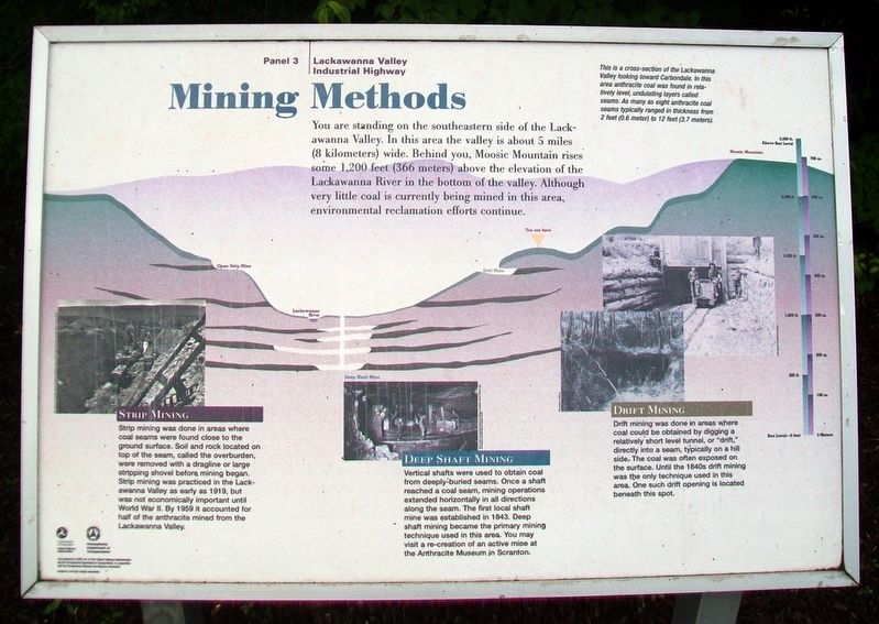
You are standing on the southeastern side of the Lackawanna Valley. In this area the valley is about 5 miles (8 kilometers) wide. Behind you, Moosic Mountain rises some 1,200 feet (366 meters) above the elevation of the Lackawanna River in the bottom of the valley. Although very little coal is currently being mined in this area, environmental reclamation efforts continue.
Strip Mining
Strip mining was done in areas where coal seams were found close to the ground surface. Soil and rock located on top of the seam, called the overburden, were removed with a dragline or large stripping shovel before mining began. Strip mining was practiced in the Lackawanna Valley as early as 1919, but was not economically important until World War II. By 1959 it accounted for half of the anthracite mined from the Lackawanna Valley.
Deep Shaft Mining
Vertical shafts were used to obtain coal from deeply-buried seams. Once a shaft reached a coal seam, mining operations extended horizontally in all directions along the seam. The first local shaft mine was established in 1843. Deep shaft mining became the primary mining technique used in
this page online
Drift Mining
Drift mining was done in areas where coal could be obtained by digging a relatively short level tunnel, or "drift," directly into a seam, typically on a hill side. The coal was often exposed on the surface. Until the 1840s drift mining was the only technique used in this area. One such drift opening is located beneath this spot.
[Marker background illustration]
This is a cross-section of the Lackawanna Valley looking toward Carbondale. In this area anthracite coal was found in relatively level, undulating layers called seams. As many as eight anthracite coal seams typically ranged in thickness from 2 feet (0.6 meter) to 12 feet (3.7 meters).
Erected by Pennsylvania Dept of Transportation and the Federal Highway Commission. (Marker Number 3.)
Topics. This historical marker is listed in these topic lists: Environment • Industry & Commerce. A significant historical year for this entry is 1919.
Location. 41° 33.198′ N, 75° 29.695′ W. Marker is near Carbondale, Pennsylvania, in Lackawanna County. It is in Carbondale Township.

Regionally, this marker is in the Wyoming Valley and in Greater Scranton and Wilkes-Barre. It is also in the American Northeast, in the Mid-Atlantic, in Appalachia, and specifically in Northern Appalachia. Globally, it is in North America, the Western Hemisphere, the Western World, and the Anglosphere. Historically, it finds itself in what was once the Haudenosaunee (Iroquois) Confederacy and also one of the original Thirteen Colonies.
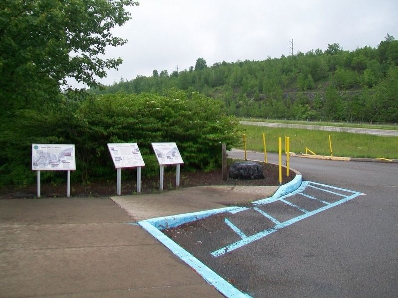
Other nearby markers. At least 8 other markers are within 2 miles of this marker, measured as the crow flies: From Mine to Market (here, next to this marker); The Gravity Railroad (here, next to this marker); McCawley Park: Carbondale's UFO (approx. 1.2 miles away); Carbondale (approx. 1.2 miles away); The First Underground Anthracite Mine (approx. 1.4 miles away); Site of the First Deep Underground Anthracite Mine in America
Also see . . .
1. History of the Pennsylvania Anthracite Region. (Submitted on June 6, 2017, by William Fischer, Jr. of Reynoldsburg, Ohio.)
2. Anthracite Coal Mines and Mining. (Submitted on June 6, 2017, by William Fischer, Jr. of Reynoldsburg, Ohio.)
3. Pennsylvania Anthracite Heritage Museum. (Submitted on June 6, 2017, by William Fischer, Jr. of Reynoldsburg, Ohio.)
Credits. This page was last revised on January 21, 2025. It was originally submitted on June 6, 2017, by William Fischer, Jr. of Reynoldsburg, Ohio. This page has been viewed 727 times since then and 63 times this year. Photos: 1, 2, 3. submitted on June 6, 2017, by William Fischer, Jr. of Reynoldsburg, Ohio. 4. submitted on June 11, 2017, by William Fischer, Jr. of Reynoldsburg, Ohio.
