Aldie in Loudoun County, Virginia — The American South (Mid-Atlantic)
The Fog of War
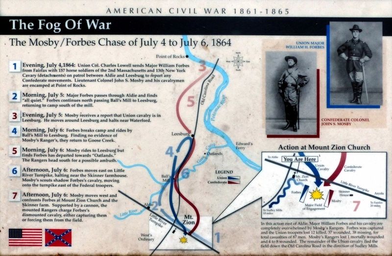
The Mosby / Forbes Chase of July 4 to July 6, 1864
— American Civil War 1861 - 1865 —
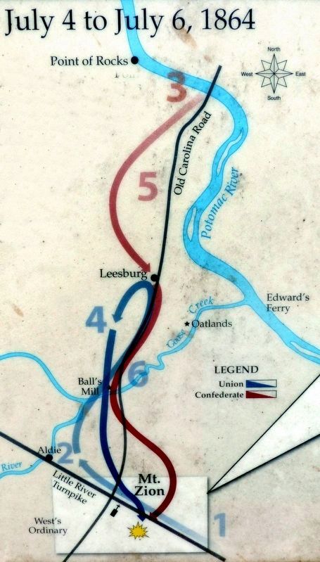
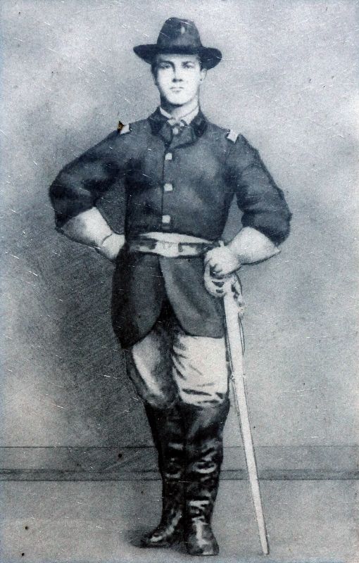
❶ Evening, July 4, 1864: Union Col. Charles Lowell sends Major William Forbes from Fairfax with 157 horse soldiers of the 2nd Massachusetts and 13th New York Cavalry (detachments) on patrol between Aldie and Leesburg to report any Confederate movements. Lieutenant Colonel John S. Mosby and his cavalrymen are encamped at Point of Rocks.
❷ Morning, July 5: Major Forbes passes through Aldie and finds “all quiet.” Forbes continues north passing Ball's Mill to Leesburg, returning to camp south of the mill.
❸ Evening, July 5: Mosby receives a report that Union cavalry is in Leesburg. He moves around Leesburg and halts near Waterford.
❹ Morning July 6: Forbes breaks camp and rides by Balls Mill to Leesburg. Finding no evidence of Mosby's Rangers, they return to Goose Creek.
❺ Morning, July 6: Mosby rides to Leesburg but finds Forbes has departed towards “Oatlands.” The Rangers head south for a possible ambush.
❻ Afternoon, July 6: Forbes moves east on Little River Turnpike, halting near the Skinner farmhouse. Mosby's scouts shadow Forbes's cavalry, moving onto the turnpike east of the Federal troopers.
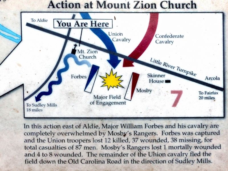
❼ Afternoon, July 6: Mosby moves west and confronts Forbes at Mount Zion Church and the Skinner farm. Supported by a cannon, the mounted Rangers charge Forbes's dismounted cavalry, either capturing them or forcing them from the field.
Topics. This historical marker is listed in this topic list: War, US Civil. A significant historical month for this entry is July 1864.
Location. 38° 57.807′ N, 77° 36.557′ W. Marker is in Aldie, Virginia, in Loudoun County. Marker can be reached from the intersection of Lee Jackson Memorial Highway (U.S. 50) and Watson Road (Virginia Route 860), on the left when traveling west. At Mt. Zion Old School Baptist Church. Touch for map. Marker is at or near this postal address: 40319 Lee Jackson Memorial Highway, Aldie VA 20105, United States of America. Touch for directions.
Other nearby markers. At least 8 other markers are within walking distance of this marker. The Mosby-Forbes Engagement July 6, 1864 (here, next to this marker); Elders of the Mount Zion Old School Baptist Church (a few steps from this marker); Mt. Zion Historic Park (a few steps from this marker); Mt. Zion Church (within shouting distance of this marker); Mt. Zion Cemetery (within shouting distance of this marker); Mt. Zion Old School Baptist Church (within shouting distance of this marker); Plain Path…Shenandoah Hunting Path…Carolina Road…Rogue’s Road… (about 400 feet away, measured in a direct line); This is Gilbert's Corner! (about 600 feet away). Touch for a list and map of all markers in Aldie.
Photographed By Allen C. Browne, June 12, 2017
4. Action at Mount Zion Church
In this action east of Aldie, Major Forbes and his cavalry are completely overwhelmed by Mosby's Rangers. Forbes was captured and Union troopers lost 12 killed , 37 wounded, 38 missing, for total casualties of 87 men. Mosby's Rangers lost 1 mortally wounded and 4 to 8 wounded. The remainder of the Union cavalry fled the field down the Old Carolina Road in the direction of Sudley Mills.Close-up of map on marker
Credits. This page was last revised on June 19, 2017. It was originally submitted on June 15, 2017, by Allen C. Browne of Silver Spring, Maryland. This page has been viewed 560 times since then and 22 times this year. Photos: 1, 2, 3, 4, 5, 6. submitted on June 15, 2017, by Allen C. Browne of Silver Spring, Maryland. • Bernard Fisher was the editor who published this page.
