King near Ann Arbor in Washtenaw County, Michigan — The American Midwest (Great Lakes)
Native American Trails
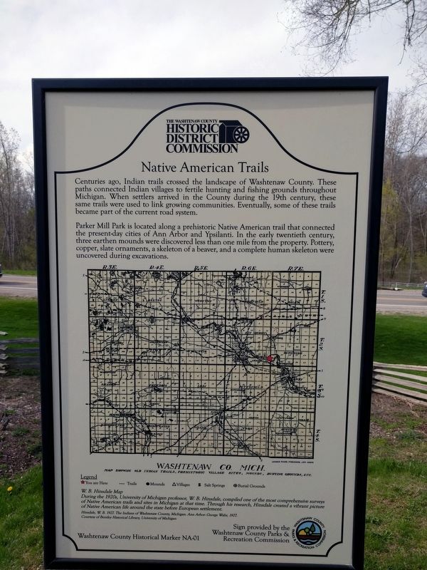
Centuries ago, Indian trails crossed the landscape of Washtenaw County. These paths connected Indian villages to fertile hunting and fishing grounds throughout Michigan. When settlers arrived in the County during the 19th century, these same trails were used to link growing communities. Eventually, some of these trails became part of the current road system.
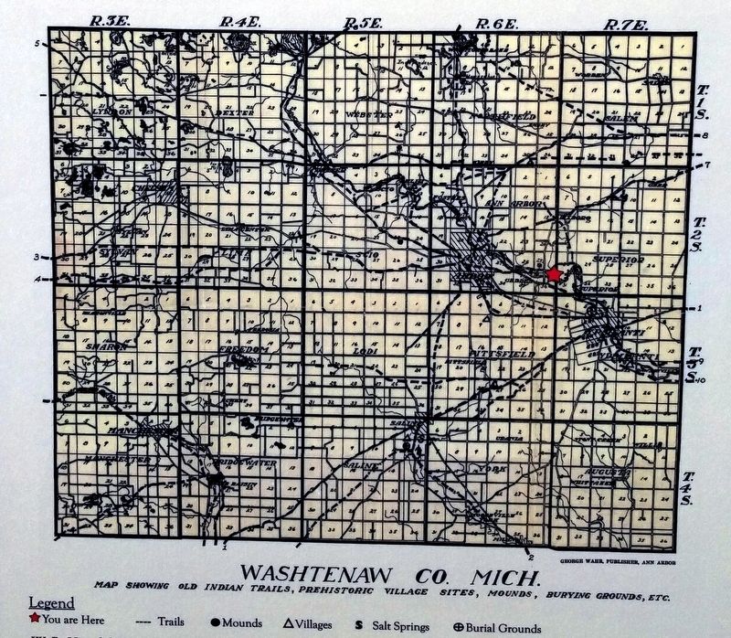
Parker Mill Park is located along a prehistoric Native American trail that connected the present-day cities of Ann Arbor and Ypsilanti. In the early twentieth century, three earthen mounds were discovered less than one mile from the property. Pottery, copper, slate ornaments, a skeleton of a beaver, and a complete human skeleton were uncovered during excavations.
W. B. Hinsdale Map
During the 1920s, University of Michigan professor, W. B. Hinsdale, compiled one of the most comprehensive surveys of Native American trails and sites in Michigan at that time. Through his research, Hinsdale created a vibrant picture of Native American life around the state before European settlement.
Hinsdale, W. B. 1927. The Indians of Washtenaw County, Michigan, Ann Arbor: George Waht, 1927.
Courtesy of Bentley Historical Library, University of Michigan
Sign provided by the Washtenaw County Parks & Recreation Commission
Erected by The Washtenaw County Historic District Commission. (Marker Number NA-01.)
Topics. This historical marker is listed in this topic list: Native Americans. A significant historical year for this entry is 1927.
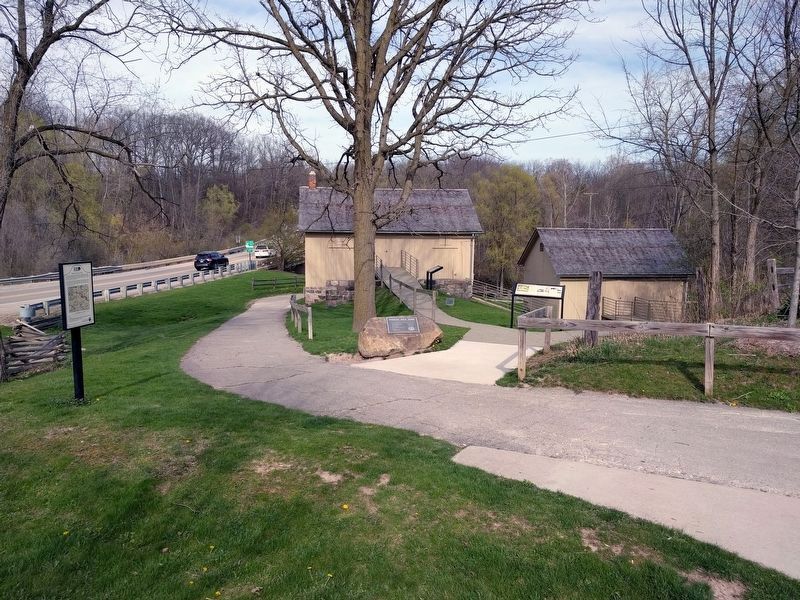
Location. 42° 16.441′ N, 83° 40.083′ W. Marker is near Ann Arbor, Michigan, in Washtenaw County. It is in King. Marker is on Geddes Road, 0.2 miles east of North Dixboro Road, on the right when traveling east. Marker is in Parker Mill County Park, near the parking lot. Touch for map. Marker is at or near this postal address: 4650 Geddes Road, Ann Arbor MI 48105, United States of America. Touch for directions.
Other nearby markers. At least 8 other markers are within walking distance of this marker. Welcome to the Parker Family Mills! (here, next to this marker); Grist Mill (a few steps from this marker); The Gristmill (a few steps from this marker); Cider Mill (a few steps from this marker); The Parker Family & Mill (within shouting distance of this marker); Landscape Transformed (within shouting distance of this marker); Hoyt Garrod Post and Family History (within shouting distance of this marker); The Power of Fleming Creek (within shouting distance of this marker). Touch for a list and map of all markers in Ann Arbor.
Also see . . . The Indians of Washtenaw County, Michigan. Link to the book mentioned on the marker. The original map is on page 69. (Submitted on June 23, 2017, by Joel Seewald of Madison Heights, Michigan.)
Credits. This page was last revised on February 12, 2023. It was originally submitted on June 23, 2017, by Joel Seewald of Madison Heights, Michigan. This page has been viewed 1,236 times since then and 103 times this year. Photos: 1, 2, 3, 4. submitted on June 23, 2017, by Joel Seewald of Madison Heights, Michigan.


