Near Scotland in St. Mary's County, Maryland — The American Northeast (Mid-Atlantic)
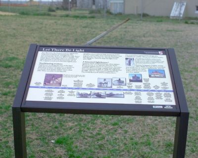
Let There Be Light
Point Lookout State Park
— Maryland Park Service —
Inscription.
For 136 years, the Point lookout Lighthouse
helped generations of Chesapeake Bay
mariners avoid shoals, navigate through dense
fog, and find the Potomac River’s mouth. The
beam shone until 1966, when an automated light off Point Lookout assumed the job of the original wood-and-masonry lighthouse.
Trailblazing Women. Lighthouse keeping was one of the first non-clerical government jobs available to American women. In 1830, when Point Lookout’s first keeper James Davis died after three months of service, his daughter Ann replaced him, working on for 17 years. Then came short tenures for three men followed by two years for Martha Edwards. Her daughter Pamelia kept the light from 1855-1869.
A haunted lighthouse? Isolated wind-swept buildings often attract ghost stories, if not ghosts, and the point Lookout lighthouse is no exception. Decades-old tales about strange sounds and sightings led a parapsychologist to study the lighthouse in 1980, and the Maryland Committee for Psychical Research held a séance there. The committee reported the image of a Confederate soldier. But proof remains elusive.
“[Grandfather] would fix us baked turtle for dinner which I didn’t look forward to.” Recollection by Mildred Lucy Goldhborough Voight, granddaughter of William Yeatman, lighthouse keeper for 37 years.
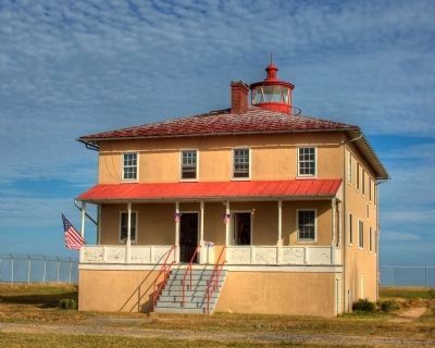
During Yeatman’s lengthy tenure (1871–1908) the light was expanded and modernized, a buoy depot built, and the house raised one story, with a new tin roof and porches added.
(caption) The Point Lookout Lighthouse, built by John Donohoo, began operations on September 20, 1830.
Erected by Point Lookout State Park, Maryland Park Service.
Topics and series. This historical marker is listed in these topic lists: Notable Buildings • Waterways & Vessels • Women. In addition, it is included in the Lighthouses series list. A significant historical month for this entry is September 1787.
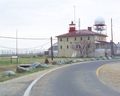
Location. 38° 2.345′ N, 76° 19.321′ W. Marker is near Scotland, Maryland, in St. Mary's County. Marker is on Point Lookout Road, at its southernmost tip (Maryland Route 5), on the right when traveling north. It is at the Point Lookout Lighthouse. Touch for map. Marker is in this post office area: Scotland MD 20687, United States of America. Touch for directions.
Other nearby markers. At least 8 other markers are within walking distance of this marker. A Crucial Point (within shouting distance of this marker); John Wilkes Booth (within shouting distance of this marker); Point Lookout State Park (within shouting distance of this marker); Point Lookout-Hammond Hospital (within shouting distance of this marker); Defense Strategies
(about 600 feet away, measured in a direct line); Fort Lincoln (about 600 feet away); A Bustling Civil War Community (about 600 feet away); "Contraband" Camp (approx. 0.2 miles away). Touch for a list and map of all markers in Scotland.
More about this marker. Marker is in the Point Lookout State Park. A fee per person is charged to enter the park.
Regarding Let There Be Light. Click on the map link in the Location Section and switch to satellite view to see the point and the buildings. Zoom out on the map to see the expanse of water that is the Chesapeake Bay and the mouth of the Potomac River.
The lighthouse is open only once a year on the first Saturday in November.
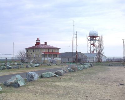
The radar tower seen in the 2007 photos has since been removed.
Also see . . . History of and Hauntings of the Point Lookout Lighthouse. (Submitted on May 6, 2007.)
Photographed By Tom Fuchs, March 31, 2007
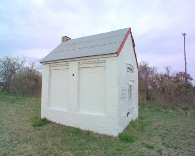
3. Lightkeeper’s Smoke House
The sign on the building reads, “this building is a smoke house that was used by the Point Lookout Light House keeper. This property is part of Point Lookout State Park by donation from the United States Government, Department of the Interior.”
Credits. This page was last revised on July 14, 2019. It was originally submitted on May 6, 2007, by Tom Fuchs of Greenbelt, Maryland. This page has been viewed 1,751 times since then and 15 times this year. Last updated on June 26, 2017, by Pete Payette of Orange, Virginia. Photos: 1, 2, 3, 4. submitted on May 6, 2007, by Tom Fuchs of Greenbelt, Maryland. 5. submitted on March 7, 2009, by Jason Rearick of Lexington Park, Maryland. • Bill Pfingsten was the editor who published this page.
