Near Great Falls in Fairfax County, Virginia — The American South (Mid-Atlantic)
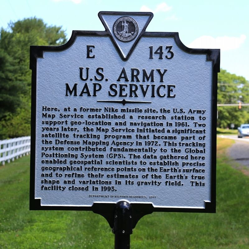
U.S. Army Map Service
Erected 2017 by Department of Historic Resources. (Marker Number E-143.)
Topics and series. This historical marker is listed in these topic lists: Air & Space • Communications • Military • Science & Medicine. In addition, it is included in the Virginia Department of Historic Resources (DHR) series list. A significant historical year for this entry is 1961.
Location. 38° 59.866′ N, 77° 18.866′ W. Marker is near Great Falls, Virginia, in Fairfax County. Marker is on Springvale Road (County Route 673) just south of Georgetown Pike (Virginia Route 193). Touch for map. Marker is in this post office area: Great Falls VA 22066, United States of America. Touch for directions.
Other nearby markers. At least 8 other markers are within 2 miles of this marker, measured as the crow flies. Great Falls Nike Missile Site (a few steps from this marker); Forestville Volunteer Fire Department, est. May 5, 1942 (approx. 1.2 miles away); Battle of Dranesville (approx. 1˝ miles away); Sharpsburg / Antietam Campaign (approx. 1˝ miles away); Forestville School (approx. 1.6 miles away); Action At Dranesville (approx. 1.6 miles away); Fields of Fire (approx. 1.6 miles away); Gettysburg Campaign (approx. 1.6 miles away). Touch for a list and map of all markers in Great Falls.
Also see . . .
1. Wikipedia entry for Global Positioning System. “During Labor Day weekend in 1973, a meeting of about twelve military officers at the Pentagon discussed the creation of a Defense Navigation Satellite System (DNSS). It was at this meeting that the real synthesis that became GPS was created. Later that year, the DNSS program was named Navstar, or Navigation System Using Timing and Ranging. With the individual satellites being associated with the name Navstar (as with the predecessors Transit and Timation), a more fully encompassing name was used to identify the constellation of Navstar satellites, Navstar-GPS.” (Submitted on June 26, 2017.)
2. A brief history of GPS (video from CNN).
Credits. This page was last revised on July 7, 2021. It was originally submitted on June 26, 2017, by J. J. Prats of Powell, Ohio. This page has been viewed 928 times since then and 36 times this year. Photos: 1, 2. submitted on June 26, 2017, by J. J. Prats of Powell, Ohio.
