Scotland in St. Mary's County, Maryland — The American Northeast (Mid-Atlantic)
Fort Lincoln
Point Lookout State Park
| — | Maryland Park Service | — |
Photographed by Tom Fuchs, July 1, 2008
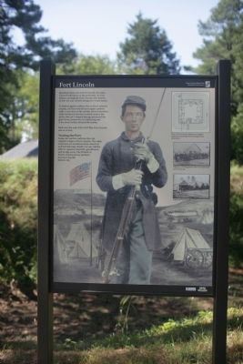
1. Fort Lincoln Marker
Standing before you is Fort Lincoln, the main Union fortification on the peninsula. As a key defense stronghold, Fort Lincoln, also known as Fort #2, was cleverly designed to resist attack.
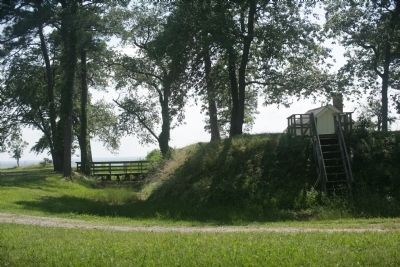
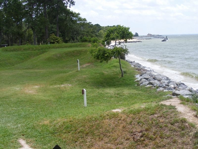
To defend against artillery fire or direct infantry assaults, the Fort had 60-yard square earthen walls. Loose dirt on the outside slowed attackers, while hardened interiors resisted cannon fire. At the rear, an L-shaped passage protected the gates from cannon fire or a battering ram. A dry moat further delayed the enemy.
Built near the end of the Civil War, Fort Lincoln saw no action.
Visiting the Fort
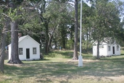
Today, the earthen walls are the only original vestiges of Fort Lincoln. The other structures are reconstructions, based on archival drawings. Inside you can visit the officers quarters, barracks, guardhouse and storage areas. The Friends of Point Lookout are key partners in preserving this historic site.
Erected by Maryland Park Service.
Topics. This historical marker is listed in these topic lists: Forts and Castles • War, US Civil.
Location. This marker has been replaced by another marker nearby. It was located near 38° 2.889′ N, 76° 19.548′ W. Marker was in Scotland, Maryland, in St. Mary's County. It could be reached from Point Lookout Road (Maryland Route 5) 1½ miles south of 3rd Way, on the right when traveling south. Touch for map. Marker was at or near this postal address: 10444 Point Lookout Rd, Scotland MD 20687, United States of America. Touch for directions.

Regionally, this marker was in Southern Maryland. It was also in the American South, specifically in the Upper South, in the Mid-Atlantic, in the Tidewater, in the Chesapeake Bay Region, and on the Eastern Seaboard. Globally, it was in the North Atlantic Region, North America,
this page online
Other nearby markers. At least 8 other markers are within walking distance of this location: Civil War Fort #3 (here, next to this marker); Defense Strategies (here, next to this marker); A Crucial Point (a few steps from this marker); Storm Blocks the Road to Freedom (a few steps from this marker); Redoubt #3 (a few steps from this marker); The Veteran Reserve Corps (within shouting distance of this marker); The 5th Massachusetts Colored Cavalry (within shouting distance of this marker); United States Colored Troops (within shouting distance of this marker). Touch for a list and map of all markers in Scotland.
Photographed by Tom Fuchs, July 1, 2008
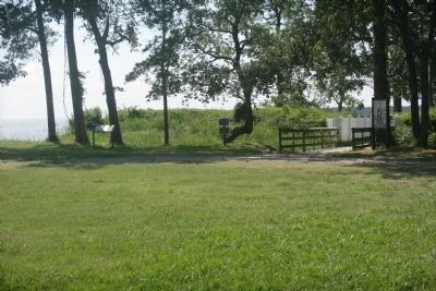
2. Entrance to Fort Lincoln
Photographed by Tom Fuchs, July 1, 2008
3. Earthen Wall Surrounding the Fort
Photographed by Tom Fuchs, July 1, 2008
4. Interior of the Fort
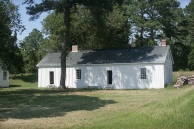
Photographed by Tom Fuchs, July 1, 2008
5. Barracks
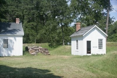
Photographed by Tom Fuchs, July 1, 2008
6. Small Building Near Entrance
Photographed by Pete Payette, June 19, 2017
7. Fort Lincoln
What's left of the western fort wall along the Potomac River shoreline. The Point Lookout Lighthouse is visible in the distance.
Credits. This page was last revised on April 13, 2026. It was originally submitted on July 8, 2008, by Tom Fuchs of Greenbelt, Maryland. This page has been viewed 2,481 times since then and 183 times this year. Last updated on June 26, 2017, by Pete Payette of Orange, Virginia. Photos: 1, 2, 3, 4, 5, 6. submitted on July 8, 2008, by Tom Fuchs of Greenbelt, Maryland. 7. submitted on June 26, 2017, by Pete Payette of Orange, Virginia. • Bernard Fisher was the editor who published this page.
