Phoebus in Hampton, Virginia — The American South (Mid-Atlantic)
Camp Hamilton
On Sacred Soil
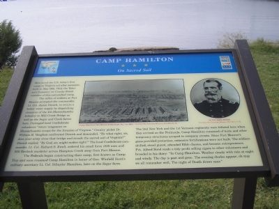
The influx of soldiers at Fort Monroe prompted the commander, Lt. Col. Justin Dimick, to secure a better water supply by dispatching elements of the 4th Massachusetts Infantry to Mill Creek Bridge as well as the Segar and Clark farms here. Outraged local Confederate volunteers “swore vengeance on Massachusetts troops for the Invasion of Virginia.” Cavalry picket Dr. William R. Vaughan confronted Dimick and demanded, “By what right does your army cross that bridge and invade the sacred soil of Virginia?” Dimick replied, “By God, sir, might makes right!” The local Confederate commander, Lt. Col. Richard S. Ewell, ordered his small force (820 men and 300 flintlock muskets) across Hampton Creek away from Fort Monroe.
The Federals began constructing their camp, first known as Camp Troy and soon renamed Camp Hamilton in honor of Gen. Winfield Scott’s military secretary Lt. Col. Schuyler Hamilton, here on the Segar farm. The 2nd New York and the 1st Vermont regiments were billeted here when they arrived on the Peninsula. Camp Hamilton consisted of tents and other temporary structures arrayed in company streets. Since Fort Monroe’s guns provided protection, extensive fortifications were not built. The soldiers drilled, stood guard, attended Bible classes, and became entrepreneurs. Pvt. Alfred Bond made a tidy profit selling cigars to other volunteers and brooded in his diary: “In Camp Hamilton. Weather cloudy with rain at night and windy. The day is past and gone. The evening shades appear; oh may we all remember well, The night of Death draws near.”
Erected by Virginia Civil War Trails.
Topics and series. This historical marker is listed in this topic list: War, US Civil. In addition, it is included in the Virginia Civil War Trails series list. A significant historical month for this entry is May 1861.
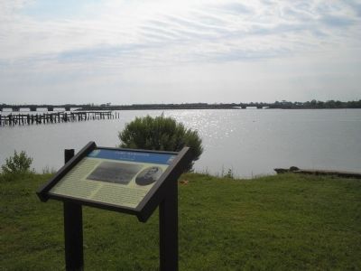
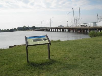
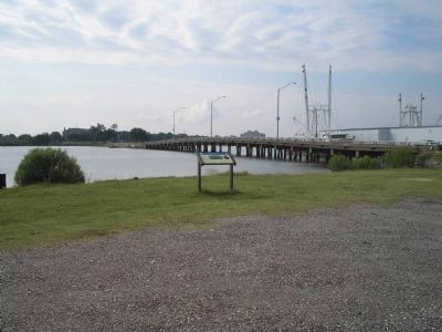
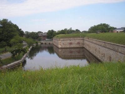
Location. 37° 0.872′ N, 76° 19.086′ W. Marker is in Hampton, Virginia. It is in Phoebus. Marker is on Water Street (Virginia Route 143), on the left when traveling south. Marker is just before the bridge leading to the Main Entrance of Fort Monroe in Hampton’s historic Phoebus area. Touch for map. Marker is in this post office area: Hampton VA 23663, United States of America. Touch for directions.
Other nearby markers. At least 8 other markers are within walking distance of this marker. War of 1812 (here, next to this marker); Saint Mary Star Of The Sea And Its School (about 400 feet away, measured in a direct line); In Memoriam (approx. 0.3 miles away); Phoebus - The Gateway To The New World (approx. 0.3 miles away); Town Hall / Fire Department (approx. 0.3 miles away); Harrison Phoebus (approx. 0.3 miles away); Phoebus Life (approx. 0.3 miles away); Chesapeake & Ohio (approx. 0.4 miles away). Touch for a list and map of all markers in Hampton.
More about this marker. The top of the marker contains a picture of “Camp Hamilton, Fort Monroe & Rip-Raps, Va.,” ca. 1861. Next to this is a photograph of Camp Hamilton’s commander, Lt. Col. Justin Dimick. Both pictures are Courtesy of The Casemate Museum, Fort Monroe, Va.
Also see . . . More Tidewater Virginia Sites. Civil War Traveler. (Submitted on August 19, 2008, by Bill Coughlin of Woodland Park, New Jersey.)
Photographed By Chancer Irving Hill, circa May 15, 2012
5. Camp Hamilton Marker
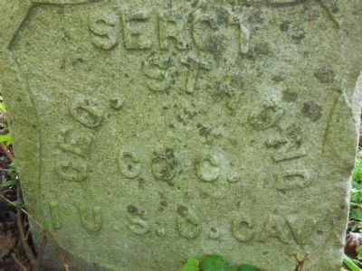
Sergeant Geo.Strong First Regiment US Colored Cavalier..Sergeant Strong was part of this Regiment that formed here at Camp Hamilton in 1863.His grave can be found at the corner of Mercury Blvd and Woodland Rd at the Zion Cemetery.
Credits. This page was last revised on February 1, 2023. It was originally submitted on August 19, 2008, by Bill Coughlin of Woodland Park, New Jersey. This page has been viewed 4,860 times since then and 114 times this year. Photos: 1, 2, 3, 4. submitted on August 19, 2008, by Bill Coughlin of Woodland Park, New Jersey. 5. submitted on May 28, 2012, by Chancer Irving Hill of Hampton, Virginia. 6. submitted on August 19, 2008, by Bill Coughlin of Woodland Park, New Jersey.
