Paducah in Cottle County, Texas — The American South (West South Central)
The Gray and The Blue

Photographed by Mansfieldphoto.com, October 19, 2025
1. The Gray and The Blue Marker
In Cottle County, 85 per cent of the early pioneers had worn the Gray. One out of 3 had been in Texas units. Others, were from Alabama, Arkansas, Tennessee and Virginia. Of the great early brands, most were owned by Confederate veterans, but one in Cottle was run by a strong pro-Unionist.
8,722 Union veterans lived in Texas in 1890. One example in Cottle County at this time was Union veteran, William Frederick Liedtke (1836-1914), who had migrated to the U.S. from Prussia, in 1856. He served as a county official and then as state auditor of Nebraska before settling in Paducah. He was legal advisor, abstractor and Justice of the Peace here.
Gray or Blue in the 1860s, the 1890 uniform tended to be cowman's regalia on an American looking to the future rather than at the past.
Erected 1964 by State Historical Survey Committee. (Marker Number 5346.)
Topics. This historical marker is listed in this topic list: War, US Civil. A significant historical year for this entry is 1885.
Location. 34° 0.84′ N, 100° 18.099′ W. Marker is in Paducah, Texas, in Cottle County. It is on North 9th Street north of Richards Street, on the right when traveling north. Marker is on the courthouse lawn. Touch for map. Marker is in this post office area: Paducah TX 79248, United States of America. Touch for directions.

Regionally, this marker is in Big Country. It is also on the American Great Plains and specifically on the Southern Plains.
this page online
Other nearby markers. At least 6 other markers are within 11 miles of this marker, measured as the crow flies: Cottle County Courthouse (within shouting distance of this marker); Quanah Parker Trail (about 600 feet away); Gober-Barron-Williford House (approx. 0.3 miles away); Emmett Martin (approx. 0.7 miles away); Garden of Memories Cemetery (approx. 0.7 miles away); Chalk (approx. 10.4 miles away).
Another marker is no longer nearby. Cottle County (was about 500 feet away, measured in a direct line but has been confirmed missing).
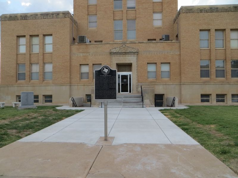
Photographed by Bill Kirchner, June 8, 2017
2. The Gray and The Blue Marker

Photographed by Bill Kirchner, June 8, 2017
3. The Gray and The Blue Marker
Credits. This page was last revised on November 4, 2025. It was originally submitted on June 30, 2017, by Bill Kirchner of Tucson, Arizona. This page has been viewed 601 times since then and 29 times this year. Photos: 1. submitted on November 4, 2025, by James Hulse of Medina, Texas. 2, 3. submitted on June 30, 2017, by Bill Kirchner of Tucson, Arizona.
