Washington in Warren County, New Jersey — The American Northeast (Mid-Atlantic)
Musconetcong River Valley Double Lime Kiln
Photographed by Matthew Handley, March 10, 2017
1. Musconetcong River Valley Double Lime Kiln Marker
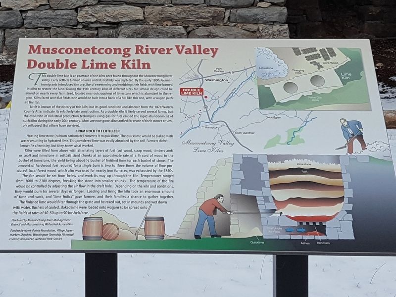
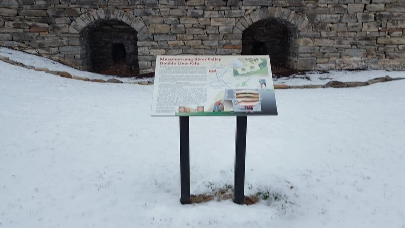
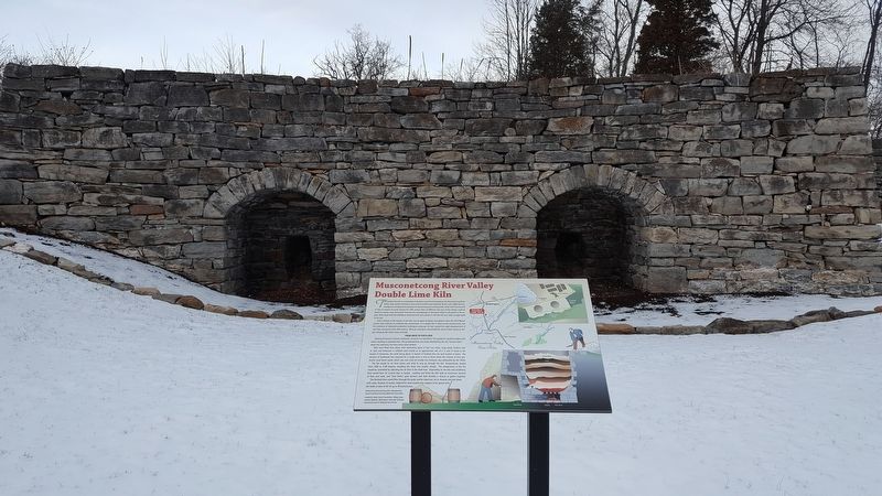
This double lime kiln is an example of the kilns once found throughout the Musconetcong River Valley. Early settlers farmed an area until its fertility was depleted. By the early 1800s German immigrants introduced the practice of sweetening and enriching their fields with lime burned in kilns to restore the land. During the 19th century kilns of different sizes but similar design could be found on nearly every farmstead, located near outcroppings of limestone which is abundant in the region. Kilns faced with flat fieldstone would be built into a bank of a hill like this one, with a wagon path to the top.
Little is known of the history of this kiln, but its good condition and absence from the 1874 Warren County Atlas indicate its relatively late construction. As a double kiln it likely served several farms, but the evolution of industrial production techniques using gas for fuel caused the rapid abandonment of such kilns during the early 20th century. Most are now gone, dismantled for reuse of their stones or simply collapsed. But others have survived.
this page online
The fire would be set from below and work its way up through the kiln. Temperatures range from 1600 to 2100 degrees, breaking the stone into smaller chunks. The temperature of the fire would be controlled by adjusting the air flow in the draft hole. Depending on the kiln and conditions, they would burn for several days or longer. Loading and firing the kiln took an enormous amount of time and work, and "lime frolics" gave farmers and their families
Photographed by Matthew Handley, March 10, 2017
2. Musconetcong River Valley Double Lime Kiln Marker
The finished lime would filter through the grate and be raked out, set in mounds and wet down with water. Bushels of cooled, slaked lime were loaded onto wagons to be spread onto the fields at rates of 40-50 up to 90 bushels/acre.
Produced by Musconetcong River Management Council and Musconetcong Watershed Association
Funded by Hawk Pointe Foundation, Village Supermarkets ShopRite, Washington Township Historical Commission and US National Park Service
Topics. This historical marker is listed in this topic list: Agriculture.
Location. 40° 44.241′ N, 74° 58.468′ W. Marker is in Washington, New Jersey, in Warren County. It is at the intersection of New Jersey Route 31 and Hawke Point Blvd., on the right when traveling north on New Jersey Route 31. Located on the entrance drive way to ShopRite. Touch for map. Marker is at or near this postal address: 2 Clubhouse Drive, Washington NJ 07882, United States of America. Touch for directions.

Regionally, this marker is in New Jersey’s North Jersey. It is also in the American Northeast and in
Photographed by Matthew Handley, March 10, 2017
3. Musconetcong River Valley Double Lime Kiln Marker
The kiln wall is embedded in a slope. Any structure above the openings is long since gone.
Other nearby markers. At least 8 other markers are within 2 miles of this marker, measured as the crow flies: Revolutionary Artillery Site (approx. 0.9 miles away); U.S.S. Maine Memorial (approx. 1.3 miles away); Major General Daniel Morgan (approx. 1.3 miles away); General Daniel Morgan (approx. 1.3 miles away); New Hampton (approx. 1.4 miles away); Dusenbery Mansion House (approx. 1.4 miles away); Sister Mary Miranda C.S.S.F. (approx. 1.6 miles away); Changewater Trestle (approx. 1.8 miles away). Touch for a list and map of all markers in Washington.
Also see . . . Musconetcong Watershed Association. (Submitted on July 1, 2017, by Michael Herrick of Southbury, Connecticut.)
Credits. This page was last revised on July 1, 2017. It was originally submitted on July 1, 2017, by Michael Herrick of Southbury, Connecticut. This page has been viewed 2,009 times since then and 110 times this year. Photos: 1, 2, 3. submitted on July 1, 2017, by Michael Herrick of Southbury, Connecticut.
