
Near Vernon in Wilbarger County, Texas — The American South (West South Central)
Doan's Crossing

Photographed by Gary Estep, October 24, 2025
1. Doan's Crossing Marker
Erected 1993 by Texas Historical Commission. (Marker Number 1234.)
Topics. This historical marker is listed in these topic lists: Animals • Roads & Vehicles. A significant historical year for this entry is 1876.
Location. 34° 20.593′ N, 99° 15.317′ W. Marker is near Vernon, Texas, in Wilbarger County. It is at the intersection of Farm to Market Road 924 and Farm to Market Road 2916, on the right when traveling north on Highway 924. Touch for map. Marker is in this post office area: Vernon TX 76384, United States of America. Touch for directions.

Regionally,
this page online
Other nearby markers. At least 8 other markers are within 14 miles of this marker, measured as the crow flies: Doan's Crossing on Red River (here, next to this marker); The Western Texas – Kansas Trail (here, next to this marker); Capt. John T. Lytle (within shouting distance of this marker); The Doans' Adobe Building (within shouting distance of this marker); Site of Beginning Trip of Abernathy Boys to New York City in 1910 (approx. 10.2 miles away in Oklahoma); W. D. Berry Home (approx. 13.2 miles away); Wilbarger County Veterans Memorial (approx. 13.2 miles away); Vernon Drugstore (approx. 13.2 miles away). Touch for a list and map of all markers in Vernon.
Also see . . . Doan's Crossing - The Encyclopedia of Oklahoma History and Culture .
Photographed by Bill Kirchner, June 8, 2017
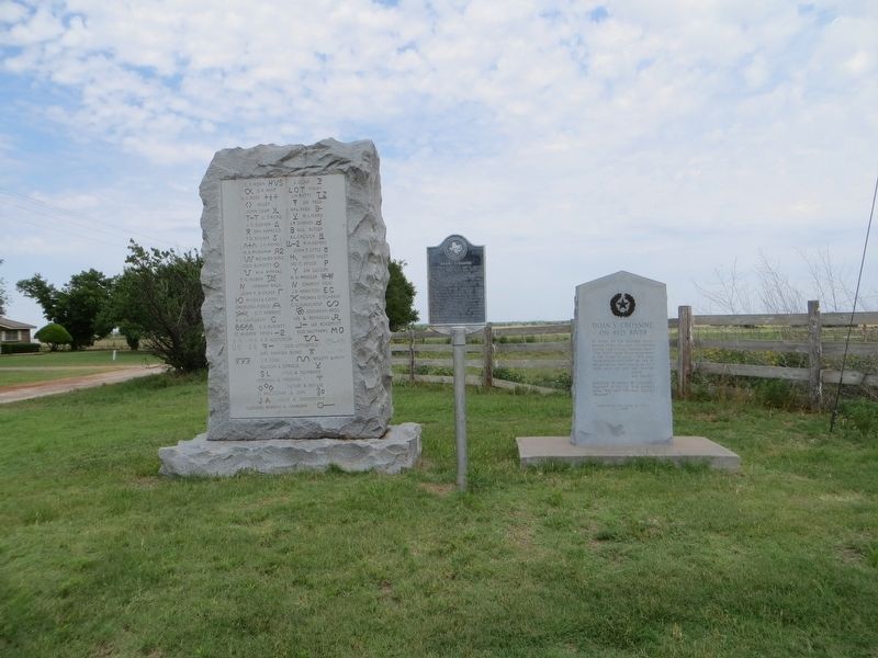
2. Doan's Crossing Marker in the center
Three Historical Markers at Doan's Crossing.

Photographed by Bill Kirchner, June 8, 2017
3. Doan's Crossing Marker
Credits. This page was last revised on October 31, 2025. It was originally submitted on July 2, 2017, by Bill Kirchner of Tucson, Arizona. This page has been viewed 5,900 times since then and 218 times this year. Photos: 1. submitted on October 27, 2025, by Gary Estep of Anna, Texas. 2, 3. submitted on July 2, 2017, by Bill Kirchner of Tucson, Arizona.
