Hunting Island in Beaufort County, South Carolina — The American South (South Atlantic)
Hunting Island Light Station
Photographed by Mike Stroud, April 26, 2009
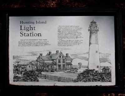
1. Hunting Island Light Station Marker
This lighthouse, built of interlocking cast iron plates, was completed in 1875. The light station was originally located on the northern end of the island, but severe beach erosion forced its relocation to this site in 1889. The Hunting Island light continued to aid navigators until 1933 when a buoy took over its function.
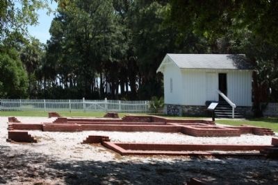
In addition to the lighthouse, the light station included housing for the staff, supplies and equipment necessary to keep the light burning. Within this fence are the remaining original buildings and archaeological traces of the Hunting Island Light Station.
(text at left) Help us preserve the past
The Hunting Island Light Station is listed on the National Register of Historic Places as an important part of our nation's past. Please help us preserve it for future generations. Treat the buildings with respect and care. Digging and
this page online
Erected by Hunting Island State Park.
Topics and series. This historical marker is listed in these topic lists: Landmarks • Notable Buildings • Waterways & Vessels. In addition, it is included in the Lighthouses series list. A significant historical year for this entry is 1859.
Location. 32° 22.5′ N, 80° 26.264′ W. Marker is on Hunting Island, South Carolina, in Beaufort County. It can be reached from N. Beach Drive. At Hunting Island State Park, Sea Island Parkway ( US21). Touch for map. Marker is in this post office area: Saint Helena Island SC 29920, United States of America. Touch for directions.

Regionally, this marker is in the Lowcountry and on the Sea Islands. It is also in the American South, specifically in the Deep South, and on the Eastern Seaboard. Globally, it is in the North Atlantic Region, North America, the Western Hemisphere, the Western World, and the Anglosphere. Historically, it finds itself in what was once New Spain, the territory of the Mississippian Culture, one of the original Thirteen Colonies, one of the Confederate States
Photographed by Mike Stroud, 2009
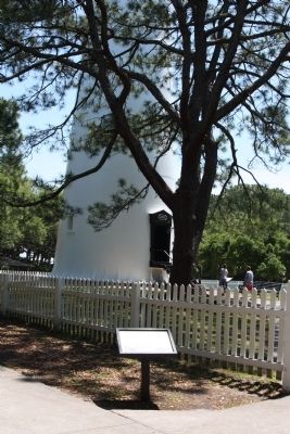
2. Hunting Island Light Station Marker
Other nearby markers. At least 8 other markers are within 9 miles of this marker, measured as the crow flies: Home at the Lighthouse (within shouting distance of this marker); Harvesting Drinking Water (within shouting distance of this marker); Island Delivery Service (within shouting distance of this marker); A Guiding Light (within shouting distance of this marker); Fuel for the Flame (within shouting distance of this marker); A Life-Saving Light Station (about 300 feet away, measured in a direct line); Chapel of Ease (approx. 8.1 miles away); Penn School (approx. 8.2 miles away).
Regarding Hunting Island Light Station. National Register of Historic Places :
Hunting Island State Park Lighthouse ** (added 1970 - Structure - #70000561)
(Also known as Hunting Island Lighthouse )
♦ Historic Significance: Event, Architecture/Engineering
♦ Architect, builder, or engineer: US Coast Guard
♦ Architectural Style: No Style Listed
♦ Area of Significance: Engineering, Commerce
♦ Period of Significance: 1875-1899, 1925-1949
♦ Owner: State
♦ Historic Function: Transportation
♦ Historic Sub-function: Water-Related
♦ Current Function: Transportation
♦ Current Sub-function: Water-Related
Photographed by Mike Stroud, April 26, 2009
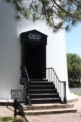
3. Hunting Island Light house
Photographed by Mike Stroud, 2005
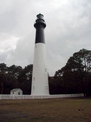
4. Hunting Island Light Station
Visible for 17 miles. Standing 132½ feet high.
Photographed by Mike Stroud, 2009
5. Hunting Island Light Station house remains
Light station storage building in background
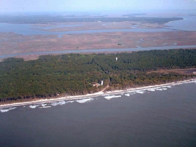
Photographed by Mike Stroud, April 7, 2006
6. Hunting Island Light Station , seen from the air, Atlantic Ocean, looking west
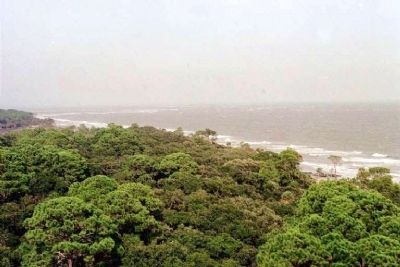
Photographed by Mike Stroud
7. Looking Northeast from atop Hunting Island Light House
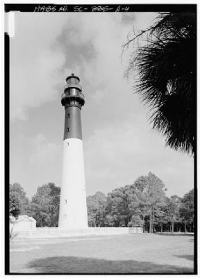
Historic American Buildings Survey, Jack E. Boucher, April 1987
8. Hunting Island Light Station
Historic American Engineering Record,HABS SC,7-HUNTIL,1A-4
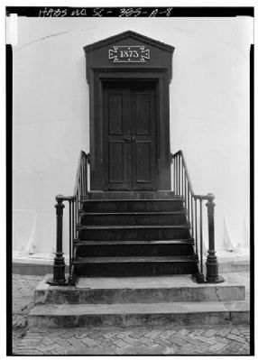
Historic American Buildings Survey, Jack E. Boucher, April 1987
9. Hunting Island Light Station entrance north side
Historic American Engineering Record,HABS SC,7-HUNTIL,1A-8
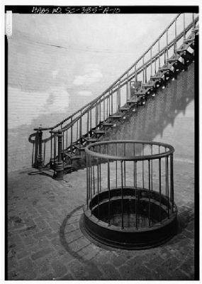
Historic American Buildings Survey, Jack E. Boucher, April 1987
10. Hunting Island Light Station Interior, lamp mechanism weight pit, stairway
Historic American Engineering Record,HABS SC,7-HUNTIL,1A-10
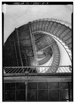
Historic American Buildings Survey, Jack E. Boucher, April 1987
11. Hunting Island Light Station Stairway
Historic American Engineering Record,
HABS SC,7-HUNTIL,1A-15
Credits. This page was last revised on October 18, 2020. It was originally submitted on May 3, 2009, by Mike Stroud of Bluffton, South Carolina. This page has been viewed 1,442 times since then and 17 times this year. Last updated on July 4, 2017, by Byron Hooks of Sandy Springs, Georgia. Photos: 1, 2, 3, 4, 5, 6, 7. submitted on May 3, 2009, by Mike Stroud of Bluffton, South Carolina. 8, 9, 10, 11. submitted on May 16, 2010, by Mike Stroud of Bluffton, South Carolina. • Bill Pfingsten was the editor who published this page.
