Rogersville in Lauderdale County, Alabama — The American South (East South Central)
Wheeler Dam
1936
⎯⎯⎯ Wheeler Reservoir/Locks
1836
Photographed by Sandra Hughes, July 4, 2017
1. Wheeler Dam Marker
Inscription.
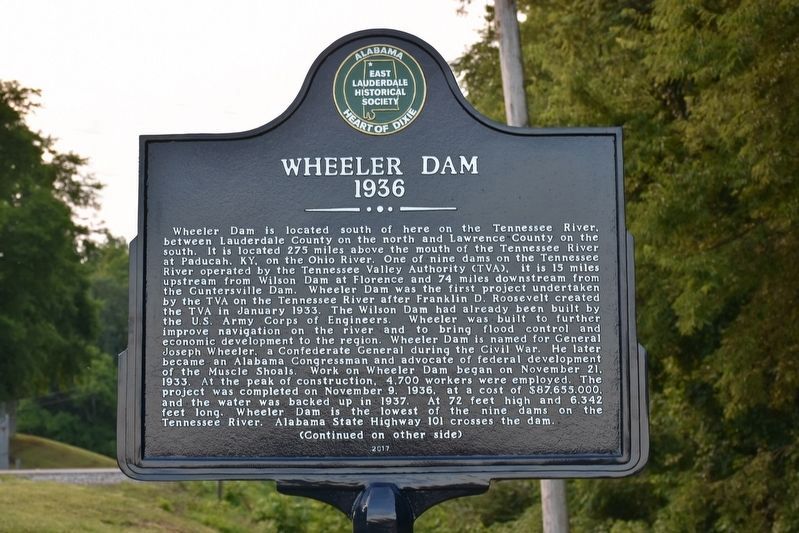
Wheeler Dam
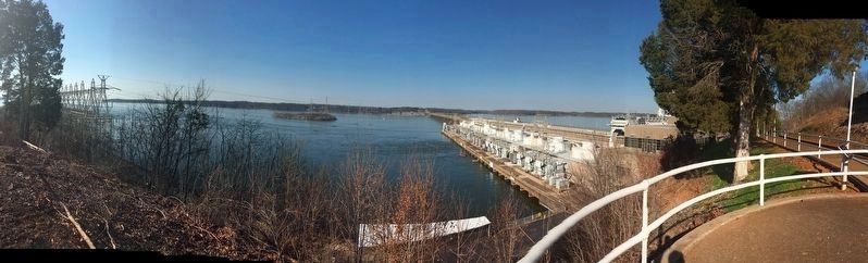
Wheeler Dam is located south of here on the Tennessee River, between Lauderdale County on the north and Lawrence County on the south. It is located 275 miles above the mouth of the Tennessee River at Paducah, Ky. on the Ohio River. One of nine dams on the Tennessee River operated by the Tennessee Valley Authority (TVA). It is 15 miles upstream from Wilson Dam at Florence and 74 miles downstream from the Guntersville Dam. Wheeler Dam was the first project undertaken by the TVA on the Tennessee River after Franklin D. Roosevelt created the TVA in January 1933. The Wilson Dam had already been built by the US Army Corps of Engineers. Wheeler was built to further improve navigation on the river and to bring flood control and economic development to the region. Wheeler Dam is named for General Joseph Wheeler a Confederate General during the Civil War. He later became an Alabama Congressman and advocate of federal development of the Muscle Shoals. Work on Wheeler Dam began on November 21, 1933. At the peak of construction, 4,700 workers were employed. The project was completed on November 9, 1936, at a cost of $87,655,000
Click or scan to see this page online
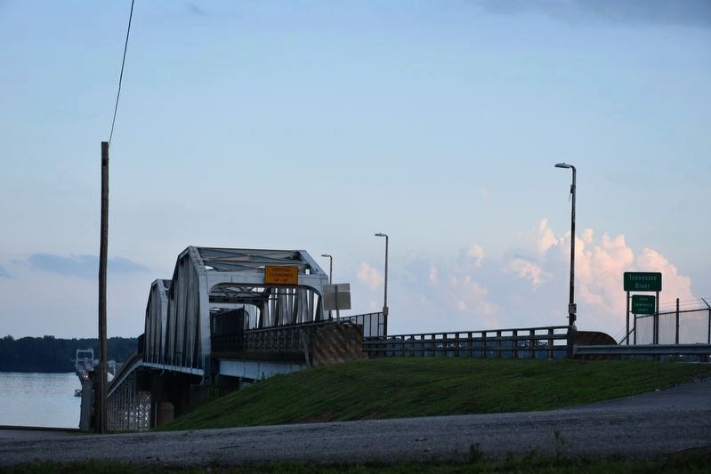
and the water was backed up in 1937. At 72 feet high and 6,342 feet long, Wheeler Dam is the lowest of the nine dams on the Tennessee River. Alabama State Highway 101 crosses the dam.
(Continued on other side)
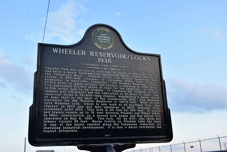
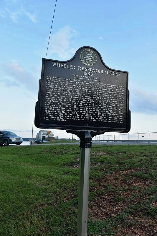
(Continued from other side) Wheeler Reservoir/Locks
Wheeler Dam was pivotal in covering the shoals in the river, which has been a major hindrance to navigation on the middle section of the Tennessee River. Wheeler forms one of nine reservoirs that create a 652-mile stairway of navigable water from Paducah, Kentucky, to Knoxville, Tennessee. The Wheeler Reservoir covers 67,070 acres of water surface and creates a shoreline of 1,027 miles. TVA purchased 103,400 acres of land for the reservoir. A total of 31,228 acres had to be cleared. It required the removal of 840 families and 176 graves and the relocation of 30 miles of road. The reservoir forms a 74-mile-long channel maintaining a water depth of nine feet to the base of the Guntersville Dam. The minimum evaluation for the Wheeler Reservoir is 550.5 feet. Work on the first Wheeler Lock, which is now used as an auxiliary lock, was started in 1933 and put into operation
Photographed by Sandra Hughes, July 4, 2017
2. Wheeler Reservoir/Locks Marker
in 1934, although work continued until 1937. This lock is 60 feet by 360 feet, it raises and lowers vessels up to 52 feet between Wheeler and Wilson Lakes. In 1960, construction on a second lock began and was placed into operation on May 8, 1963. This lock, 110’ by 600', also raises and lowers vessels 52 feet. Barge traffic on Wheeler Lake has made it one of the major centers along the Tennessee waterway for shoreline industrial development. It is also a major recreation and tourist attraction.
Erected 2017 by East Lauderdale Historical Society.
Location. 34° 48.909′ N, 87° 22.948′ W. Marker is in Rogersville, Alabama, in Lauderdale County. It is on Wheeler Dam Highway (Alabama Route 101) half a mile south of County Route 584, on the left when traveling south. Located on the north end of Wheeler Dam. Touch for map. Marker is in this post office area: Rogersville AL 35652, United States of America. Touch for directions.
Regionally, this marker
Photographed by Sandra Hughes, July 4, 2017
3. Wheeler Reservoir/Locks Marker
is in North Alabama and in the Shoals. It is also in the American South, specifically in the Deep South, in Appalachia, and specifically in Southern Appalachia. Globally, it is in North America, a Gulf of Mexico state, the Western Hemisphere, the Western World, and the Anglosphere. Historically, it finds itself in what was once the territory of the Mississippian Culture, one of the Confederate States of America, and the Antebellum South.
Credits. This page was last revised on December 9, 2024. It was originally submitted on July 6, 2017, by Sandra Hughes Tidwell of Killen, Alabama, USA. This page has been viewed 1,851 times since then and 118 times this year. Photos:1, 2, 3, 4, 5. submitted on July 6, 2017, by Sandra Hughes Tidwell of Killen, Alabama, USA. • Bernard Fisher was the editor who published this page.