Soda Springs in Nevada County, California — The American West (Pacific Coastal)
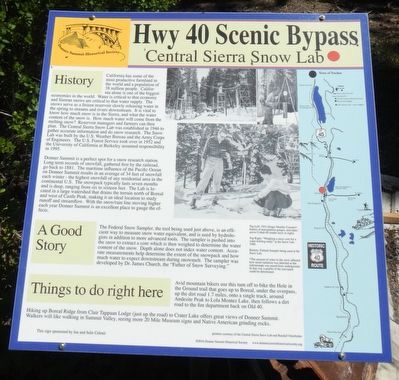
Central Sierra Snow Lab
Hwy 40 Scenic Bypass

Photographed By Barry Swackhamer, June 18, 2017
1. Central Sierra Snow Lab Marker
Captions: (top left) 1951 Geiger Mueller Counter*, battery of precipitation gauges, and radio-active Cobalt 60 (under now at right).; (top right) "Weighing a snow core for a water holding sturdy" at the Snow Lab 1948.; (bottom) Federal Sampler being used at Snow Lab. *The amount of water in the snow affected how much radiation was detected as the radioisotope was raised from underground. In that way a profile of the snowpack could be determined.
California has some of the most productive farmland in the world and a population of 38 million people. California alone is on of the biggest economies in the world. Water is critical to that economy and Sierran snows are critical to that water supply. The snows serve as a frozen reservoir slowly releasing what in the spring to streams and rivers downstream. It is vital to know how much snow is in the Sierra, and what the water content of the snow is. How much water will come from the melting snow? Reservoir managers and farmers can then plan. The Central Sierra Snow Lab was established in 1946 to gather accurate information and do snow research. The Snow Lab was built by the U.S. Weather Bureau and the Army Corp of Engineers. The U.S. Forest Service took over in 1952 and the University of California at Berkeley assumed responsibility in 1995.
Donner Summit is a perfect spot for a snow research station. Long term records of snowfall, gathered first by the railroad, go back to 1881. The maritime influence of the Pacific Ocean on Donner Summit results in an average of 34 feet of snowfall each winter - the highest snowfall of any residential area in the continental U.S. The snowpack typically last seven months and is deep, ranging from six to sixteen feet. The Lab is located in a large watershed that drains the terrain north of Boreal and west of Castle Peak, making it an ideal location to study runoff and streamflow. With the snow/rain line moving higher each year Donner Summit is an excellent place to gauge the effects.
Avid mountain bikers use this turn off to bike the Hole in the Ground trail that goes up to Boreal, under the overpass, up the dirt road 1.7 miles, onto a single track, around Andesite Peak to Lola Montez Lake, then follows a dirt road to the fire department back on Old 40.
Hiking up Boreal Ridge from Clair Tappaan Lodge (just up the road) to Crater Lake offers great views of the Donner Summit. Walkers will like walking in Summit Valley, seeing more 20 Mile Museum signs and Native American grinding rock.
Erected by Donner Summit Historical Society.
Topics and series. This historical marker is listed in these topic lists: Environment • Science & Medicine. In addition, it is included in the Donner Summit Historical Society series list. A significant historical year for this entry is 1946.
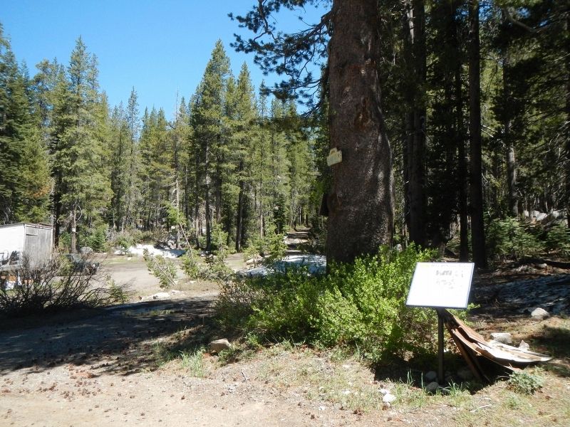
Location. 39° 19.388′ N, 120° 22.104′ W. Marker is in Soda Springs, California, in Nevada County. Marker is on Donner Pass Road near Bunny Hill Drive, on the left when traveling east. Touch for map. Marker is at or near this postal address: 20181 Donner Pass Road, Soda Springs CA 95728, United States of America. Touch for directions.
Other nearby markers. At least 8 other markers are within walking distance of this marker. Summit Valley Native American Mortars (about 800 feet away, measured in a direct line); Lake Van Norden Dam (approx. half a mile away); Dutch Flat Donner Lake Wagon Road (approx. 0.6 miles away); Soda Springs Hotel (approx. 0.6 miles away); Soda Springs Store (approx. 0.8 miles away); Hutchinson Lodge (approx. 0.9 miles away); Norden Station (approx. 0.9 miles away); Summit Valley Sheep Pens (approx. one mile away). Touch for a list and map of all markers in Soda Springs.
Also see . . .
1. Central Sierra Snow Laboratory - Tahoetopia. The science of snow surveying and forecasting water runoff began after the turn of the 20th century when a 31-year-old University of Nevada professor of Classics, Dr. James Church, strapped on a pair of web snowshoes and headed towards the summit of Mount Rose. (Submitted on July 8, 2017, by Barry Swackhamer of Brentwood, California.)
2. Snowpack Measurement. For the first time in 2017, scientists recorded the amount of water that is in the Sierra Snowpack, a crucial measurement as California faces a prolonged drought. (1/3/17) (Submitted on July 8, 2017, by Barry Swackhamer of Brentwood, California.)
Credits. This page was last revised on July 8, 2017. It was originally submitted on July 8, 2017, by Barry Swackhamer of Brentwood, California. This page has been viewed 418 times since then and 20 times this year. Photos: 1, 2. submitted on July 8, 2017, by Barry Swackhamer of Brentwood, California.
