Maxatawny Township near Kutztown in Berks County, Pennsylvania — The American Northeast (Mid-Atlantic)
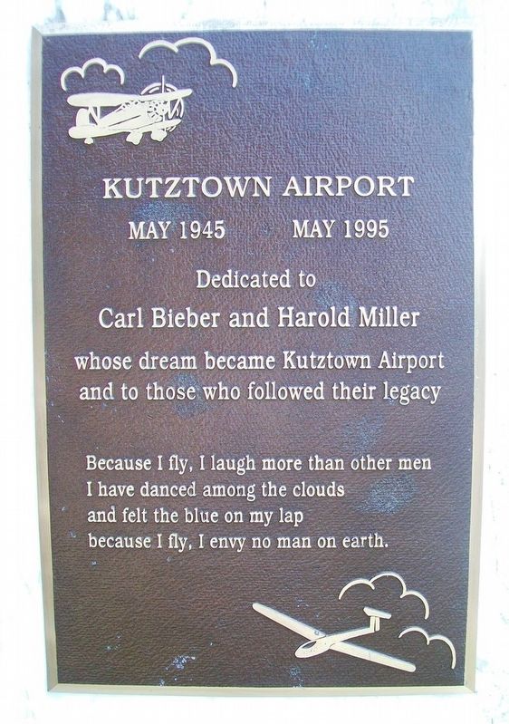
Kutztown Airport
May 1945 • May 1995
Photographed by William Fischer, Jr., July 3, 2017
1. Kutztown Airport Marker
Carl Bieber and Harold Miller
whose dream became Kutztown Airport
and to those who followed their legacy
I have danced among the clouds
and felt the blue on my lap
because I fly, I envy no man on earth.
Topics. This historical marker is listed in this topic list: Air & Space.
Location. 40° 30.43′ N, 75° 47.227′ W. Marker is near Kutztown, Pennsylvania, in Berks County. It is in Maxatawny Township. It is at the intersection of Kutztown Road and Luckinbill Road, on the left when traveling west on Kutztown Road. Touch for map. Marker is at or near this postal address: 15130 Kutztown Road, Kutztown PA 19530, United States of America. Touch for directions.

Regionally, this marker is in Southeast Pennsylvania and specifically in Pennsylvania Dutch Country. It is also in the American Northeast and in the Mid-Atlantic. Globally, it is in North America, the Western Hemisphere, the Western World, and the Anglosphere. Historically, it finds itself in what was once the Haudenosaunee (Iroquois) Confederacy
this page online
Other nearby markers. At least 8 other markers are within walking distance of this marker: Clarence Schock (approx. 0.2 miles away); Wiesenberger Alumni Center (approx. ¼ mile away); Thompson Cabin (approx. ¼ mile away); Dr. Nathan C. Schaeffer (approx. 0.4 miles away); Kutztown Army National Guard Memorial (approx. 0.6 miles away); Town Crier's House (approx. 0.6 miles away); Pennsylvania Dutch Ballads (approx. ¾ mile away); Cider Making (approx. ¾ mile away). Touch for a list and map of all markers in Kutztown.
Also see . . . Kutztown Airport. Wikipedia entry (Submitted on July 11, 2017, by William Fischer, Jr. of Reynoldsburg, Ohio.)
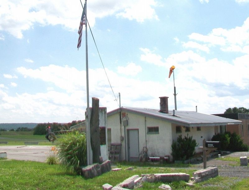
Photographed by William Fischer, Jr., July 3, 2017
2. Former Kutztown Airport and Marker
Abandoned & Little-Known Airfields website entry
Click for more information.
Click for more information.
Credits. This page was last revised on February 7, 2023. It was originally submitted on July 11, 2017, by William Fischer, Jr. of Reynoldsburg, Ohio. This page has been viewed 685 times since then and 49 times this year. Photos: 1, 2. submitted on July 11, 2017, by William Fischer, Jr. of Reynoldsburg, Ohio.
