Near Edom in Van Zandt County, Texas — The American South (West South Central)
Asbury Cemetery
Photographed by QuesterMark, June 26, 2017
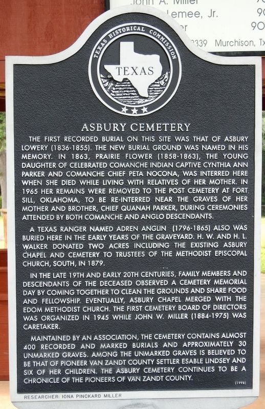
1. Asbury Cemetery Texas Historical Marker
A Texas Ranger named Adren Anglin (1796-1865) also was buried here in the early years of the graveyard. H.W. and H.L. Walker donated two acres including the existing Asbury Chapel and Cemetery to trustees of the Methodist Episcopal Church, South, in 1879.
In the late 19th and early 20th centuries, family members and descendants of the deceased observed a cemetery memorial day by coming together to clean the grounds and share food and fellowship. Eventually, Asbury Chapel merged with the Edom Methodist Church. The first cemetery board of directors was organized in 1945 while John W. Miller (1884-1975) was caretaker.
Maintained by an association, the cemetery contains almost 400 recorded and marked burials and approximately 30 unmarked graves. Among the unmarked graves is believed to be that of pioneer Van Zandt County settler Esable Lindsey and six of her children. The Asbury Cemetery continues to be a chronicle of the pioneers of Van Zandt County.
(Incise on base)
Researcher: Iona Pinckard Miller
Erected 1998 by Texas Historical Commission. (Marker Number 12259.)
Topics. This historical marker is listed in these topic lists: Cemeteries & Burial Sites • Settlements & Settlers.
Location. 32° 21.312′ N,
this page online

Regionally, this marker is in the American South and in the Piney Woods. Globally, it is in North America, a Gulf of Mexico state, the Western Hemisphere, the Western World, and the Anglosphere. Historically, it finds itself in what was once New Spain, the Republic of Texas, one of the Confederate States of America, and the Antebellum South.
Other nearby markers. At least 8 other markers are within 5 miles of this marker, measured as the crow flies: Adren Anglin (here, next to this marker); Mars Community (approx. 2.7 miles away); Tyler-Porter's Bluff Road (approx. 4 miles away); Edom (approx. 4.2 miles away); Potters Brown (approx. 4.3 miles away); Edom Methodist Church (approx. 4.3 miles away); Site of C.W. Morris Cotton Gin (approx. 4½ miles away); First Baptist Church of Edom (approx. 4½ miles away). Touch for a list and map
Photographed by QuesterMark, June 26, 2017
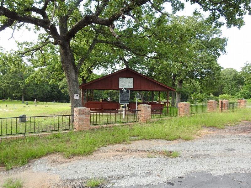
2. Asbury Cemetery with marker and Adren Anglin Marker
Adren Anglin marker is to the right of the Asbury Cemetery subject marker.
Credits. This page was last revised on July 17, 2017. It was originally submitted on July 14, 2017, by QuesterMark of Fort Worth, Texas. This page has been viewed 1,184 times since then and 107 times this year. Photos: 1, 2. submitted on July 14, 2017, by QuesterMark of Fort Worth, Texas. • Bernard Fisher was the editor who published this page.
