Mackinaw City in Cheboygan County, Michigan — The American Midwest (Great Lakes)
The Algomah
Mackinaw City Historical Pathway
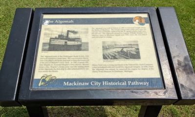
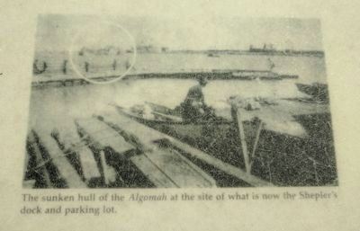
The Algomah sank at the Cheboygan docks in July 1942 and was raised two years later. She was towed to Mackinaw City, filled with stone, and sunk to form the breakwall at the end of Shelpler's ferry dock. In 1947, Captain William Shepler, Jr., founded Shepler's ferry service. Several times a day, Shepler's ferries pass near the resting place of the Algomah, the first ship to offer scheduled ferry service across the Straits.
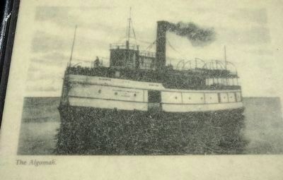
The Algomah was built in Detroit in 1881 to transport freight across the Straits of Mackinac. She towed a barge that could carry four rail cars but was eventually replaced by the St. Ignace which could carry ten rail cars. The Algomah, piloted by Captain William Shepler, was used as a ferry to Mackinac Island until 1936 when she was retired and converted to a barge.
Henry Ford was a young machinist at the Detroit Dry Dock Company when he helped build and install the Algomah's engine. In 1936, when the Algomah was retired, he removed the engine for display at the Henry Ford Museum in Dearborn, Michigan. (Marker Number 13.)
Topics. This historical marker is listed in this topic list: Waterways & Vessels. A significant historical month for this entry is July 1942.
Location. 45° 46.871′ N, 84° 43.52′ W. Marker is in Mackinaw City, Michigan, in Cheboygan County. Marker is at the intersection of South Huron Avenue and North Huron Avenue, on the right when traveling north on South Huron Avenue. Touch for map. Marker is in this post office area: Mackinaw City MI 49701, United States of America. Touch for directions.
Other nearby markers. At least 8 other markers are within walking distance of this marker. Mackinaw City (a few steps from this marker); Mackinaw, Mackinac or Michilimackinac? (a few steps from this marker); Mackinaw's Civil War Dahlgren Cannons (a few steps from this marker); Iron Horse (within shouting distance of this marker); Chief Wawatam (within shouting distance of this marker); Mackinaw City Veterans Memorial (within shouting distance of this marker); Historic Mackinaw City (within shouting distance of this marker); American Legion Memorial (within shouting distance of this marker). Touch for a list and map of all markers in Mackinaw City.
Credits. This page was last revised on June 10, 2019. It was originally submitted on July 20, 2017, by Joel Seewald of Madison Heights, Michigan. This page has been viewed 434 times since then and 40 times this year. Photos: 1, 2, 3, 4. submitted on July 20, 2017, by Joel Seewald of Madison Heights, Michigan.


