Near Montpelier in Bear Lake County, Idaho — The American West (Mountains)
Snowslide Canyon and Hanke’s Ranch
(Crow Creek Road)
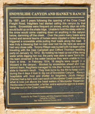
Photographed by Barry Swackhamer, June 21, 2017
1. Snowslide Canyon and Hanke’s Ranch Marker
this page online
Erected 2010 by Star Valley Historical Society.
Topics. This historical marker is listed in these topic lists: Industry & Commerce • Roads & Vehicles. A significant historical year for this entry is 1879.
Location. 42° 23.592′ N, 111° 10.194′ W. Marker is near Montpelier, Idaho, in Bear Lake County. It is on Crow Creek Road (Forest Road 111) near Road 239, on the left when traveling north. Touch for map. Marker is in this post office area: Montpelier ID 83254, United States of America. Touch for directions.

Regionally, this marker is in Bear River Country. It is also in the American Mountain West. Globally, it is in North America, the Western Hemisphere, the Western World, and the Anglosphere.
Other nearby markers. At least 8
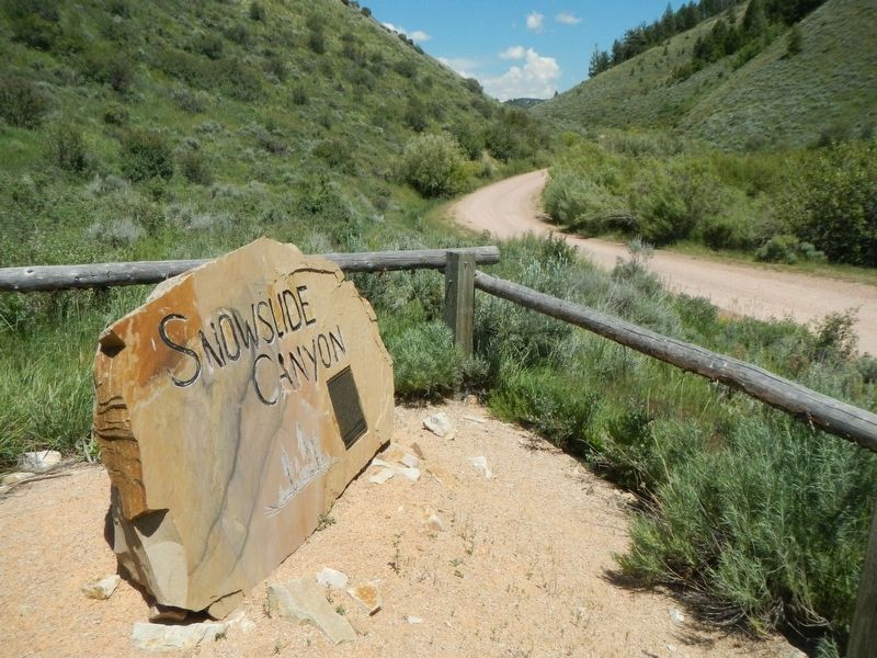
Photographed by Barry Swackhamer, June 21, 2017
2. Snowslide Canyon and Hanke’s Ranch Marker
Regarding Snowslide Canyon and Hanke’s Ranch. For nearly five decades, the (40-mile) Crow Creek Road served as the main link in and out of Star Valley. Starting in 1879 the route was used by Star Valley’s first settlers. Later the road proved to be vital route for commerce between the rail lines in Montpelier and the families that now called Star Valley their home. Crow Creek Road was used extensively until a new road was built over the Salt River Pass...connecting Star Valley to rail lines in Cokeville. -- Star Valley Independent
Also see . . . Historical Routes Near the Oregon Trail Center - Oregon Trail Center, Montpelier. The route is known even today as the Crow Creek Road and was the link between the settlements of Afton, Wyoming and Montpelier, Idaho. The 100 mile round trip between Afton and the rail head at Montpelier would take a team of horses from three to seven days depending on the conditions along the way. The route started in 1879 and was used by Star Valley's first settlers. (Submitted on July 21, 2017, by Barry Swackhamer of Brentwood, California.)
Credits. This page was last revised on July 21, 2017. It was originally submitted on July 21, 2017, by Barry Swackhamer of Brentwood, California. This page has been viewed 477 times since then and 24 times this year. Photos: 1, 2. submitted on July 21, 2017, by Barry Swackhamer of Brentwood, California.
