
Congress Heights in Southeast Washington in Washington, District of Columbia — The American Northeast (Mid-Atlantic)
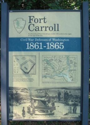
Fort Carroll
Civil War Defenses of Washington
| — | 1861-1865 | — |
Photographed by Craig Swain, August 7, 2008
1. Fort Carroll Marker
Earthworks of Fort Carroll are visible 100 yards to the right at the top of the hill.
Fort Carroll was named in honor of Maj. Gen. Samuel Sprigg Carroll, a West Point graduate from the District of Columbia.
Erected by National Park Service, U.S. Department of the Interior.
Topics and series. This historical marker is listed in these topic lists: Forts and Castles • War, US Civil. In addition, it is included in the Defenses of Washington series list. A significant historical year for this entry is 1861.
Location. 38° 50.223′ N, 77° 0.417′ W. Marker is in Southeast Washington in Washington, District of Columbia. It is in Congress Heights. It is on Martin Luther King, Jr. Avenue Southeast 0.1 miles north of South Capitol Street Southeast, on the right when traveling west. Located in the Fort Carroll Park. Touch for map. Marker is at or near this postal address: 3720 Martin Luther King Jr Avenue Southeast, Washington DC 20032, United States of America. Touch for directions.

Regionally, this marker is in the Washington Metropolitan Area. It is also in the American Northeast, in the Upper South, in the Mid-Atlantic,
this page online
Other nearby markers. At least 8 other markers are within walking distance of this marker: Defending the Capital (a few steps from this marker); In Memory of Col. Raynal C. Bolling (approx. 0.4 miles away); Republic F-105D Thunderchief (approx. 0.6 miles away); Congress Heights School (approx. 0.7 miles away); a different marker also named Defending the Capital (approx. 0.9 miles away); Holocaust Memorial (approx. 0.9 miles away); Bolling Air Force Base (approx. 0.9 miles away); Welcome to St. Elizabeths East (approx. one mile away). Touch for a list and map of all markers in Southeast Washington.
Another marker is no longer nearby. Fort Greble (was approx. 0.9 miles away but has been replaced with another marker now near it).
More about this marker. The marker displays a plan of Fort Carroll from U.S. Army Corps of Engineers drawing. A map shows other Civil War fortifications surrounding Washington, D.C. administered by the park service. The bottom of the marker is

Photographed by Evan Dwyer, January 17, 2026
2. Markers at the site of Fort Carroll
Also see . . .
1. Fort Carroll. National Park Service page on the fort and nearby Fort Greble. (Submitted on August 22, 2008, by Craig Swain of Leesburg, Virginia.)
2. Samuel S. Carroll. (Submitted on March 13, 2011, by Richard E. Miller of Oxon Hill, Maryland.)
Additional commentary.
1. Fort Carroll Particulars
From "Mr. Lincoln's Forts: A Guide to the Civil War Defenses of Washington," by Benjamin Franklin Cooling III and Walton H. Owen II:
The fort had a perimeter of 340 yards. It covered what was Piscataway Road, passing up Oxen Run. Battery Carroll, with four unoccupied positions and another small redoubt were outer works to Fort Carroll
In 1862 armament included two 8-inch siege howitzers, four 32-pdr. seacoast guns, six 12-pdr field guns, one 30-pdr Parrott rifle, and one 24-pdr. Coehorn mortar. However by 1864 the armament had evolved to one 12-pdr field gun, twelve 32-pdr seacoast guns, one 8-inch siege howitzer, two 30-pdr Parrott rifles, and one
Photographed by Craig Swain, August 7, 2008
3. Fort Carroll Marker
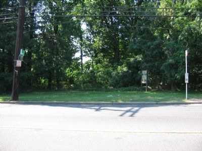
The fort and battery remains are behind the marker to the west of the avenue.
Units which spent time at this fort included the 70th New York Infantry, 4th and 10th New York Heavy Artillery, 17th and 19th Maine Heavy Artillery, 9th Rhode Island Infantry, and 8th Massachusetts Heavy Artillery.
In addition to the fortifications, the grounds became an administrative hub for this section of the Washington Defenses, including hospitals, provost marshal facilities, and garrison headquarters. After the war the fort was used for a short time by the Signal Corps.
— Submitted August 22, 2008, by Craig Swain of Leesburg, Virginia.
Photographed by Richard E. Miller, November 27, 2009
4. View westward from near Fort Carroll Marker
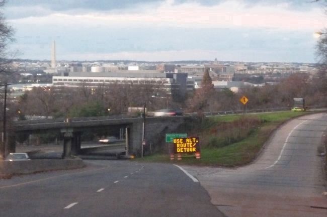
South Capitol Street intersection with the Anacostia Freeway (I-295), Bolling Air Base beyond, and downtown Washington in the background across the Potomac River.
courtesy of National Archives and Records Administration
5. Fort Carroll
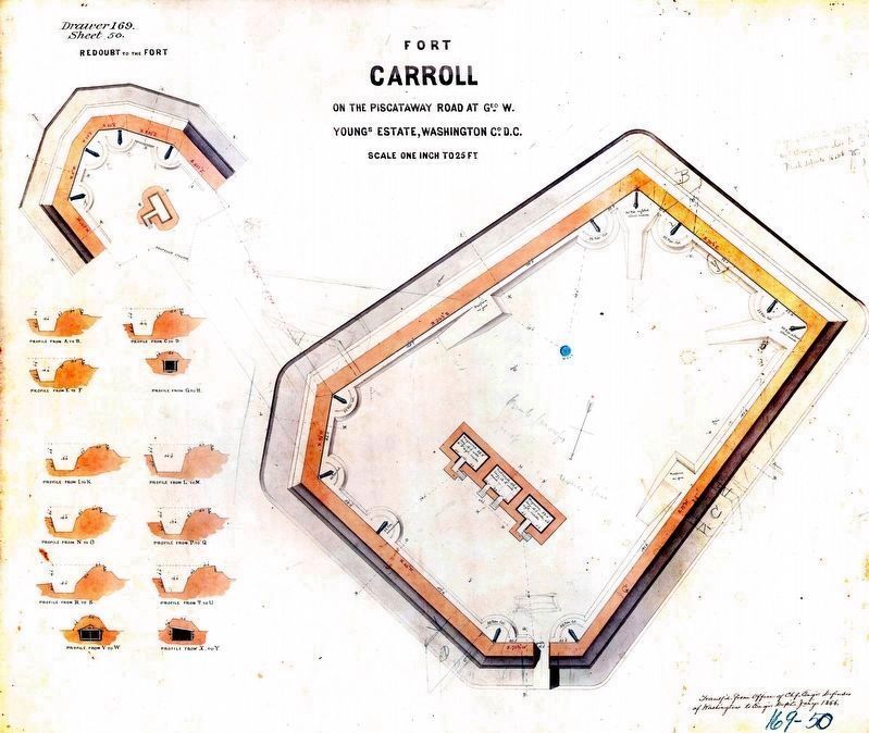
On the Piscataway Road at Geo. W. Young's Estate, Washington County, DC.
On the Piscataway Road at Geo. W. Young's Estate, Washington County, DC.
Plans & sections of Fort Redoubt, Record Group 77, Records of the Office of the Chief of Engineers, Fortifications Map File Plans of Military Forts, Drawer 169.

Photographed by Evan Dwyer, January 17, 2026
6. Fort Carroll
Exterior view of the earthworks from the down the hill, view facing northeast towards the fort's southwest (& sole surviving) corner. MLK Avenue SW runs beyond.
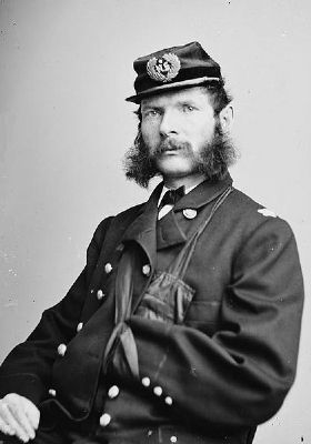
courtesy of Library of Congress
7. Maj. Gen. Samuel Sprigg "Red" Carroll
Credits. This page was last revised on March 12, 2026. It was originally submitted on August 22, 2008, by Craig Swain of Leesburg, Virginia. This page has been viewed 4,674 times since then and 124 times this year. Photos: 1. submitted on August 22, 2008, by Craig Swain of Leesburg, Virginia. 2. submitted on March 12, 2026, by Evan Dwyer of Richmond, Virginia. 3. submitted on August 22, 2008, by Craig Swain of Leesburg, Virginia. 4. submitted on November 28, 2009, by Richard E. Miller of Oxon Hill, Maryland. 5. submitted on March 12, 2024, by Allen C. Browne of Silver Spring, Maryland. 6. submitted on March 12, 2026, by Evan Dwyer of Richmond, Virginia. 7. submitted on March 13, 2011, by Richard E. Miller of Oxon Hill, Maryland.
