Columbia in Boone County, Missouri — The American Midwest (Upper Plains)
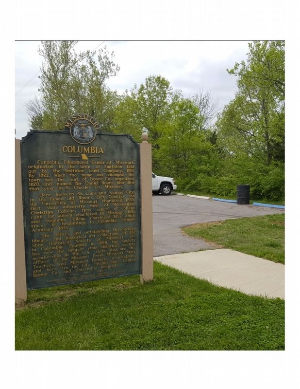
Columbia
Here between St. Louis and Kansas City in the famed old Boon's Lick Country are the University of Missouri, chartered 1839, first state university west of Mississippi, Christian College, first school of college rank for women chartered in Missouri, 1851, and Stephens College, chartered 1857, which traces its beginnings to Columbia Female Academy, 1833.
The offices and outstanding Missouriana library and historical art collections of the State Historical Society of Missouri are in Columbia. Founded in 1898, the Society has now the largest state historical society membership in the U.S. Here also are the offices of the Missouri Press, Missouri State Teachers and Missouri Farmers' Association and here are the Ellis Fischel State Cancer, Boone Co., and University Hospitals.
Erected 1953 by State Historical Society of MO and State Highway Commission.
Topics and series. This historical marker is listed in these topic lists: Education • Notable Places • Settlements & Settlers. In addition, it is included in the Missouri, The State Historical Society of series list. A significant historical year for this entry is 1819.
Location. 38° 56.233′ N, 92° 18.446′ W. Marker is in Columbia, Missouri, in Boone County. Marker is on Old U.S. 63 just south of Shepard Boulevard, on the right when traveling south. Touch for map. Marker is at or near this postal address: 1001 Old Highway 63 South, Columbia MO 65201, United States of America. Touch for directions.
Other nearby markers. At least 8 other markers are within 2 miles of this marker, measured as the crow flies. Memorial Union Tower (approx. 1.1 miles away); The Mel Carnahan Quadrangle (approx. 1.2 miles away); Beetle Bailey (approx. 1.3 miles away); Don Faurot / Faurot Field (approx. 1.4 miles away); Site of Columbia College (approx. 1.4 miles away); Lest We Forget: Lynching at the Stewart Road Bridge (approx. 1.6 miles away); "Make A Brighter Future" (approx. 1.6 miles away); African-American Heritage Trailhead (approx. 1.7 miles away). Touch for a list and map of all markers in Columbia.
Additional keywords. Smithton Land Company, University of Missouri, Land grant universities, State Historical Society, founding of city, founding of county, Daniel Boone
Credits. This page was last revised on October 6, 2019. It was originally submitted on July 31, 2017, by Jeneva Pace of Columbia, Missouri. This page has been viewed 428 times since then and 54 times this year. Photo 1. submitted on July 31, 2017, by Jeneva Pace of Columbia, Missouri. • Bill Pfingsten was the editor who published this page.
Editor’s want-list for this marker. A wide shot of the marker and its surroundings. • Can you help?
