
Fort Myers in Lee County, Florida — The American South (South Atlantic)
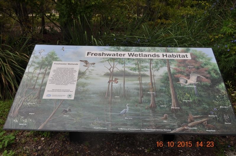
Freshwater Wetlands Habitat
Photographed by Sandra Hughes, October 16, 2015
1. Freshwater Wetlands Habitat Marker
Not all plants and animals illustrated are found at Manatee Park.
Alligator Flag
Alligator
Spider Lilly
Anhinga
Osprey
Snail Kite
Cattails
Blue Heron
Purple Pickerelweed
Otter
Bald Cypress
Lizard Tail
Bromeliads
Golden Canna
Red-Bellied Slider
Great White Egret
Red Maple
Blue Flag Iris
Button Bush
Marsh Rabbit
Raccoon
American Elm
White Ibis
In Memory of Volunteer John Sculthorpe and Joe Mulvihill
Topics. This historical marker is listed in these topic lists: Animals •
this page online
Location. 26° 41.59′ N, 81° 46.656′ W. Marker is in Fort Myers, Florida, in Lee County. It is on Palm Beach Boulevard. Marker is located inside park. Touch for map. Marker is at or near this postal address: 10901 Palm Beach Blvd, Fort Myers FL 33905, United States of America. Touch for directions.

Regionally, this marker is on Florida’s Gulf Coast. It is also in the American South and on the Gulf Coast. Globally, it is in the North Atlantic Region, North America, a Gulf of Mexico state, the Western Hemisphere, the Western World, and the Anglosphere. Historically, it finds itself in what was once New Spain, the territory of the Mississippian Culture, one of the Confederate States of America, and the Antebellum South.
Other nearby markers. At least 8 other markers are within walking distance of this marker: Explore Southwest Florida Naturally! (here, next to this marker); The Florida Manatee (here, next to this marker); Why do Manatees Come to Manatee Park ? (here, next to this marker); Other Visitors to Manatee Park (here, next to this marker); The Anatomy of a Manatee (here, next to this marker); The Manatee-Human Comparison (here, next to this marker); Manatee Island (here, next to this marker); Butterflies of Lee County (here, next to this marker). Touch for a list and map of all markers in Fort Myers.
Credits. This page was last revised on May 4, 2018. It was originally submitted on August 7, 2017, by Sandra Hughes Tidwell of Killen, Alabama, USA. This page has been viewed 361 times since then and 20 times this year. Photo 1. submitted on August 7, 2017, by Sandra Hughes Tidwell of Killen, Alabama, USA. • Bill Pfingsten was the editor who published this page.
