Fredericksburg, Virginia — The American South (Mid-Atlantic)
The Canal Ditch
The City of Fredericksburg, Virginia
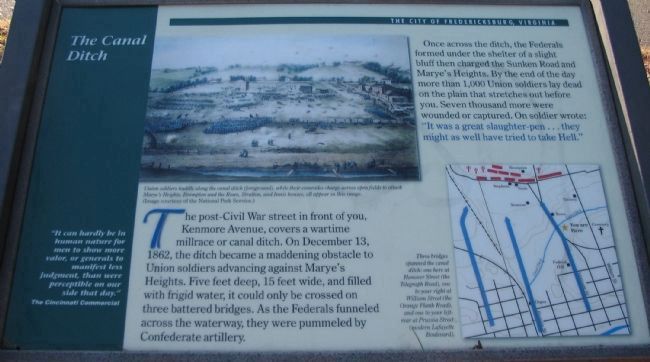
Once across the ditch, the Federals formed in the shelter of a slight bluff, then charged the Sunken Road and Marye’s Heights. By the end of the day more than 1,000 Union soldiers lay dead on the plain that stretches out before you. Seven thousand more were wounded or captured. “It was a great slaughter-pen...they might as well have tried to take Hell.”
(Sidebar Quote):
"It can hardly be in human nature for men to show more valor, or generals to manifest less judgment, than were perceptible on our side that day.”
—The Cincinnati Commercial
Topics. This historical marker is listed in this topic list: War, US Civil. A significant historical month for this entry is December 1864.
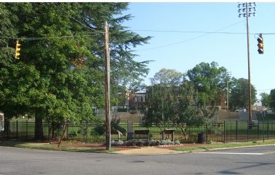
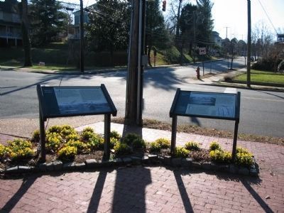
Location. This marker has been replaced by another marker nearby. It was located near 38° 17.941′ N, 77° 27.901′ W. Marker was in Fredericksburg , Virginia. Marker was at the intersection of Kenmore Avenue and Hanover Street, on the right when traveling east on Kenmore Avenue. Touch for map. Marker was in this post office area: Fredericksburg VA 22401, United States of America. Touch for directions.
Other nearby markers. At least 10 other markers are within walking distance of this location. Ravaged Town (a few steps from this marker); Marye's Heights (a few steps from this marker); a different marker also named The Canal Ditch (a few steps from this marker); 1849 (about 300 feet away, measured in a direct line); The Rowe House (about 400 feet away); Barton Street Confederate Monument (about 500 feet away); The Barton Street Potter's Field (about 700 feet away); Liberty Town (about 700 feet away); A Memorial Landscape (about 800 feet away); The Bass-Ellison Building (about 800 feet away). Touch for a list and map of all markers in Fredericksburg.
More about this marker. In the upper center of the marker is a painting captioned, Union soldiers huddle along the canal ditch (foreground), while their comrades charge across open fields to attack Marye's Heights. Brompton and the Rowe, Stratton, and Innis houses all appear in this image.
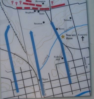
On the lower right is a map showing unit movements at this stage of the battle. Three bridges spanned the canal ditch: one here at Hanover Street (the Telegraph Road), one to your right at William Street (the Orange Plank Road), and one to your left rear at Prussia Street (modern Lafayette Boulevard).
Regarding The Canal Ditch. This marker was repaired and revised in 2008. The Original Marker Text Read:
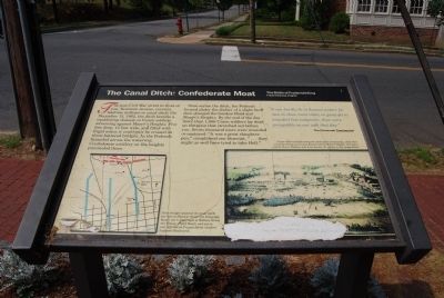
The Canal Ditch: Confederate Moat
The post-Civil War street in front of you, Kenmore Avenue, covers a wartime millrace or canal ditch. On December 13, 1862, the ditch became a maddening obstacle to Union soldiers advancing against Marye’s Heights. Five feet deep, 15 feet wide, and filled with frigid water, it could only be crossed on three battered bridges. As the Federals funneled across the waterway, Confederate artillery on the heights pummeled them.
Once across the ditch, the Federals formed in the shelter of a slight bluff, then charged the Sunken Road and Marye’s Heights. By the end of the day more than 1,000 Union soldiers lay dead on the plain that stretched before you. Seven thousand more were wounded or captured. “It was a great slaughter-pen,” complained one bluecoat. “… they might as well have tried to take Hell.”
“It can hardly be in human nature for men to show more valor, or generals to manifest less judgment, than were perceptible on our side that day.” —The Cincinnati Commercial
Related marker. Click here for another marker that is related to this marker. This
marker has been replaced by the linked marker.
Credits. This page was last revised on February 2, 2023. It was originally submitted on June 2, 2007, by Dawn Bowen of Fredericksburg, Virginia. This page has been viewed 2,102 times since then and 39 times this year. Photos: 1, 2. submitted on December 15, 2008, by Craig Swain of Leesburg, Virginia. 3. submitted on June 2, 2007, by Dawn Bowen of Fredericksburg, Virginia. 4. submitted on September 15, 2007, by Kevin W. of Stafford, Virginia. 5. submitted on December 15, 2008, by Craig Swain of Leesburg, Virginia. • J. J. Prats was the editor who published this page.
