Lamar in Prowers County, Colorado — The American Mountains (Southwest)
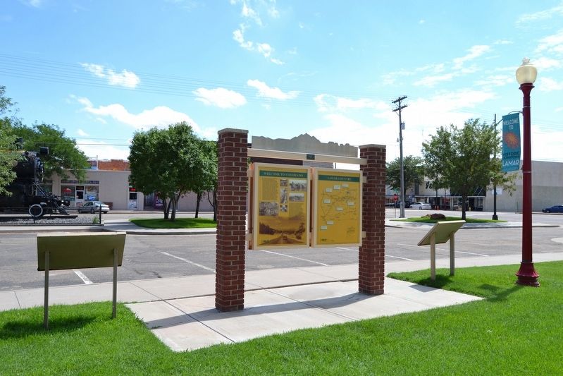
Welcome to Colorado - Lamar Country
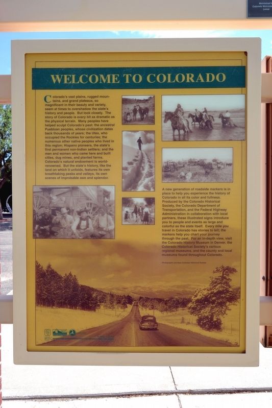
Welcome to Colorado
Colorado’s vast plains, rugged mountains, and grand plateaus, so magnificent in their beauty and variety, seem at times to overshadow the state’s history and people. But look closely. The story of Colorado is every bit as dramatic as the physical terrain. Many peoples have helped sculpt Colorado’s past: the ancestral Puebloan peoples, whose civilization dates back thousands of years; the Utes, who occupied the Rockies for centuries; the numerous other native peoples who lived in this region; Hispano pioneers, the state’s first permanent non-Indian settlers; and the men and women who came here and built cities, dug mines, and planted farms. Colorado’s natural endowment is world-renowned. But the state’s history, like the land on which it unfolds, features its own breathtaking peaks and valleys, its own scenes of improbable awe and splendor.
A new generation of roadside markers is in place to help you experience the history of Colorado in all its color and fullness. Produced by the Colorado Historical Society, the Colorado Department of Transportation, and the Federal Highway Administration in collaboration with local partners, these illustrated signs introduce you to people and events as large and colorful as the state itself. Every mile you travel in Colorado has stories to tell; the markers help you chart your journey through the past. For an in-depth view, visit the Colorado History Museum in Denver, the Colorado Historical Society’s various regional museums, and the county and local museums found throughout Colorado.
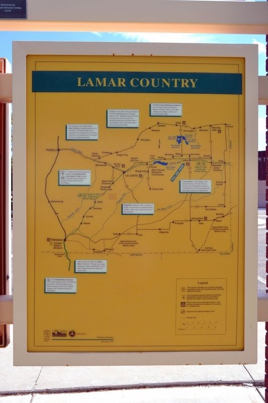
Lamar Country
• The center of a vast trading empire, Bent’s Old Fort flourished between 1833 and 1849. The National Park Service operates the reconstructed fort year round. Experience the mountain man era through the fort’s educational programs.
• Founded as New Bent’s Fort and renamed Fort Wise, Fort Lyon took its existing name in 1861. Originally located 20 miles to the east, the fort was moved to its present location near Las Animas after it was flooded in 1867. Kit Carson died at the new Fort Lyon in 1868.
• The Bent County Historical Courthouse in Las Animas, listed in the National Register of Historic Places, is the oldest continuously operated courthouse in Colorado (since 1888).
• U.S. Highway 350 and 50 generally parallels the Mountain Route of the Santa Fe Trail, the great nineteenth-century highway of commerce between Missouri and New Mexico.
• Boggsville, founded in 1862 by Thomas O. Boggs, was the home of prominent frontier families. Many of the original homes have been restored.
• Camp Amache. This detention center operated between 1942 and 1945 and housed some 7,500 Japanese Americans evacuated from the West Coast during the anti-Japanese hysteria of World War II.
• Native peoples traveled across Raton Pass for centuries. The pass was a major obstacle for wagons until Richens “Uncle Dick” Wootton opened his famous toll road in 1865.
• The Trinidad History Museum, featuring the Santa Fe Trail Museum, Baca House, and Bloom Mansion and Historic Gardens in downtown Trinidad, interprets early Trinidad and Santa Fe Trail history.
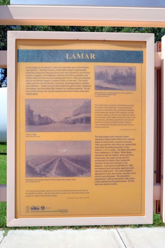
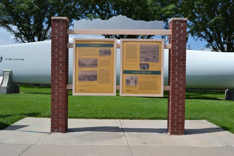
Lamar
At the height of the Santa Fe Trail, this spot was one of the liveliest way stations. The Big Timbers, a thick belt of giant cottonwoods, stretched along the Arkansas River from here almost to Las Animas. Indians, trappers, and freighters relished this Plains paradise, and William Bent built his second trading post here in 1853, two decades before the railroad began to replace traffic on the trail. The tracks wiped out the old road as they advanced, bringing soldiers, settlers, and cattlemen. These pioneers decimated the game herds, displaced the Indians, and harvested Big Timbers for building material. By the turn of the century, the woody expanse and active trade route were largely gone.
The transformation of this part of Colorado was surely the product of the Omnipotent. We have looked with amazement at the flights of the vast herds of wild game, and the advancing caravans of the emigrants; seen the locomotives climb over the very crest of the Rocky Mountains; the tepees of the Indians swept away to make room for the factory, schoolhouse an church; and today the old Santa Fe Trail is yet visible along this Arkansas valley, marked by the bleaching and decaying bones of both man and beast.
— Lamar Register, April 18, 1896
The speculators who founded Lamar required a federal land office and a railroad depot to ensure their venture’s success. They secured the land office by naming their town after the sitting secretary of the interior, L.Q.C. Lamar. The depot they stole from cattleman A.R. Black. When Black refused to sell his station, which sat three miles away, the Lamar group had him summoned to Pueblo, then hauled the structure to the new townsite in his absence. Lots went on sale May 24, 1886, and saloons and real estate agencies were open by week’s end. The Lamar Register appeared in June, and stores, schools, and a church soon followed. The population approached 1,000 by December 1886, when Lamar elected its first government. All this took only seven months.
A few years ago the freight wagons and oxen were counted by thousands, the value of merchandise by millions. But the shriek of the iron horse silenced the lowing of the panting ox, and the old Trail looks desolate.
— Junction City (Kans.) Union, August 1867
(Top Image Caption)
Big Timbers on the Arkansas River, from a sketch by Lt. James William Abert, 1845
(Center Image Caption)
Lamar, c. 1900
(Bottom Image Caption)
Still-visible ruts along the Santa Fe Trail indicate heavy wagon travel.
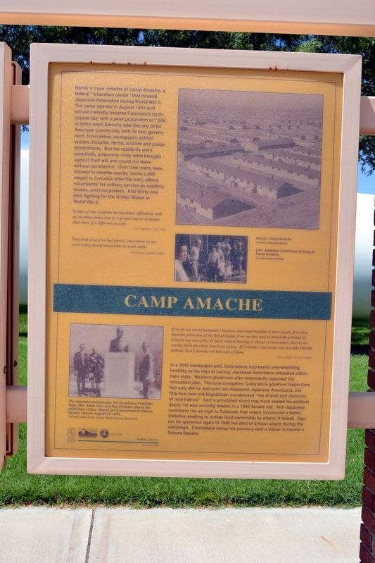
Camp Amache
Barely a trace remains of Camp Amache, a federal “relocation center” that housed Japanese Americans during World War II. The camp opened in August 1942 and almost instantly became Colorado’s tenth-largest city, with a peak population of 7,500. In some ways Amache was like any other American community, with its own government, businesses, newspaper, school system, hospital, farms, and fire and police departments. But the residents were essentially prisoners—they were brought against their will and could not leave without permission. Over time many were allowed to resettle nearby (some 2,000 stayed in Colorado after the war); others volunteered for military service as soldiers, nurses, and interpreters. And thirty-one died fighting for the United States in World War II.
In time of war, residents having ethnic affiliations with an invading enemy may be a greater source of danger than those of a different ancestry.
— U.S. Supreme Court, 1943
They treat us as if we had leprosy everywhere we go; we’re being shoved around like so much cattle.
— Anonymous Amache resident
If we do not extend humanity’s kindness and understanding to these people, if we deny them the protection of the Bill of Rights, if we say they may be denied the privilege of living in any one of the 48 states without hearing or charge of misconduct, then we are tearing down the whole American system. If Colorado’s part in the war is to take 100,000 of them, then Colorado will take care of them.
— Gov. Ralph Carr of Colorado
In a 1942 newspaper poll, Coloradans expressed overwhelming hostility to the idea of having Japanese Americans relocated within their state. Western governors also vehemently opposed the relocation plan. The lone exception: Colorado’s governor Ralph Carr. Not only did he welcome the displaced Japanese Americans, the fifty-five-year-old Republican condemned “the shame and dishonor of race hatred.” Carr’s principled stand may have sealed his political doom: he was soundly beaten in a 1942 Senate bid. Anti-Japanese sentiment ran so high in Colorado that voters introduced a ballot initiative seeking to outlaw land ownership by aliens (it failed). Carr ran for governor again in 1950 but died of a heart attack during the campaign. Coloradans honor his memory with a statue in Denver’s Sakura Square.
(Top Image Caption)
Camp Amache
(Center Image Caption)
Japanese Americans arriving at Camp Amache
(Bottom Image Caption)
The Japanese ambassador, His Excellency Fumihiko Togo, Mrs. Ralph Carr, and Roy Erickson attend the dedication of Gov. Ralph Carr's monument in Sakura Square, Denver, August 21, 1976.
Erected 1997 by Colorado Historical Society, Colorado Department of Transportation, Federal Highway Administration.
Topics and series. This historical marker is listed in these topic lists: Roads & Vehicles • Settlements & Settlers • War, World II. In addition, it is included in the Colorado - History Colorado series list.
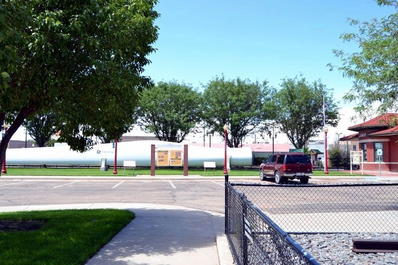
Location. 38° 5.379′ N, 102° 37.13′ W. Marker is in Lamar, Colorado, in Prowers County. Marker can be reached from the intersection of Main Street (U.S. 50) and E. Beech Street, on the right when traveling north. Marker is located at the Colorado Welcome Center. Touch for map. Marker is at or near this postal address: 109 E Beech St, Lamar CO 81052, United States of America. Touch for directions.
Other nearby markers. At least 8 other markers are within 2 miles of this marker, measured as the crow flies. Experience the Past on the Santa Fe Trail (here, next to this marker); Lamar Railroad Depot (a few steps from this marker); Steam Locomotive No. 1819 (within shouting distance of this marker); Madonna of the Trail (within shouting distance of this marker); Prowers County Courthouse (approx. 0.2 miles away); Harmony and Perfection in Wilson Garden (approx. ¼ mile away); Santa Fe Trail (approx. 1.8 miles away); Explore Big Timbers Region (approx. 1.8 miles away). Touch for a list and map of all markers in Lamar.
Credits. This page was last revised on August 14, 2017. It was originally submitted on August 13, 2017, by Duane Hall of Abilene, Texas. This page has been viewed 423 times since then and 48 times this year. Photos: 1, 2, 3, 4, 5, 6, 7. submitted on August 13, 2017, by Duane Hall of Abilene, Texas.
