Jacksonport in Door County, Wisconsin — The American Midwest (Great Lakes)
Reynolds' Pier
Wisconsin's Maritime Trails
— Historic Site —
Type: Wooden Schooner, two-masted
Built: 1859, Thomas Arnold, Newport, Mich.
Sank: October 16, 1880
Length: 93’ Beam: 25’
Cargo: Wood
Depth of Wreckage: 6’
Schooner Cecelia
Type: Wooden Schooner, three-masted
Built: 1868, James MacGiven, White Lake , Mich.
Sank: September 8, 1885
Length: 118’ Beam: 26’
Cargo: Wood
Depth of Wreckage: 6’
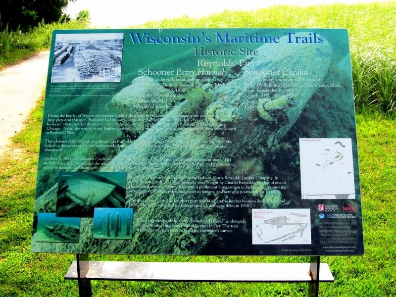
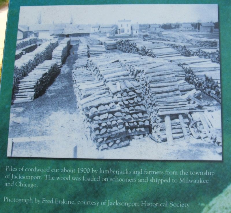
During the heyday of Wisconsin’s lumber industry, Jacksonport’s business and community life centered around three large piers near this spot. Each pier had its own general store and lumber mill. Wooden schooners called “lumber hookers,” often crowded the piers to load cordwood, shingles, and posts bound for the ports of Milwaukee and Chicago. Today, the wrecks of two lumber hookers lie along the remains of the southern most of those piers, known as Reynolds’ Pier.
The schooner Perry Hannan was driven into Reynolds’ Pier in the “Great Alpena Blow” of October 16, 1880. She lodged in the center of the pier and severely damaged it. The schooner was later hauled alongside the pier and abandoned.
On Sept. 9, 1885, the schooner Cecelia tried to wait out another storm by anchoring safely away from shore. Her anchors dragged, however, and she was blown ashore. Her bow was pushed under Reynolds' Pier, and she sustained extensive damage. Her masts were salvaged, but she was also abandoned.
Reynolds' Pier was built in 1869 for the Jackson-Harris-Reynolds Lumber Company. In 1873, the pier, mill, and other property were bought by Charles Reynolds, brother of one of the original owners. Reynolds became a prominent businessman in Jacksonport, promoting settlement of families, extending credit to farmers, and acting as postmaster for 20 years.
The importance of the Jacksonport piers waned when the lumber business declined around 1920. The piers were used for fishing until ice damaged them in 1938.
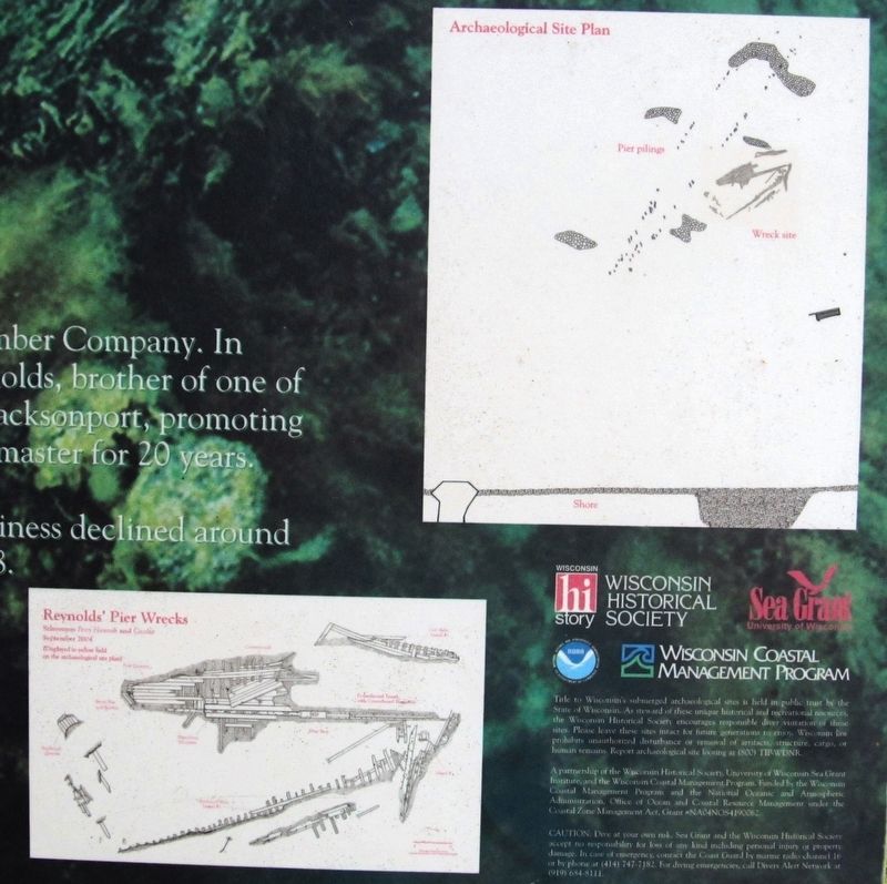
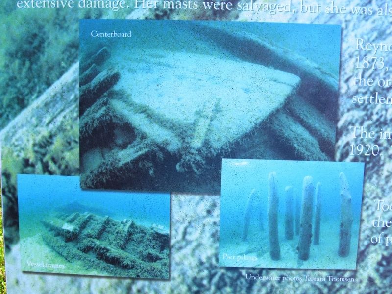
Today, wrecks of the Perry Hannah and Cecelia lie alongside the remaining pilings and cribs of Reynolds' Pier. The tops of pilings can often be seen breaking the water's surface.
Erected by Wisconsin Historical Society, University of Wisconsin Sea Grant Institute, Wisconsin Coastal Management Program.
Topics and series. This historical marker is listed in these topic lists: Industry & Commerce • Waterways & Vessels. In addition, it is included in the Wisconsin’s Maritime Trails series list.
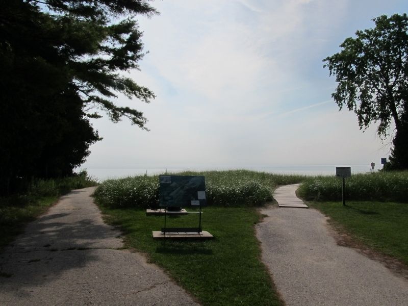
Location. 44° 58.687′ N, 87° 11.025′ W. Marker is in Jacksonport, Wisconsin, in Door County. Marker can be reached from the intersection of Lakeside Park Drive and State Highway 57. Marker is located in Lakeside Park, on the path to the beach area. Touch for map. Marker is in this post office area: Sturgeon Bay WI 54235, United States of America. Touch for directions.
Other nearby markers. At least 8 other markers are within 4 miles of this marker, measured as the crow flies. Anchor & Capstan (a few steps from this marker); Town of Jacksonport (within shouting distance of this marker); Erskine Root Cellar (about 600 feet away, measured in a direct line); St. Michael the Archangel (approx. ¼ mile away); Jacksonport United Methodist Church (approx. 0.6 miles away); The Episcopal Church of the Holy Nativity (approx. 0.6 miles away); Halfway to the North Pole (approx. 2 miles away); Zion Evangelical Lutheran Church (approx. 3.2 miles away). Touch for a list and map of all markers in Jacksonport.
Additional keywords. Shipwrecks
Credits. This page was last revised on August 18, 2017. It was originally submitted on August 17, 2017, by Paul Fehrenbach of Germantown, Wisconsin. This page has been viewed 553 times since then and 21 times this year. Photos: 1, 2, 3, 4, 5. submitted on August 17, 2017, by Paul Fehrenbach of Germantown, Wisconsin. • Bill Pfingsten was the editor who published this page.
