
Natchez in Adams County, Mississippi — The American South (East South Central)
Intersection of Washington and South Pearl streets
Natchez Trails
Photographed by Cajun Scrambler, July 7, 2017
1. Intersection of Washington and South Pearl streets Marker
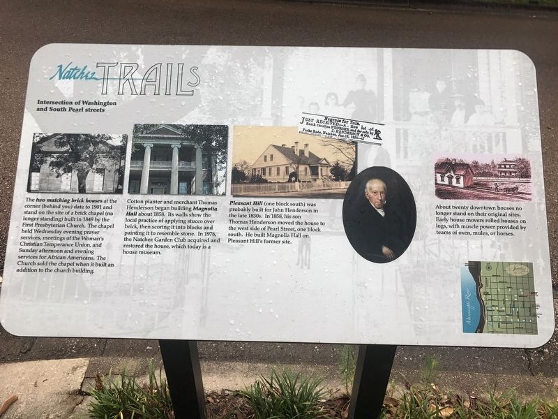
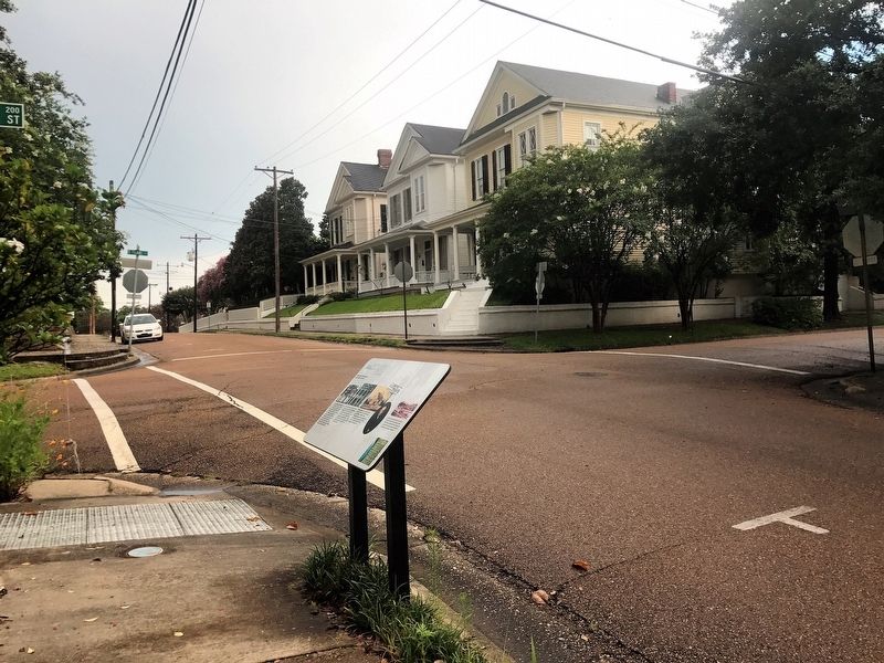
The two matching brick houses at the corner (behind you) date to 1901 and stand on the site of a brick chapel (no longer standing) built in 1849 by the First Presbyterian Church. The chapel held Wednesday evening prayer services, meetings of the Woman's Christian Temperance Union, and Sunday afternoon and evening services for African Americans. The Church sold the chapel when it built an addition to the church building.
Cotton planter and merchant Thomas Henderson began building Magnolia Hall about 1858. Its walls show the local practice of applying stucco over brick, then scoring it into blocks and painting it to resemble stone. In 1976, the Natchez Garden Club acquired and restored the house, which today is a house museum.
Pleasant Hill (one block south) was probably built for John Henderson in the late 1830s. In 1858, his son Thomas Henderson moved the house to the west side of Pearl Street, one block south. He built Magnolia Hall on Pleasant Hill's former site.
About twenty downtown houses no longer stand on their original sites. Early house movers rolled houses on logs, with muscle power provided by teams of oxen, mules,
this page online
Topics and series. This historical marker is listed in these topic lists: Roads & Vehicles • Settlements & Settlers. In addition, it is included in the Mississippi - Natchez Trails series list.
Location. 31° 33.508′ N, 91° 24.302′ W. Marker is in Natchez, Mississippi, in Adams County. It is at the intersection of Washington Street and South Pearl Street, on the right when traveling east on Washington Street. Touch for map. Marker is in this post office area: Natchez MS 39120, United States of America. Touch for directions.

Regionally, this marker is in Southwest Mississippi and in Natchez Trace Corridor. It is also in the American South, specifically in the Deep South, and in the Great River Road Region. Globally, it is in North America, a Gulf of Mexico state, the Western Hemisphere, the Western World, and the Anglosphere. Historically, it finds itself in what was once New Spain, the Viceroyalty of New France, the territory of the Mississippian Culture, one of the Confederate States of America, and the Antebellum South.
Other nearby markers. At least
Photographed by Cajun Scrambler, July 7, 2017
2. Intersection of Washington and South Pearl streets Marker
Credits. This page was last revised on March 6, 2022. It was originally submitted on August 19, 2017, by Cajun Scrambler of Assumption, Louisiana. This page has been viewed 418 times since then and 16 times this year. Photos: 1, 2. submitted on August 19, 2017, by Cajun Scrambler of Assumption, Louisiana.
