Near Huntington in Baker County, Oregon — The American West (Northwest)
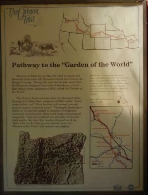
Farewell Bend Oregon Trail Kiosk
Photographed By Barry Swackhamer, June 28, 2017
1. "Pathway to the "Garden of the World" Marker
Captions: (top right) Map of the Oregon Trail; (bottom left) Relief Map of Oregon showing the route of the Oregon Trail.: (center right) Remained in camp to graze our poor brave cattle. Will start about two and go as far as we can tonight, as the days are so excessively hot, and we have 28 miles to go without water! Felt very unwell today, Am almost worn down with the fatigue of constant travel. Our way seem endless! -- Esther Bell McMillan Hanna, August 13, 1852. (map of Oregon Trail sites near Ontario, Oregon.)
Excitement filled the air May 22, 1843 as nearly one thousand Americans left Missouri toward new lives in the Oregon Country. During the next two decades, more than 50,000 people emigrated to a land of abundance. a land that Abigail Scott, emigrant of 1852, called the "Garden of the World."
The Oregon Trail was more than two thousand miles through what Riley Root, emigrant of 1848, called "Landscape without soil! River bottoms with scarcely enough grass to support emigrant teams." The fragile landscape's ability to sustain life eroded as numbers of emigrants increased and privation, illness and death often plagued emigrants. Survivors endured an extremely wearisome road, and by the time they reached this portion of the Trail, with much of the journey behind them, the "Garden of the World" still seemed very distant.
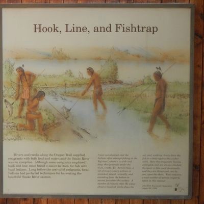
Rivers and creeks along the Oregon Trail supplied emigrants with both food and water, and the Snake River was no exception. Although some emigrants employed hook and line, most found it easier to trade for fish with local Indians. Long before the arrival of emigrants, local Indians had perfected techniques for harvesting the bountiful Snake River salmon.
I have not observed that the Indians often attempt fishing in the 'big river,' where it is wide and deep; they generally prefer the slues, creeks, &c. Across these, a net of closely woven willows is stretched, placed vertically, and extending from the bottom to several feet above the surface. A number of Indians enter the water about a hundred yards above the net, and, walking closely drive the fish in a body against the wicker work. Here they frequently become entangle, and are alway checked; the spear is then used dexterously, and they are thrown out, one by one, upon the shore. With industry, a vast number of salmon might be taken in this manner... -- John Kirk Townsend, Naturalist, August 24, 1834
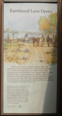
Gold was discovered in Idaho during the 1860s, and emigrants traveling westward often met propectors heading east. Gold rushers seeking the most direct route to their bonanza crossed the Snake River near Farewell Bend. In 1863 Reuben P. Olds, a local entrepreneur, realized substantial profits from both emigrants and miners by establishing a ferry a few miles to the south. Old's ferry allowed emigrants to bypass the Snake River crossing near Fort Boise and follow an alternate route along the north bank of the river.
Going seven miles we reach the ferry. It took all the fore noon to get our party across, only one wagon at a time, with one span of horses or one yoke of oxen, for which we paid $2.00 in gold dust, or $4.00 in Green Backs. but with plenty of patience and still plenty of money we finally crossed. When the ferryman said, "here you are in a land of rain, grain, and big red apples," yet neither was realized only in anticipation. -- Harriet A. Loughary, August 5, 1864
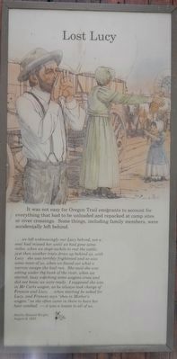
It was not easy for Oregon Trail emigrants to account for everything that had to be unloaded and repacked at camp sites or river crossings. Some things, including family members, were accidentally left behind.
... we left unknowingly our Lucy behind, not a soul had missed her until we had gone some miles, when we stopt awhile to rest the cattle just then another train drove up behind us, with Lucy she was terribly frightened and so was some more of us, when we found out what a narrow escape she had run. She said she was sitting under the bank of the river, when we started, busy watching some wagons cross and did not know we were ready. I supposed she was in Mr. Carls wagon, as he always took charge of Frances and Lucy ... when starting he asked for Lucy, and Frances says "shes in Mother's wagon." as she often came in there to have her hair combed. - it was a lesson to all of us. -- Amelia Stewart Knight, August 8, 1853
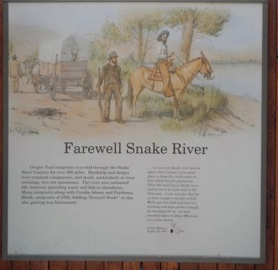
Oregon Trail emigrants traveled through the Snake River Country for over 300 miles. Hardship and danger were constant companions, and death, particularly at river crossings, was not uncommon. The river also sustained life, however, providing water and fish in abundance. Many emigrants along with Cecelia Adams and Parthenia Blank, emigrants of 1852, bidding "farewell Snake" at this site, parting was bittersweet.
... we came on Snake river bottom again, here I campt a very good place, a large dry creek come in here which has got good grass ... There the road leaves Snake river and we see it no more only in the Columbia I was sorry for that for we have caught a number of fish Willie gets his hook and line in a morning and soon catches enough for breakfast for us we have traveled down it about 360 miles it is a fine stream -- George Belshaw, August 23, 1853
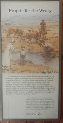
Camp sites along the Oregon Trail were determined by the presence of water, grazing for livestock, or simply the end of a long exhausting day. Although emigrants camped at Farewell Bend, a typical day's journey brought emigrants from the Malheur River through the alkali desert to camp at nearby Birch Creek. Water was available along this route, but is was often tainted, and many along with Martha S. Read. emigrant of 1852, found themselves "most all sick from the effects." Farewell Bend provided a welcome respite for emigrants recovering from the effects of bad water and other illness.
... moved 3 miles to the river to get better water. Found plenty of feed. The Indians have visited us every day and brought us fish. They appear perfectly friendly. We have had very warm days ever since we stopt here. To day we have had a few sprinkles of rain. There is an immense sight of sickness on the road. Lydia is getting sick to day ... -- Martha S. Read, September 13, 1852
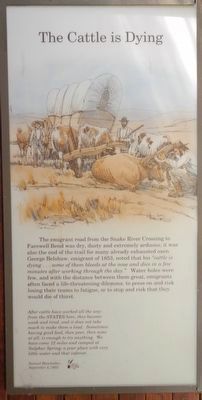
The emigrant road from the Snake River Crossing to Farewell Bend was dry, dusty and extremely arduous; it was also the end of the trail for many already exhausted oxen. George Belshaw, emigrant of 1853, noted that his "cattle is dying ... some of them bleeds at the nose and dies in a few minutes after working through the day." Water holes were few, and with the distance between them great, emigrants often faced a life-threatening dilemma: to press on and risk losing their team to fatigue, or to stop and risk that they would die of thirst.
After cattle have worked all the way from the STATES here, they become weak and tired, and it does not take much to make them a load. Sometimes having good feed, then poor, then none at all, is enough to try anything. We have come 12 miles and camped at Sulphur Spring; a poor place with very little water and that inferior. -- Samuel Handsaker, September 4, 1853
Erected by Oregon Highway Commission.
Topics and series. This historical marker is listed in these topic lists: Roads & Vehicles • Settlements & Settlers. In addition, it is included in the Oregon Trail series list.
Location. 44° 18.23′ N, 117° 13.592′ W. Marker is near Huntington, Oregon, in Baker County. Marker can be reached from Huntington Highway (Business U.S. 30) near Interstate 84, on the right when traveling north. Touch for map. Marker is at or near this postal address: 5960 Huntington Highway, Huntington OR 97907, United States of America. Touch for directions.
Other nearby markers. At least 7 other markers are within 15 miles of this marker, measured as the crow flies. Farewell Bend (within shouting distance of this marker); Remnants of the Oregon Trail (approx. 2.2 miles away); Van Ornum Wagon Train Massacre (approx. 2.3 miles away); Van Ornum Massacre (approx. 2.3 miles away); The Last Spike (approx. 3.9 miles away); a different marker also named Van Ornum Wagon Train Massacre (approx. 3.9 miles away); Weatherby Oregon Trail Kiosk (approx. 14.9 miles away).
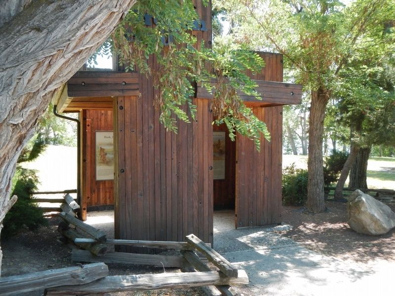
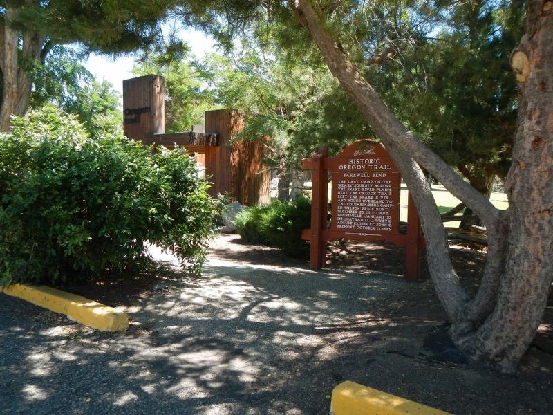
More about this marker. The kiosk is located in Farewell Bend State Recreation Area, near the parking lot.
Additional keywords. Oregon Trail
Credits. This page was last revised on August 22, 2017. It was originally submitted on August 20, 2017, by Barry Swackhamer of Brentwood, California. This page has been viewed 670 times since then and 27 times this year. Photos: 1, 2, 3, 4, 5, 6, 7, 8, 9. submitted on August 20, 2017, by Barry Swackhamer of Brentwood, California.
