Near Spotsylvania Courthouse in Spotsylvania County, Virginia — The American South (Mid-Atlantic)
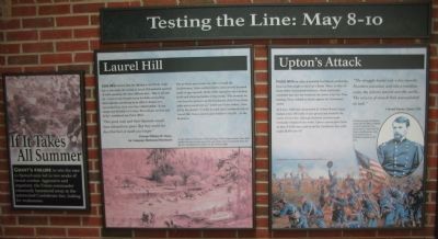
Testing the Line: May 8-10
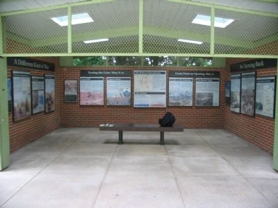
Spotsylvania Exhibit Shelter
— West Wall —
Inscription.
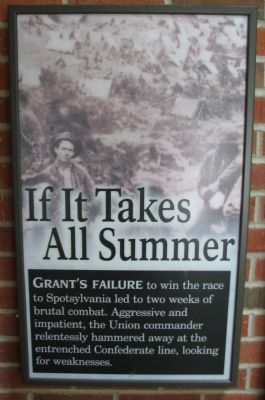
If It Takes All Summer
Grant's failure to win the race to Spotsylvania led to two weeks of brutal combat. Aggressive and impatient, the Union commander relentlessly hammered away at the entrenched Confederate line, looking for weakness.
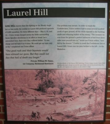
Laurel Hill
Less well known than the fighting at the Bloody Angle but no less costly, the combat at Laurel Hill produced upwards of 5,000 casualties. On three different days - May 8, 10, and 12 - Union troops charged across the fields surrounding Sarah Spindle's farmhouse in an effort to break Lee's entrenched lines. Each time they suffered defeat. "It was charge and fall back 6 to 8 times. We could get our men only so far," complained one officer.
"One good rush and their bayonets would have silenced our guns. But they could not face that hail of death any longer."
Private William M. Dame,
1st Company, Richmond Howitzers
The problem was terrain. In order to reach the Confederates, Union soldiers had to cross several hundred yards of open ground, all the while exposed to the bursting shells and whizzing bullets of the enemy. "The moment we rose from the ground a perfect hailstorm of ball from three sides were poured into us," wrote one Union soldier, "men fell by the dozens." Unable to crack the Confederate line at Laurel Hill, Grant cast his gaze further to the left - to the Muleshoe.
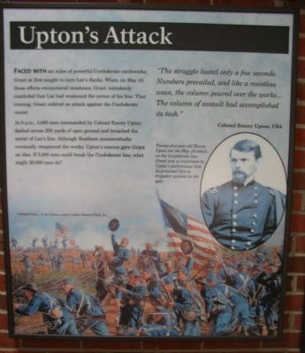
Upton's Attack
Faced with six miles of powerful Confederate earthworks, Grant at first sought to turn Lee's flanks. When, on May 10, those efforts encountered resistance, Grant mistakenly concluded that Lee had weakened the center of his line. That evening, Grant ordered an attack against the Confederate center.
At 6 p.m., 5,000 men commanded by Colonel Emory Upton dashed across 200 yards of open ground and breached the center of Lee's line. Although Southern counterattacks eventually recaptured the works, Upton's success gave Grant an idea. If 5,000 men could break the Confederate line, what might 20,000 men do?
"The struggle lasted only a few seconds. Numbers prevailed, and like a resistless wave, the column poured over the works...The column of assault had accomplished its task."
Colonel Emory Upton, USA
Topics. This historical marker is listed in this topic list: War, US Civil. A significant historical month for this entry is May 1873.
Location. 38° 13.147′ N, 77° 36.863′ W. Marker is near Spotsylvania Courthouse, Virginia, in Spotsylvania County. Marker is on Grant Drive, 0.1 miles north of Brock Road (County Route 613), on the left when traveling north. Located at stop one (The Exhibit Shelter) on the driving tour of Spotsylvania Battlefield unit of the Fredericksburg and Spotsylvania National Military Park. Touch for map. Marker is at or near this postal address: 9550 Grant Dr, Spotsylvania VA 22553, United States of America. Touch for directions.
Other nearby markers. At least 8 other markers are within walking distance of this marker. A Different Kind of War (here, next to this marker); The Battle of Spotsylvania (here, next to this marker); No Turning Back (here, next to this marker); Grant Finds an Opening: May 12 (here, next to this marker); Spotsylvania Court House (a few steps from this marker); The Death of Sedgwick (about 300 feet away, measured in a direct line); Spotsylvania Campaign (about 400 feet away); a different marker also named Spotsylvania Campaign (about 400 feet away). Touch for a list and map of all markers in Spotsylvania Courthouse.
More about this marker. The background of If it Takes All Summer panel is a collage of soldiers in camp. For the Laurel Hill panel, a scene of the fighting is shown. In this sketch of the Laurel Hill fighting, Union troops (center) leave their earthworks and charge across the open field, only to be pinned down by the fire of Confederate soldiers on the distant ridge. The Upton's Attack panel features a portrait of Upton, captioned Twenty-five-year-old Emory Upton led the May 10 attack on the Confederate line. Grant was so impressed by Upton's performance that he promoted him to brigadier general on the spot. In the lower half is a painting titled "A Brigade Today..." by Rick Reeves.
Related markers. Click here for a list of markers that are related to this marker. Battle of Spotsylvania - Exhibit Shelter and Tour Stop One Trails
Also see . . . The Exhibit Shelter. National Park Service virtual tour stop. Note photos of the shelter with older markers on the walls. (Submitted on August 25, 2008, by Craig Swain of Leesburg, Virginia.)
Photographed By Craig Swain
5. The Spotsylvania Exhibit Shelter
To the left is the south wall, with the A Different Kind of War marker. In the center are the Testing the Line: May 8-10, The Battle of Spotsylvania, and Grant Finds and Opening: May 12 markers along the west wall. To the right is the north wall with No Turning Back.
Credits. This page was last revised on July 9, 2021. It was originally submitted on August 25, 2008, by Craig Swain of Leesburg, Virginia. This page has been viewed 1,057 times since then and 10 times this year. Photos: 1, 2, 3, 4. submitted on August 25, 2008, by Craig Swain of Leesburg, Virginia. 5. submitted on August 24, 2008, by Craig Swain of Leesburg, Virginia.
