McCalla in Jefferson County, Alabama — The American South (East South Central)
Williams House
Circa 1889
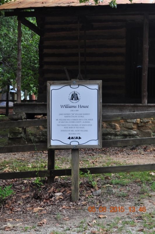
Photographed by Sandra Hughes, August 5, 2015
1. Williams House Marker
James Monroe "Jim" Williams married Martha Evaline George.
Mr. Williams was a farmer and a coal miner at Gray Hill in Bibb County, Alabama.
They raised ten children, of which seven were born in this house.
Donated by Mrs. Audry Williams, restored 1976
Erected by Alabama Historic Ironworks Commission.
Topics. This historical marker is listed in these topic lists: Agriculture • Industry & Commerce • Settlements & Settlers. A significant historical year for this entry is 1889.
Location. 33° 15.4′ N, 87° 3.743′ W. Marker is in McCalla, Alabama, in Jefferson County. It is on Tannehill Road half a mile north of Confederate Parkway, on the right when traveling north. Marker is located in Tannehill Ironworks Historical State Park. Touch for map. Marker is at or near this postal address: 8001 Tannehill Rd, Mc Calla AL 35111, United States of America. Touch for directions.

Regionally, this marker is in the Birmingham Metropolitan Area. It is also in the American South and specifically in the Deep South. Globally, it is in North America, a Gulf of Mexico state, the Western Hemisphere, the Western World, and the Anglosphere. Historically, it finds itself in what was once the territory of the Mississippian Culture, one of the Confederate States of America, and the Antebellum South.
Other nearby markers. At least 8 other markers are within walking distance of this marker: Dairy Barn (within shouting distance of this marker); Pioneer Farm Buildings (within shouting distance of this marker); Tapawingo Bridge (within shouting distance of this marker); Bell Barn (within shouting distance of this marker); Gristmill Trail (about 400 feet away, measured in a direct line); John Wesley Hall Grist Mill & Cotton Gin (about 400 feet away); Bagley House (approx. 0.6 miles away); The Hogan House
this page online
Also see . . . Tannehill Ironworks Historical State Park. Park website entry (Submitted on August 28, 2017.)
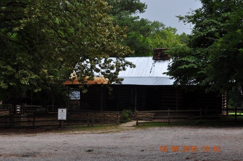
Photographed by Sandra Hughes, August 5, 2015
2. Williams House Marker
Credits. This page was last revised on May 4, 2021. It was originally submitted on August 27, 2017, by Sandra Hughes Tidwell of Killen, Alabama, USA. This page has been viewed 528 times since then and 49 times this year. Photos: 1, 2. submitted on August 27, 2017, by Sandra Hughes Tidwell of Killen, Alabama, USA. • Bernard Fisher was the editor who published this page.
