Near Buena Vista in Chaffee County, Colorado — The American Mountains (Southwest)
Stagecoach Road to Riches
Photographed by Cosmos Mariner, August 28, 2017
1. Stagecoach Road to Riches Marker
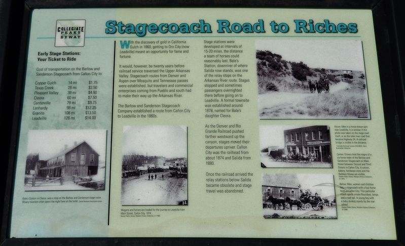
With the discovery of gold in California Gulch in 1860, getting to Oro City (now Leadville) meant an opportunity for fame and fortune.
It would, however, be twenty years before railroad service traversed the Upper Arkansas Valley. Stagecoach routes from Denver and Aspen over Mosquito and Tennessee passes were established, but travelers and commercial enterprises coming from Pueblo and south had to make their way up the Arkansas River.
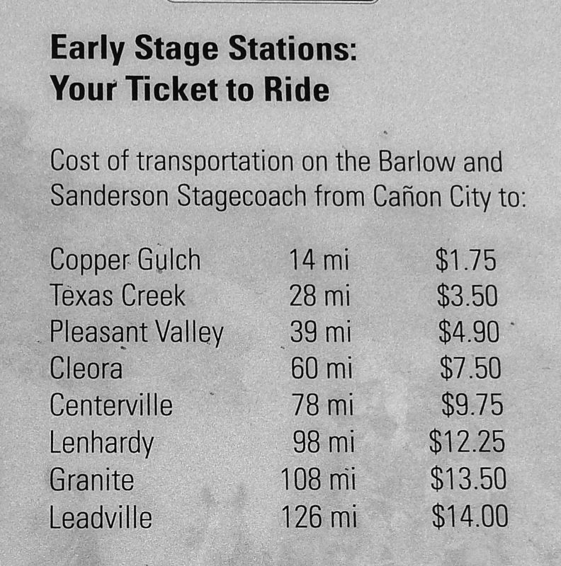
The Barlow and Sanderson Stagecoach Company established a route from Canon City to Leadville in the 1860’s.
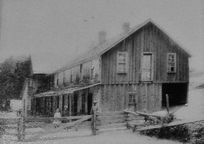
Stage stations were developed at intervals of 15-20 miles, the distance a team of horses could reasonably last. Bale’s Station, downriver of where Salida now stands, was one of the relay stops on the Arkansas River route. Stages stopped and sometimes passengers overnighted there before going on to Leadville. A formal townsite was established around 1878, named for Bale’s daughter Cleora.
As the Denver and Rio Grande Railroad pushed farther westward up the canyon, stages moved their departures upriver. Canon City was the railhead from about 1874 and Salida from 1880.
Once
this page online
Erected by Federal Highway Administration, National Scenic Byways & Greater Arkansas River Nature Association.
Topics. This historical marker is listed in these topic lists: Industry & Commerce • Railroads & Streetcars • Roads & Vehicles • Settlements & Settlers.
Location. 39° 2.029′ N, 106° 15.429′ W. Marker is near Buena Vista, Colorado, in Chaffee County. It is on U.S. 24 one mile east of County Highway 397, on the left when traveling east. Marker is located in a pull-out area overlooking the Arkansas River, on the north side of US Highway 24. Touch for map. Marker is in this post office area: Buena Vista CO 81211, United States of America. Touch for directions.

Regionally, this marker is in the Arkansas River Valley, in the Colorado High Rockies and on the Continental Divide. It is also in the American Mountain West. Globally, it is in North America, the Rocky Mountains, the Western Hemisphere, the Western World, and the Anglosphere.
Other nearby markers. At
Photographed by Cosmos Mariner, August 28, 2017
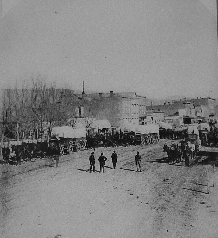
2. Marker Detail: Wagons and horses, Canon City
Wagons and horses are loaded for the journey to Leadville from Main Street, Canon City. 1874.
Denver Public Library, Western History Collection, X-17960
More about this marker. Marker is associated with Colorado's Collegiate Peaks Scenic and Historic Byway. Marker is relatively new and in good condition.
Related markers. Click here for a list of markers that are related to this marker. Colorado's Collegiate Peaks Scenic and Historic Byway
Also see . . .
1. Barlow and Sanderson Stagecoach.
Before the rapid expansion of railroads in the West in the 1870s and 1880s, stagecoaches carried passengers, mail, and freight from town to town. Bradley Barlow and Jared Sanderson first entered the stagecoach business in the early 1860s in Missouri. The first use of
Photographed by Cosmos Mariner, August 28, 2017
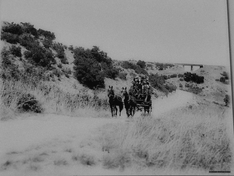
3. Marker Detail: Horse-drawn Cart
Men in a horse-drawn cart near Leadville. It is unclear if this photo was taken on the stage road itself, or on the later river road that became U.S. Highway 24. A railroad bridge is visible in the distance.
Colorado Historical Society CHS-B638, Harry Buckwalter Collection.
2. Barlow & Sanderson Company – Staging in the Mountains. Legends of America website entry (Submitted on April 2, 2024, by Larry Gertner of New York, New York.)
Photographed by Cosmos Mariner, August 28, 2017
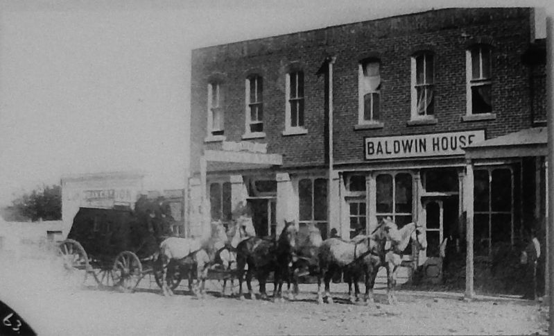
4. Marker Detail: Baldwin House
Drivers hold the reigns of a six horse team of the Barlow and Sanderson Stagecoach on Main Street between Second and Third Streets in Canon City. A saloon, bakery, hardware store and the Baldwin House are visible.
Denver Public Library, Western History Collection, X-17975
Photographed by Cosmos Mariner, August 28, 2017
5. Marker Detail: Four Horse Team
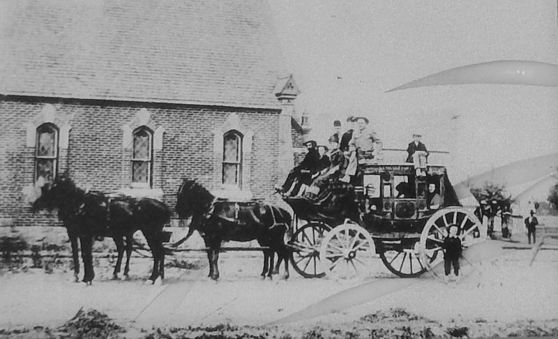
Men, women and children ride a stagecoach with a four horse team in Canon City. This particular coach sports ornate flourishes, lamps and a roof rail. A young boy with a baby donkey stands by the rear wheel.
Denver Public Library, Western History Collection, X-17966
Photographed by Cosmos Mariner, August 28, 2017
6. Marker Detail: Stagecoach Ticket Prices
Photographed by Cosmos Mariner, August 28, 2017
7. Marker Detail: Bale's Station
Bale's Station in Cleora was a stop on the Barlow and Sanderson stage route. Weary travelers often spent the night here at the hotel. Salida Museum Association photo
Photographed by Cosmos Mariner, August 28, 2017
8. Stagecoach Road to Riches Marker (wide view)
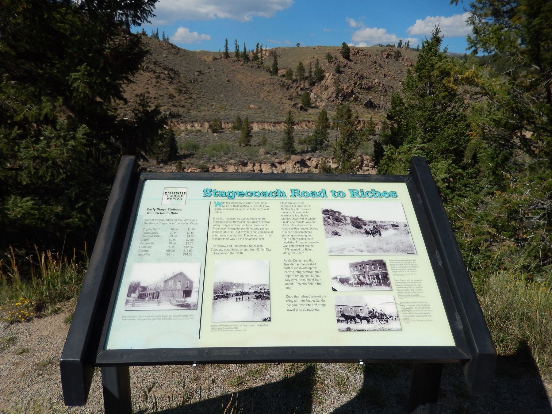
Looking north across marker, over Arkansas River, with railroad grade visible in the background
Photographed by Cosmos Mariner, August 28, 2017
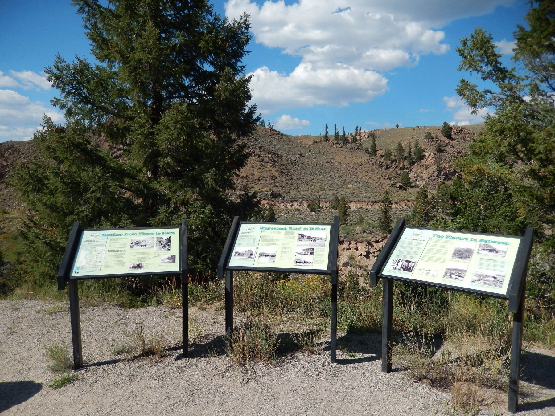
9. Related marker group (Overlooking the Arkansas River)
Related Markers: "Getting from There to Here", "Stagecoach Road to Riches", and "The Placers in Between"
Credits. This page was last revised on July 6, 2026. It was originally submitted on September 1, 2017, by Cosmos Mariner of Cape Canaveral, Florida. This page has been viewed 1,995 times since then and 155 times this year. Photos: 1, 2, 3, 4, 5. submitted on September 1, 2017, by Cosmos Mariner of Cape Canaveral, Florida. 6, 7. submitted on September 18, 2017, by Cosmos Mariner of Cape Canaveral, Florida. 8. submitted on September 1, 2017, by Cosmos Mariner of Cape Canaveral, Florida. 9. submitted on September 18, 2017, by Cosmos Mariner of Cape Canaveral, Florida. • Bill Pfingsten was the editor who published this page.
