Townville in Anderson County, South Carolina — The American South (South Atlantic)
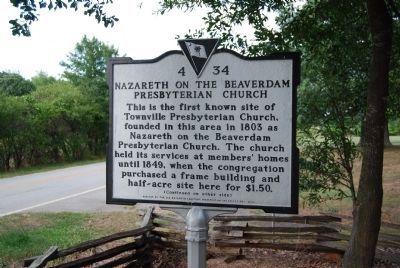
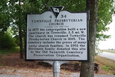
Nazareth on the Beaverdam Presbyterian Church / Townville Presbyterian Church
Inscription.
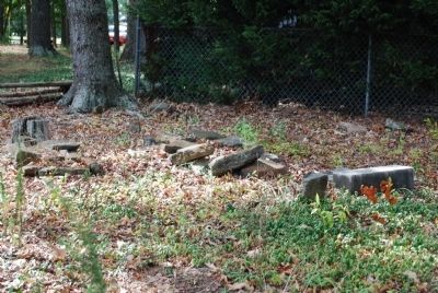
Nazareth on the Beaverdam Presbyterian Church. This is the first known site of Townville Presbyterian Church, founded in this area in 1803 as Nazareth on the Beaverdam Presbyterian Church. The church held its services at members' homes until 1849, when the congregation purchased a frame building and half-acre site here for $1.50.
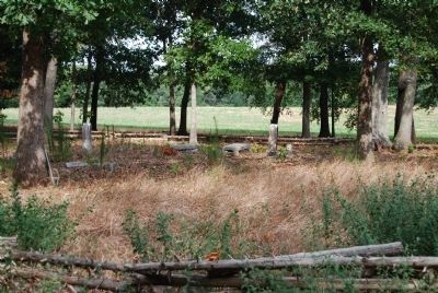
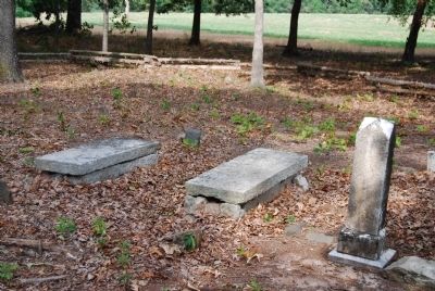
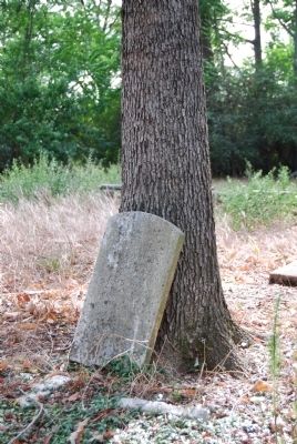
Townville Presbyterian Church. In 1877 the congregation built a new sanctuary in Townville, 2.5 mi. W. The church was renamed Townville Presbyterian Church in 1885. The cemetery includes the graves of many early church families. In 2002 the Stevenson family donated this site to the Old Nazareth Cemetery Preservation Organization.
Erected 2002 by Old Nazareth Cemetery Preservation Organization. (Marker Number 4-34.)
Topics. This historical marker is listed in these topic lists: Cemeteries & Burial Sites • Churches & Religion. A significant historical year for this entry is 1803.
Location. 34° 32.144′ N, 82° 55.573′ W. Marker is in Townville, South Carolina, in Anderson County. Marker is on Fairplay Road near Rogers Farm Road, on the left when traveling south. Touch for map. Marker is in this post office area: Townville SC 29689, United States of America. Touch for directions.
Other nearby markers. At least 10 other markers are within 10 miles of this marker, measured as the crow flies. Townville Presbyterian Church (approx. 2.4 miles away); Beaverdam Baptist Church (approx. 3.4 miles away); Capt. Samuel Earle (approx. 4.3 miles away); The Wilton E. Hall Bridge (approx. 6 miles away); Portman Shoals (approx. 6 miles away); Center Methodist Church (approx. 6.3 miles away); Vandiver Bridge (approx. 6.8 miles away); Shoal Creek (approx. 9.1 miles away in Georgia); Hopewell Plantation (approx. 9˝ miles away); Roberts Church (approx. 9˝ miles away). Touch for a list and map of all markers in Townville.
Additional commentary.
1. Nazareth to Townville Presbyterian by Mel Woody
Townville Presbyterian Church (USA) has a long history, although until recently it was a struggling church, which often seemed on its last legs.
It was founded as Nazareth on Beaverdam in 1803, which makes it older than 34 of the states of the U.S. It's even older than Townville itself, which was originally called Brown's Store, after store owner and postmaster Sam Brown, then Brownsville, until that caused too much confusion with another Brownsville in Marlboro County near Bennettsville. It wasn't until April 12, 1837, that the U.S. Postal service took the bull by the horns and renamed the place Townville, with Sam Brown continuing as Townville's postmaster. Sam, one of the founders of the Townville Baptist Church, is buried in that church's cemetery.
Page 162 of the minutes of the Synod of the Carolinas at Montreat, N.C., tells the story of Townville Presbyterian's birth. The minutes note that on the 12th of September, 1803, "a society in the fork between Tugaloo and Keowee (rivers) known by the name of Nazareth on the Beaverdam desires to be entered in our minutes and supplied with the gospel." Dr. George Howe's "History of the Presbyterian Church in South Carolina" goes on to say that supplies (pastors)
are ordered, viz: Messrs (John) Simpson, who was the founder of Roberts Church; (James) Gilliland Jr., and (James) McElhenny in 1803, James Gilliland Sr.,
(Andrew) Brown and Simpson in 1804, and Simpson and Brown in 1805 and 1806."
That was the beginning. It's not known exactly where the congregation met in those early years. It could have been at private homes or under a tree some
place. The first we know of a church structure is found in an Anderson County deed (Book 1, Page 71). It says that on Jan. 3, 1849, Nazareth on the Beaverdam bought for the good round sum of $1.50 a building and a half-acre tract on which it stood from
Salathiel Bradberry for use as a church building. Matthew Martin and Samuel Pickens Harris were the Nazareth trustees in the transaction.
Nazareth Beaverdam was located on the east side of Fair Play Road, 2.5 miles south of the present church, a tenth of a mile south of Jolly Road and 1.2 miles north of Route 243, not far from Little Beaverdam Creek which was part of its name. The church and cemetery were located behind what in 2001 is the home of Mr. And Mrs. Vern Ramage. (Source: http://files.usgwarchives.net/sc/oconee/cemeteries/c193a.txt.)
— Submitted January 12, 2009, by Brian Scott of Anderson, South Carolina.
Credits. This page was last revised on July 13, 2022. It was originally submitted on August 27, 2008, by Brian Scott of Anderson, South Carolina. This page has been viewed 1,366 times since then and 36 times this year. Photos: 1, 2, 3, 4, 5, 6. submitted on August 27, 2008, by Brian Scott of Anderson, South Carolina. • Kevin W. was the editor who published this page.
