Near Dalton in Whitfield County, Georgia — The American South (South Atlantic)
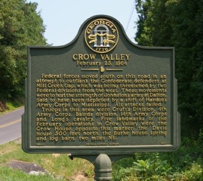
Crow Valley
February 25, 1864
Photographed by David Seibert, June 26, 2008
1. Crow Valley Marker
Troops in this area were Cruft`s division, 4th Army Corps, Bairds division, 14th Army Corps and Long’s cavalry. Five landmarks of the February operations in Crow Valley were the Crow House, opposite this marker, the Davis house 500 feet north, the Burke house, spring and log barn, two miles NE.
Erected 2001 by Georgia Department of Natural Resources. (Marker Number 155-21.)
Topics. This historical marker is listed in this topic list: War, US Civil.
Location. 34° 50.921′ N, 84° 59.875′ W. Marker is near Dalton, Georgia, in Whitfield County. It is on Crow Valley Road near Reed Pond Road, on the right when traveling north. Touch for map. Marker is in this post office area: Dalton GA 30721, United States of America. Touch for directions.

Regionally,
this page online
Other nearby markers. At least 8 other markers are within 3 miles of this marker, measured as the crow flies: Schofield's 23d Corps in Crow Valley (approx. 0.9 miles away); Stevenson's Line (approx. one mile away); North Line Dalton’s Defenses (approx. one mile away); a different marker also named Crow Valley (approx. 1.1 miles away); Harris' Gap (approx. 1.3 miles away); Military Operations in Crow Valley (approx. 1.4 miles away); a different marker also named Stevenson's Line (approx. 1.6 miles away); The Excavation (approx. 2.2 miles away). Touch for a list and map of all markers in Dalton.

Photographed by Jimmy Emerson, May 7, 2026
2. Crow Valley Marker
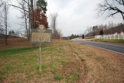
Photographed by Brandon Fletcher, February 21, 2012
3. Crow Valley Marker Wide View
Credits. This page was last revised on May 8, 2026. It was originally submitted on August 27, 2008, by David Seibert of Sandy Springs, Georgia. This page has been viewed 2,662 times since then and 120 times this year. Photos: 1. submitted on August 27, 2008, by David Seibert of Sandy Springs, Georgia. 2. submitted on May 7, 2026, by Jimmy Emerson of Dalton, Georgia. 3. submitted on July 21, 2015, by Brandon Fletcher of Chattanooga, Tennessee. • Craig Swain was the editor who published this page.
