Dalton in Whitfield County, Georgia — The American South (South Atlantic)
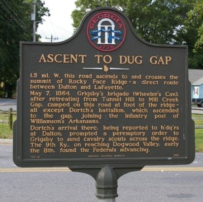
Ascent to Dug Gap
Photographed by David Seibert, June 30, 2008
1. Ascent to Dug Gap Marker
May 7, 1864. Grigsby's brigade (Wheeler's Cav.), after retreating from Tunnel Hill to Mill Creek Cap, camped on this road at foot of the ridge - all except Dortch's battalion, which ascended to the gap, joining the infantry post of Williamson's Arkansans.
Dortch's arrival there, being reported to h'dq'rs at Dalton, prompted a peremptory order to Grigsby to send cavalry scouts across the ridge. The 9th Ky., on reaching Dogwood Valley, early the 8th, found the Federals advancing.
Erected 1989 by Georgia Department of Natural Resources. (Marker Number 155-12.)
Topics. This historical marker is listed in this topic list: War, US Civil. A significant historical date for this entry is May 7, 1864.
Location. 34° 44.405′ N, 84° 59.912′ W. Marker is in Dalton, Georgia, in Whitfield County. It is at the intersection of Dug Gap Road and E. Dug Gap Mountain Road, on the right when traveling south on Dug Gap Road. Touch for map. Marker is in this post office area: Dalton GA 30721, United States of America.
this page online

Regionally, this marker is in the Mountains. It is also in the American South, specifically in the Deep South, in Appalachia, and specifically in Southern Appalachia. Globally, it is in North America, the Western Hemisphere, the Western World, and the Anglosphere. Historically, it finds itself in what was once the original Cherokee Nation, the territory of the Mississippian Culture, one of the original Thirteen Colonies, one of the Confederate States of America, and the Antebellum South.
Other nearby markers. At least 8 other markers are within 3 miles of this marker, measured as the crow flies: Dug Gap (approx. one mile away); Battle of Dug Gap (approx. one mile away); a different marker also named Dug Gap (approx. 1.4 miles away); Johnny Marcus Memorial Loop (approx. 1.4 miles away); Milltown Education (approx. 1.8 miles away); The McCarty Neighborhood (approx. 2.1 miles away); Dalton Confederate Memorial (approx. 2.2 miles away); Dalton Confederate Cemetery (approx. 2.2 miles away). Touch for a list and map of all markers in Dalton.
Another marker is no longer nearby. The McCarty Subdivision
Photographed by Brandon Fletcher, January 29, 2017
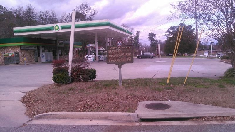
2. Ascent to Dug Gap Marker
Credits. This page was last revised on March 22, 2017. It was originally submitted on August 27, 2008, by David Seibert of Sandy Springs, Georgia. This page has been viewed 2,227 times since then and 55 times this year. Photos: 1. submitted on August 27, 2008, by David Seibert of Sandy Springs, Georgia. 2. submitted on March 21, 2017, by Brandon Fletcher of Chattanooga, Tennessee. • Craig Swain was the editor who published this page.
