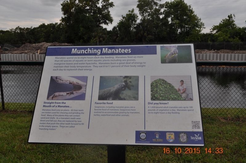
Munching Manatees
Straight from the Mouth of Manatee…
Manatees feed only on plants. All their teeth are molars used for chewing and grinding the food. Many of the plants they eat contain sand and shells. As a manatee’s teeth wear down and fall out, they are replaced by new molars that push the other teeth forward to fill in the empty spaces. These are called “marching molars.”
Favorite food
Seagrasses, including manatee grass, are a favorite food of manatees. Seagrasses have evolved to accommodate grazing by manatees, turtles, waterfowl and other animals.
Did you know?
A 1,000-pound adult manatee eats up to 100 pounds of vegetation a day. Manatees spend six to eight hours a day feeding.
Topics. This historical marker is listed in these topic lists: Animals • Environment.
Location. 26° 41.59′ N,
this page online

Regionally, this marker is on the Gulf Coast. It is also in the American South and on the Gulf Coast. Globally, it is in the North Atlantic Region, North America, a Gulf of Mexico state, the Western Hemisphere, the Western World, and the Anglosphere. Historically, it finds itself in what was once New Spain, the territory of the Mississippian Culture, one of the Confederate States of America, and the Antebellum South.
Other nearby markers. At least 8 other markers are within walking distance of this marker: Tracking Manatees (here, next to this marker); Relatives and Relationships (here, next to this marker); Manatee Young (here, next to this marker); Pine Flatwoods Habitat (here, next to this marker); Scrub Oak Habitat (here, next to this marker); Responsible Fishing (here, next to this marker); Boating with Wildlife (here, next to this marker); Mangroves - Trees of the Sea (here, next to this marker). Touch for a list and map of all markers in Fort Myers.
Credits. This page was last revised on September 6, 2017. It was originally submitted on August 7, 2017, by Sandra Hughes Tidwell of Killen, Alabama, USA. This page has been viewed 336 times since then and 22 times this year. Last updated on September 6, 2017, by Byron Hooks of Sandy Springs, Georgia. Photo 1. submitted on August 7, 2017, by Sandra Hughes Tidwell of Killen, Alabama, USA. • Bill Pfingsten was the editor who published this page.
