
Pugwash in Cumberland County, Nova Scotia — The Atlantic Provinces (North America)
Evolution of Pugwash Industry
Our Harbour • Our Heritage
Photographed by William Fischer, Jr., July 28, 2017
1. Evolution of Pugwash Industry Marker
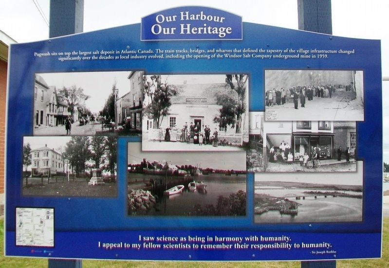
Pugwash sits on top the largest salt deposit in Atlantic Canada. The train tracks, bridges, and wharves that defined the tapestry of the village infrastructure changed significantly over the decades as local industry evolved, including the opening of the Windsor Salt Company underground mine in 1959.
I saw science as being in harmony with humanity.
I appeal to my fellow scientists to remember their responsibility to humanity.
- Sir Joseph Rotblat
[Historic Pugwash Photos]
Erected by Pugwash & Area Chamber of Commerce and Others.
Topics. This historical marker is listed in these topic lists: Environment • Industry & Commerce • Natural Resources • Settlements & Settlers. A significant historical year for this entry is 1959.
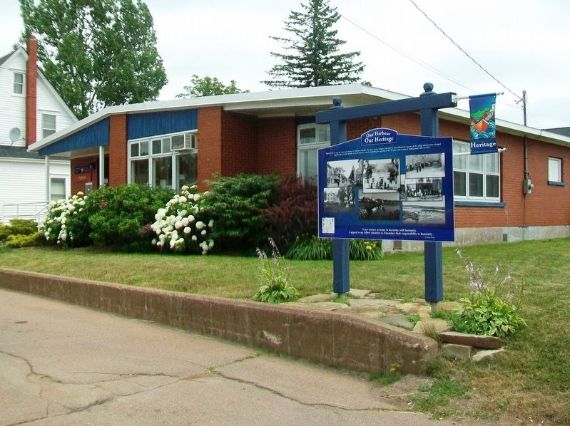
Location. 45° 50.961′ N, 63° 39.775′ W. Marker is in Pugwash, Nova Scotia, in Cumberland County. It is at the intersection of Durham Street and Water Street, on the left when traveling west on Durham Street. Touch for map. Marker is at or near this postal address: 10154 Durham Street, Pugwash NS B0K 1L0, Canada. Touch for directions.

Regionally, this marker is on Nova Scotia’s
this page online
Other nearby markers. At least 8 other markers are within walking distance of this marker: World Wars Memorial (within shouting distance of this marker); The Pugwash Conferences and Masonic Lodge (within shouting distance of this marker); The Gathering of the Clans (about 90 meters away, measured in a direct line); Pugwash Harbour (about 90 meters away); Nova Scotia Clayworks (about 90 meters away); Pugwash Streetscapes (about 120 meters away); Pugwash Train Station 1961 (about 180 meters away); Pugwash Railway Station (about 180 meters away). Touch for a list and map of all markers in Pugwash.
Also see . . . Pugwash, Nova Scotia. Wikipedia entry (Submitted on April 3, 2024, by Larry Gertner of New York, New York.)
Photographed by William Fischer, Jr., July 28, 2017
2. Evolution of Pugwash Industry Marker
Credits. This page was last revised on March 17, 2025. It was originally submitted on September 7, 2017, by William Fischer, Jr. of Reynoldsburg, Ohio. This page has been viewed 351 times since then and 28 times this year. Photos: 1, 2. submitted on September 7, 2017, by William Fischer, Jr. of Reynoldsburg, Ohio.
