Darien in McIntosh County, Georgia — The American South (South Atlantic)
New Inverness
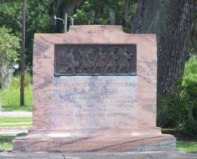
Photographed by Mike Stroud, August 2008
1. New Inverness Marker
Highlanders of Scotland
who founded New Inverness in 1736 AD
Their valor defended the struggling colony
from - the - Spanish - invasion
Their ideals traditions and culture
enriched
the land of their adoption
Erected 1936 by The Georgia Society of the Colonial Dames of America,The St. Andrews Society of the City of Savannah, The Society of Colonial Wars in the State of Georgia.
Topics and series. This historical marker is listed in these topic lists: Colonial Era • Military • Settlements & Settlers. In addition, it is included in the The Colonial Dames of America, National Society of series list. A significant historical year for this entry is 1736.
Location. 31° 22.218′ N, 81° 26.058′ W. Marker is in Darien, Georgia, in McIntosh County. It is at the intersection of Ocean Highway (U.S. 17) and Adams Street (Georgia Route 99), on the left when traveling south on Ocean Highway. Marker is one block north of City Hall. Touch for map. Marker is in this post office area: Darien GA 31305, United States of America. Touch for directions.

Regionally, this marker is on the Coastal Plain, on the Georgia Coast
this page online
Other nearby markers. At least 8 other markers are within walking distance of this marker: The Oglethorpe Oak (a few steps from this marker); McIntosh County (within shouting distance of this marker); a different marker also named Oglethorpe Oak (within shouting distance of this marker); The Vessel Kit Jones (about 300 feet away, measured in a direct line); The Burning of Darien (about 400 feet away); Methodists at Darien (about 600 feet away); Darien's Railroad and Depot (about 700 feet away); Columbus Square (about 700 feet away). Touch for a list and map of all markers in Darien.
Regarding New Inverness. Originally named "New Inverness" the name
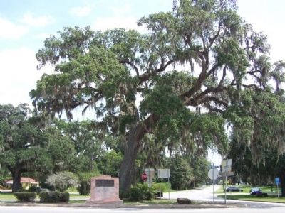
Photographed by Mike Stroud, 2008
2. New Inverness Marker
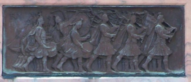
Photographed by Mike Stroud, 2008
3. New Inverness Marker, detail close-up
Credits. This page was last revised on October 21, 2020. It was originally submitted on August 29, 2008, by Mike Stroud of Bluffton, South Carolina. This page has been viewed 2,329 times since then and 105 times this year. Photos: 1, 2, 3. submitted on August 29, 2008, by Mike Stroud of Bluffton, South Carolina. • Kevin W. was the editor who published this page.
