
Mount Joy Township near Gettysburg in Adams County, Pennsylvania — The American Northeast (Mid-Atlantic)
Gettysburg Campaign
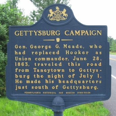
Photographed by Craig Swain, July 27, 2008
1. Gettysburg Campaign Marker
Erected 1947 by Pennsylvania Historical and Museum Commission.
Topics and series. This historical marker is listed in this topic list: War, US Civil. In addition, it is included in the Gettysburg Campaign, and the Pennsylvania Historical and Museum Commission (PHMC) series lists. A significant historical date for this entry is June 28, 1861.
Location. 39° 43.772′ N, 77° 12.632′ W. Marker is near Gettysburg, Pennsylvania, in Adams County. It is in Mount Joy Township. It is on Taneytown Road (State Highway 134) 0.4 miles north of Mason-Dixon Road, on the right when traveling north. Touch for map. Marker is in this post office area: Gettysburg PA 17325, United States of America. Touch for directions.

Regionally, this marker is in South-Central Pennsylvania. It is also in the American Northeast, in the Mid-Atlantic, in Appalachia, and specifically in Northern Appalachia. Globally, it is in North America, the Western Hemisphere,
this page online
Other nearby markers. At least 8 other markers are within 4 miles of this marker, measured as the crow flies: A.L. Horner Homestead (approx. 2.1 miles away); Manor of Maske (approx. 2.1 miles away); Barlow Creamery (approx. 2.2 miles away); Barlow and General Eisenhower (approx. 2½ miles away); a different marker also named Gettysburg Campaign (approx. 2½ miles away); Field Hospitals - Sixth Corps (approx. 3.6 miles away); Bridgeport (approx. 3.6 miles away in Maryland); Michael Trostle Farm (approx. 3.7 miles away). Touch for a list and map of all markers in Gettysburg.
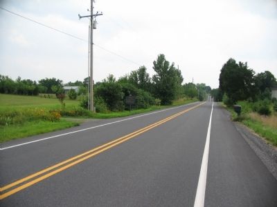
Photographed by Craig Swain, July 27, 2008
2. Gettysburg Campaign Marker
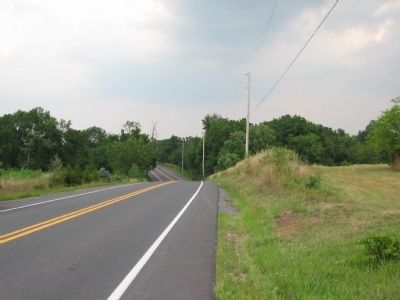
Photographed by Craig Swain, July 27, 2008
3. A Road to Gettysburg
Looking north from the marker location. With so many local roads converging on Gettysburg, it is hard to find a farm lane in Adams County that did not witness some traffic related to the great battle. In addition to Meade, the Federal II Corps used the Taneytown Road to reach Gettysburg. Upon hearing of the death of General John Reynolds on July 1, 1863 at Gettysburg, General Meade dispatched the II Corps commander, General Winfield S. Hancock, to take charge at Gettysburg. Hancock traveled the thirteen miles from Taneytown to Gettysburg, arriving at around 3 p.m. that day.
Credits. This page was last revised on February 7, 2023. It was originally submitted on August 29, 2008, by Craig Swain of Leesburg, Virginia. This page has been viewed 2,122 times since then and 28 times this year. Photos: 1, 2, 3. submitted on August 29, 2008, by Craig Swain of Leesburg, Virginia.
