Near Manassas in Prince William County, Virginia — The American South (Mid-Atlantic)
Second Battle of Manassas
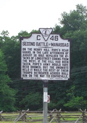
Photographed by Tom Fuchs, June 10, 2006
1. Second Battle of Manassas Marker
Erected 1931 by Conservation & Development Commission. (Marker Number C-46.)
Topics and series. This historical marker is listed in this topic list: War, US Civil. In addition, it is included in the Virginia Department of Historic Resources (DHR) series list. A significant historical date for this entry is August 30, 1862.
Location. 38° 48.519′ N, 77° 31.347′ W. Marker is near Manassas, Virginia, in Prince William County. It is on Sudley Road (Virginia Route 234) north of Exit 47 (Interstate 66), on the right when traveling north. It is at the entrance to the Manassas Campus of the Northern Virginia Community College. Touch for map. Marker is at or near this postal address: 6901 Sudley Road, Manassas VA 20109, United States of America. Touch for directions.

Regionally, this marker is in the Washington Metropolitan Area,
this page online
Other nearby markers. At least 8 other markers are within walking distance of this marker: Campaign of Second Manassas (here, next to this marker); Defeat and Disarray (approx. ¼ mile away); Counterattack (approx. ¼ mile away); Final Struggle (approx. ¼ mile away); Short of Total Victory (approx. ¼ mile away); Point Blank Volley (approx. ¼ mile away); Point-Blank Volley (approx. ¼ mile away); Frank Head (approx. 0.3 miles away). Touch for a list and map of all markers in Manassas.
More about this marker. This marker and its companion, the “Campaign of Second Manassas” marker, were originally erected on Lee Highway U.S. 29 (once
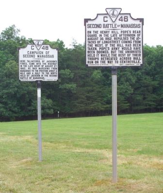
Photographed by Tom Fuchs, June 10, 2006
2. The Pair of Transplanted Markers
Related markers. Click here for a list of markers that are related to this marker. To better understand the relationship, study each marker in the order shown.
Also see . . .
1. John Pope. Entry on Wikipedia, the free Encyclopedia. (Submitted on October 12, 2006.)
2. James Longstreet. Page on Wikipedia, the free encyclopedia. (Submitted on October 12, 2006.)
Additional keywords. General John Pope, General James Longstreet
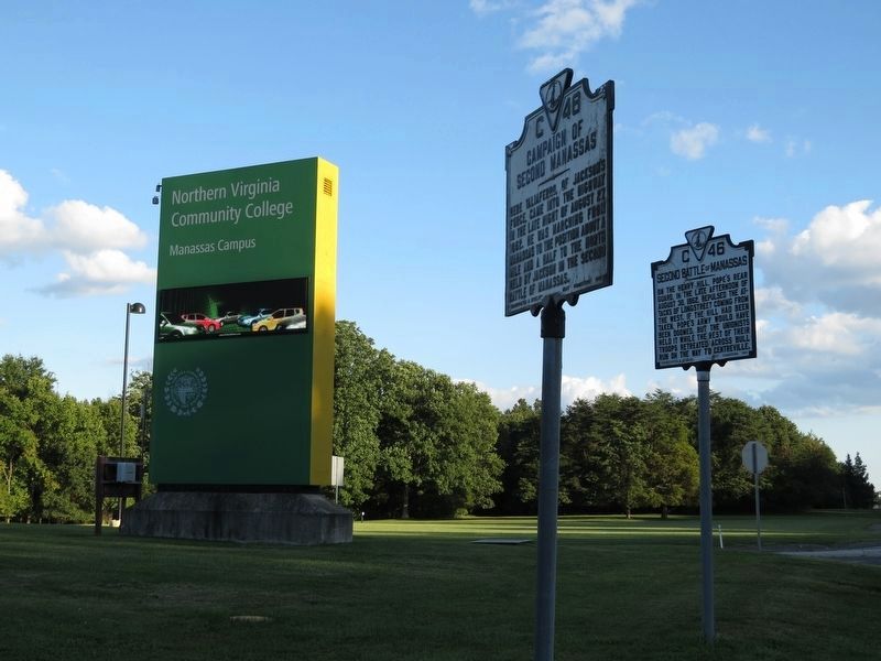
Photographed by Samuel Paik, September 9, 2017
3. Highly visible NVCC sign and markers
Credits. This page was last revised on September 20, 2017. It was originally submitted on October 12, 2006, by Tom Fuchs of Greenbelt, Maryland. This page has been viewed 1,797 times since then and 33 times this year. Last updated on September 18, 2017, by Samuel Paik of Gainesville, Virginia. Photos: 1, 2. submitted on October 12, 2006, by Tom Fuchs of Greenbelt, Maryland. 3. submitted on September 10, 2017, by Samuel Paik of Gainesville, Virginia. • Bill Pfingsten was the editor who published this page.
