Decatur in Wise County, Texas — The American South (West South Central)
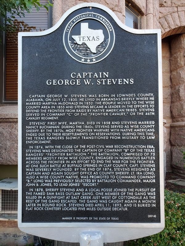
Captain George W. Stevens
Photographed by Brian Anderson, August 10, 2019
1. Captain George W. Stevens Marker
Stevens' first wife, Martha, died in 1858 and Stevens married Nancy Buchanan. During the 1860s, Stevens served as Wise County Sheriff. By the 1870s, most frontier warfare with Native Americans ended due to their resettlements on reservations. During this time, the Texas Rangers slowly transitioned from military to law enforcement.
In 1874, with the close of the post-Civil War Reconstruction Era, Stevens was designated the Captain of Company "B" of the Texas Rangers' "Frontier Battalion." The battalion, comprised of 75 members mostly from Wise County, engaged in numerous battles across the frontier in an effort to end the war for the frontier. At one such battle at Buffalo Springs in Clay County, Capt. Stevens was severely wounded.
this page online
In 1878, Sheriff Stevens and a local posse joined the pursuit of the famed Sam Bass outlaw gang. One member of the gang was killed in a gunfight at Salt Creek just west of Cottondale as the rest of the gang escaped. The gang was caught again a month later in Round Rock. Stevens died April 11, 1893 and is buried in Flat Rock Cemetery located five miles outside Decatur.
Erected 2016 by Texas Historical Commission. (Marker Number 18551.)
Topics. This historical marker is listed in these topic lists: Law Enforcement • Settlements & Settlers • Wars, US Indian.
Location. 33° 14.066′ N, 97° 35.202′ W. Marker is in Decatur, Texas, in Wise County. It is on North Trinity Street (Farm to Market Road 730) south of East Walnut Street, on the right when traveling south. Marker is on the grounds of the Wise County Courthouse.
Photographed by Brian Anderson, August 10, 2019
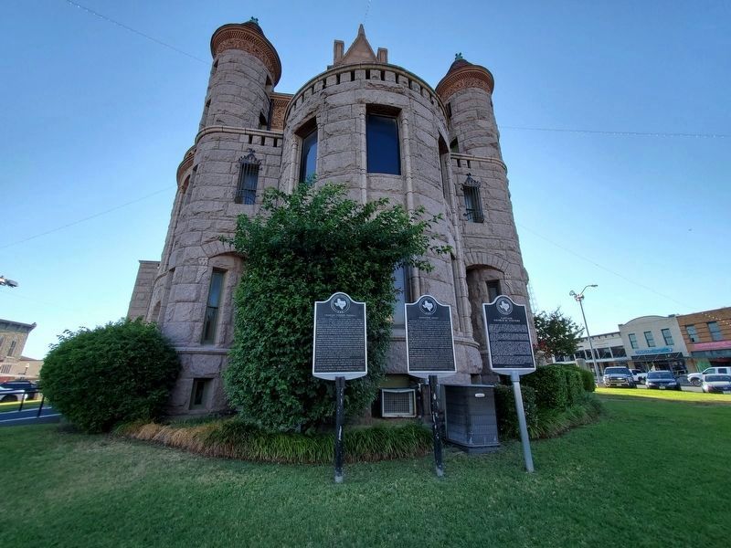
2. Captain George W. Stevens Marker
Marker is the rightmost of the three markers visible in this photo.

Regionally, this marker is in the Prairies & Lakes Region and in the Dallas-Fort Worth Metropolitan Area. Globally, it is in North America, a Gulf of Mexico state, the Western Hemisphere, the Western World, and the Anglosphere. Historically, it finds itself in what was once New Spain, the Republic of Texas, and one of the Confederate States of America.
Other nearby markers. At least 8 other markers are within walking distance of this marker: Randolph Vesey (here, next to this marker); Charles Vernon Terrell (here, next to this marker); Wise County War Memorial (a few steps from this marker); Chisholm Trail (a few steps from this marker); Wise County Courthouse (within shouting distance of this marker); Wise County C.S.A. (within shouting distance of this marker); Colonel Absalom Bishop (within shouting distance of this marker); Depression-Era Projects in Wise County (about 300 feet away, measured in a direct line). Touch for a list and map of all markers in Decatur.
Credits. This page was last revised on August 29, 2019. It was originally submitted on September 19, 2017, by James R. Murray of Elkton, Florida. This page has been viewed 1,680 times since then and 111 times this year. Photos: 1, 2. submitted on August 29, 2019, by Brian Anderson of New Albany, Ohio. • Bernard Fisher was the editor who published this page.
