Near Ashton in Fremont County, Idaho — The American West (Mountains)
Teton Mountain Range
Les Trois Teton or , The Three Breasts
Photographed by Barry Swackhamer, June 23, 2017
1. Teton Mountain Range Marker
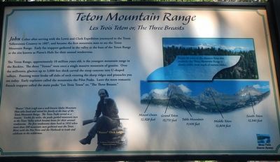
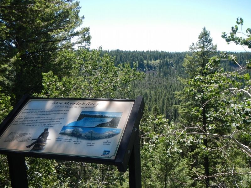
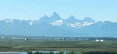
Captions: (bottom center) "Beaver" Dick Leigh; (upper right) Nearly 40 miles in the distance from this overlook, the Teton Mountain Range is clearly visible from much of eastern Idaho.; (bottom right, Teton Mountains) Mount Owen, 12,928 feet; Grand Teton. 13,770 feet; Table Mountain, 11,106 feet;
Middle Teton, 12,804 feet; South Teton, 12,541 feet.
The Teton Range, approximately 10 million years old, is the youngest mountain range in the Rockies. The three "Tetons" were once a single massive mountain of granite, Over the millennia, glaciers up to 3,000 feet thick carved steep canyons into U-shaped valleys Freezing water broke off slabs of rock creating the sharp ridges and pinnacles you see today. Early explorers called the mountains Pilot Peaks. Later the more romantic French trappers called the main peaks" Les Trois Teton" or "The Three Breasts."
"Beaver" Dick Leigh was a well-known Idaho Mountain Man who lived and raised his family at the base of the Teton Mountain Range. The Teton Peaks served as a beacon. Visible for miles, the peaks guided mountain men to the Teton Valley which became home for their annual rendezvous. The first rendezvous dates back to 1832 when more than 200 mountain men gathered near the Teton River with the Nez Perce and the Flatheads to trade and celebrate in the wilderness.
Topics.
this page online
Location. 44° 8.394′ N, 111° 17.436′ W. Marker is near Ashton, Idaho, in Fremont County. It is on Mesa Falls Scenic Byway (State Highway 47) near Forest Road 386, on the right when traveling north. Touch for map. Marker is in this post office area: Ashton ID 83420, United States of America. Touch for directions.

Regionally, this marker is in Eastern Idaho and the Yellowstone Fringe. It is also in the American Mountain West. Globally, it is in North America, the Rocky Mountains, the Western Hemisphere, the Western World, and the Anglosphere.
Other nearby markers. At least 7 other markers are within 15 miles of this marker, measured as the crow flies: Bear Gulch Ski Basin (approx. one mile away); Big Falls Inn (approx. 3.8 miles away); Volcanic Calderas (approx. 7.8 miles away); The Three Tetons (approx. 8½ miles away); Ashton-Marysville Area Pioneers (approx. 8½ miles away); Caldera Lookout (approx. 13.2 miles away); Harriman State Park (approx. 14.2 miles away).
More about this marker.
Photographed by Barry Swackhamer, June 23, 2017
2. Teton Mountain Range Marker
Photographed by Barry Swackhamer, June 23, 2017
3. Teton Mountain Range
Credits. This page was last revised on September 20, 2017. It was originally submitted on September 20, 2017, by Barry Swackhamer of Brentwood, California. This page has been viewed 1,176 times since then and 55 times this year. Photos: 1, 2, 3. submitted on September 20, 2017, by Barry Swackhamer of Brentwood, California.
