Near Tazewell in Tazewell County, Virginia — The American South (Mid-Atlantic)
Molly Tynes’s Ride
Inscription.
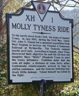
To the north stood Rocky Dell, the home of Samuel Tynes. In July 1863, during the Civil War, Union Col. John T. Toland led a mounted expedition from West Virginia to destroy the Virginia & Tennessee Railroad at Wythesville. The Federals camped nearby on 17 July. According to legend, when Tynes discovered their objective he sent his 26-year-old daughter Mary "Molly" Elizabeth Tynes to alert the town’s defenders. Tradition holds that she road all night, a distance of some forty miles. Confederate reinforcements arrived in time to stiffen resistance, and the Federals inflicted relatively little damage; Toland himself was killed in the fight.
Erected 2017 by Department of Historic Resources. (Marker Number XH-1.)
Topics and series. This historical marker is listed in this topic list: War, US Civil. In addition, it is included in the Virginia Department of Historic Resources (DHR) series list. A significant historical date for this entry is July 17, 1863.
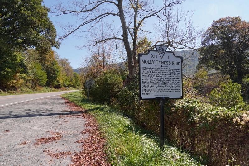
Location. 37° 7.509′ N, 81° 27.966′ W. Marker is near Tazewell, Virginia, in Tazewell County. Marker is at the intersection of Gratton Road (Virginia Route 61) and Rocky Dell Road, on the right when traveling east on Gratton Road. Touch for map. Marker is in this post office area: Tazewell VA 24651, United States of America. Touch for directions.
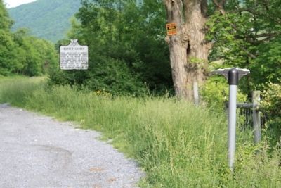
Other nearby markers. At least 8 other markers are within 6 miles of this marker, measured as the crow flies. Burke’s Garden (a few steps from this marker); First Court for Tazewell County (approx. 1½ miles away); William Wynne’s Fort (approx. 1.6 miles away); The James Wynn House (approx. 3 miles away); Tazewell (approx. 3.4 miles away); Indian-Settler Conflicts (approx. 5 miles away); Pisgah United Methodist Church (approx. 5.9 miles away); Big Crab Orchard or Witten’s Fort (approx. 5.9 miles away). Touch for a list and map of all markers in Tazewell.
More about this marker. This marker replaced a 40 year old marker with the same number and title that read, “To the north was “Rocky Dell,” the home of Samuel Tynes. From here on July 17, 1863, his daughter Molly rode across the mountains to Wythesville to warn the town of an attack by Federal forces under Colonel J. T. Toland."
Also see . . . Molly Tynes. 2006 article by Janice Busic. “Longfellow never wrote a poem about Molly as he did about Paul Revere. There were no newspapers headlines on the following day to record Molly’s brave ride. Nonetheless, very few children who grew up in or near Tazewell County did not hear the story of Molly Tynes and her courageous ride. Most people knew someone, or had a family member who remembered when Molly made her ride. Oral history does record what written words may not. Grandparents often began the story with, ‘I remember when ...’ or ‘My Momma told me about the time ...’ One example is the young boy who was standing in the door of the modest family home when an apparition riding a horse flew by the cabin door, yelling like a banshee. The boy who heard the words, ‘The Yankees are coming, tell everyone the Yankees are coming!’ grew up to be the respected physician, Dr. Caleb Thompson. Dr. Thompson enjoyed telling about his childhood experience.” (Submitted on July 17, 2011.)
Credits. This page was last revised on January 1, 2022. It was originally submitted on July 17, 2011, by J. J. Prats of Powell, Ohio. This page has been viewed 2,278 times since then and 439 times this year. Last updated on September 21, 2017, by William ("Will") B. Fairley of Swarthmore, Pennsylvania. Photos: 1, 2. submitted on December 31, 2021, by Robert Heyward of Prattville, Alabama. 3. submitted on July 17, 2011, by J. J. Prats of Powell, Ohio. • Bill Pfingsten was the editor who published this page.


