Yorktown in York County, Virginia — The American South (Mid-Atlantic)
Washington’s Headquarters
Photographed by Bill Coughlin, August 12, 2008
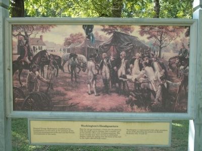
1. Washington’s Headquarters Marker
Here he set up two tents: a large one for meeting with his staff and for dining, and a smaller one for his private office and sleeping quarters. The house nearby may have served as additional shelter, while the spring over the brow of the hill to the right offered fresh water.
Washington is represented with other members of his staff, planning the attack on British Redoubts Nos. 9 and 10.
Erected by National Park Service, U.S. Department of the Interior.
Topics and series. This historical marker is listed in this topic list: War, US Revolutionary. In addition, it is included in the Former U.S. Presidents: #01 George Washington, and the George Washington Slept Here series lists.
Location. 37° 12.152′ N, 76° 31.969′ W. Marker is in Yorktown, Virginia, in York County. It is on Historical Tour Drive, on the right when traveling west. Marker is located on the Yorktown Battlefield in Colonial National Historical
this page online

Regionally, this marker is on Virginia’s Peninsula, in Coastal Virginia, and in the Hampton Roads Metropolitan Area. It is also in the American South, specifically in the Upper South, in the Tidewater, and on the Eastern Seaboard. Globally, it is in the North Atlantic Region, North America, the Western Hemisphere, the Western World, and the Anglosphere. Historically, it finds itself in what was once the territory of the Mississippian Culture, one of the original Thirteen Colonies, one of the Confederate States of America, and the Antebellum South.
Other nearby markers. At least 8 other markers are within walking distance of this marker: Comte de Rochambeau (approx. 0.2 miles away); The Adjutant General (approx. ¼ mile away); French Cemetery (approx. 0.4 miles away); French Artillery Park (approx. 0.4 miles away); French Artillery Park (approx. 0.4 miles away); Wynne's Mill (approx. 0.7 miles away); Meadowfield (approx. 0.7 miles away); Beaver Dam Creek
Photographed by Bill Coughlin, August 12, 2008
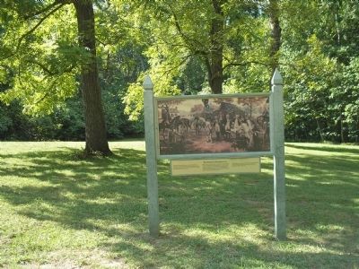
2. Marker on the Yorktown Battlefield
More about this marker. The large painting above the marker depicts Washington and his staff at a Council of War in front of his headquarters tent.
Also see . . .
1. Yorktown Battlefield. National Park Service. (Submitted on August 30, 2008, by Bill Coughlin of Woodland Park, New Jersey.)
2. The Battle of Yorktown 1781. A British perspective of the Battle of Yorktown from BritishBattles.com. (Submitted on August 30, 2008, by Bill Coughlin of Woodland Park, New Jersey.)
Photographed by Bill Coughlin, August 12, 2008
3. Washington’s Yorktown Headquarters
Photographed by Bill Coughlin, August 12, 2008
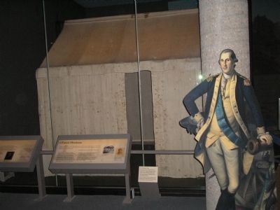
4. Washington’s Headquarters Tent
This is the actual tent used by General Washington during the Revolutionary War. It is on display in the Visitor Center at Yorktown.
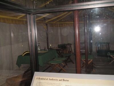
Photographed by Bill Coughlin, August 12, 2008
5. Washington’s Headquarters Tent
George Washington Parke Custis bought Washington’s tents from his grandmother Martha's estate and kept them in his home, Arlington House. When the Civil War began, Arlington House was owned by Custis’s daughter Mary and her husband Robert E. Lee. When the Union Army seized Arlington House, the tents were sent to the U.S. Patent Office for safekeeping.
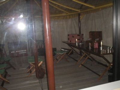
Photographed by Bill Coughlin, August 12, 2008
6. Inside Washington’s Tent
Washington’s tents are the only known remaining 18th century American officer tents.
Credits. This page was last revised on December 27, 2019. It was originally submitted on August 30, 2008, by Bill Coughlin of Woodland Park, New Jersey. This page has been viewed 3,434 times since then and 187 times this year. Photos: 1, 2, 3, 4, 5, 6. submitted on August 30, 2008, by Bill Coughlin of Woodland Park, New Jersey.
