Stevenson in Jackson County, Alabama — The American South (East South Central)
Averyville
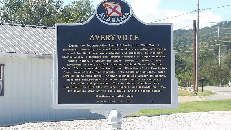
Photographed by Karen Emerson-McPeak, September 26, 2017
1. Averyville Marker
Averyville School’s most notable student was William Hooper Councill (1848-1909), a former slave brought to Alabama in 1857. He attended Averyville School as a freedman, becoming a teacher himself by the end of his third year here. He moved to Huntsville in 1869 and opened the Lincoln Normal
this page online
Erected 2014 by Alabama Historical Association.
Topics and series. This historical marker is listed in these topic lists: African Americans • Education • War, US Civil. In addition, it is included in the Alabama Historical Association, the Historically Black Colleges and Universities, and the Quakerism series lists. A significant historical year for this entry is 1865.
Location. 34° 52.404′ N, 85° 49.619′ W. Marker is in Stevenson, Alabama, in Jackson County. It is at the intersection of Old Mount Carmel Road (County Route 85) and Ohio Avenue, on the left when traveling west on Old Mount Carmel Road. Touch for map.
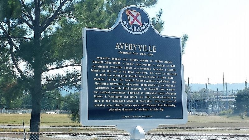
Photographed by Karen Emerson-McPeak, September 26, 2017
2. Averyville Marker

Regionally, this marker is in North Alabama. It is also in the American South, specifically in the Deep South, in Appalachia, and specifically in Southern Appalachia. Globally, it is in North America, a Gulf of Mexico state, the Western Hemisphere, the Western World, and the Anglosphere. Historically, it finds itself in what was once the original Cherokee Nation, the territory of the Mississippian Culture, one of the Confederate States of America, and the Antebellum South.
Other nearby markers. At least 8 other markers are within 8 miles of this marker, measured as the crow flies: Union Army Headquarters (approx. half a mile away); Flight 800 Memorial (approx. 0.7 miles away); Stevenson Depot and Hotel (approx. 0.8 miles away); Fort Harker (approx. 1.1 miles away); Bennett's Cove Cabin (approx. 1.2 miles away); Crow Town (approx. 1.6 miles away); Wet, Wild, and Wonderful (approx. 1.7 miles away); Rocky Springs Church of Christ (approx. 7.1 miles away). Touch for a list and map of all markers
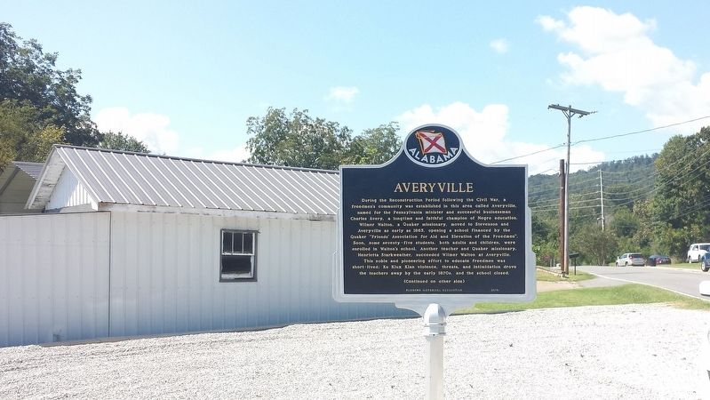
Photographed by Karen Emerson-McPeak, September 26, 2017
3. Averyville Marker
Credits. This page was last revised on November 14, 2019. It was originally submitted on September 30, 2017, by Karen Emerson-McPeak of Triune, Tennessee. This page has been viewed 1,237 times since then and 65 times this year. Photos: 1, 2, 3. submitted on September 30, 2017, by Karen Emerson-McPeak of Triune, Tennessee. • Bernard Fisher was the editor who published this page.
