Evolution of Fort McHenry
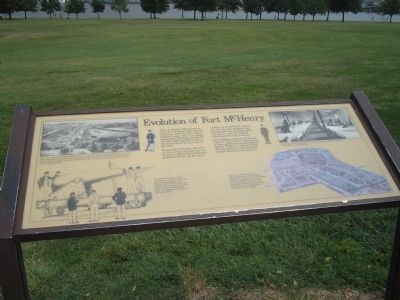
After the Battle of Baltimore in 1814, Fort McHenry continued as a military post for more than a hundred years. The U.S. Army constructed buildings outside the star fort and modified existing structures to serve the needs of the time.
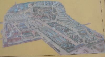
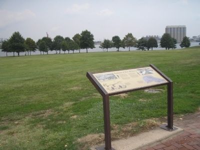
During the Civil War, the lawn in front of you was the site of a detention center for Confederate prisoners-of-war. In the next century, as World War I came to an end, the fort property was transformed into a huge hospital complex to care for soldiers returning from duty overseas.
Fort McHenry became a National Park in 1925 and in 1939 became a National Monument and Historic Shrine. Today the National Park Service preserves and interprets historic structures that remain.
Erected by National Park Service, U.S. Department of the Interior.
Topics and series. This historical marker is listed in these topic lists: Forts and Castles • War of 1812 • War, US Civil • War, World I. In addition, it is included in the Maryland, Fort McHenry series list. A significant historical year for this entry is 1814.
Location. 39° 15.848′ N, 76° 34.769′ W. Marker is in Baltimore, Maryland.
this page online

Regionally, this marker is in Central Maryland. It is also in the American Mid-Atlantic, in the Chesapeake Bay Region, and on the Eastern Seaboard. Globally, it is in the North Atlantic Region, North America, the Western Hemisphere, the Western World, and the Anglosphere. Historically, it finds itself in what was once one of the original Thirteen Colonies and also the Antebellum South.
Other nearby markers. At least 8 other markers are within walking distance of this marker: Preservation of Earthworks (a few steps from this marker); Allegiance by Force (within shouting distance of this marker); O'er the Ramparts We Watch! (within shouting distance of this marker); Heritage of Courage…The Society of the War of 1812 (within shouting distance of this marker); Armistead (within shouting distance of this marker);
Other markers no longer nearby. Remember 1814 (was within shouting distance of this marker but has been permanently removed); The Ravelin (was within shouting distance of this marker but has been permanently removed).
More about this marker. The upper left of the marker contains an engraving of Fort McHenry during the Civil War. It has a caption of “The Union Army utilized Fort McHenry for a variety of purposes during the Civil War. This 1864 engraving shows some of the buildings outside the star fort that were used for barracks and prisoners’ quarters. Note that the entrance gate shown here is in the same location as the one existing today.”
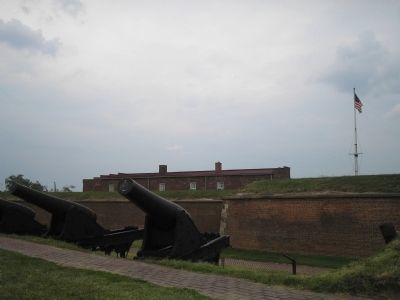
The bottom left of the marker features of a gun crew manning one of the large Rodman cannons. The caption reads “The cannon mounted around the fort were not here when ‘The Star-Spangled Banner’ was written
A picture of how Fort McHenry looked when it served as a hospital facility is at the bottom right of the marker. The caption beside it says, “You are now near the center of what used to be U.S. Army General Hospital No. 2. More than 100 buildings stood here, many of them masonry structures. Care was taken not to damage the historic star fort during the construction and subsequent demolition of the hospital.”
Above this map is a photograph of “Soldiers recuperating in a typical concrete block ward of General Hospital No. 2, Fort McHenry, in February 1919.”
Also see . . .
1. Fort McHenry National Monument and Historic Shrine. National Park Service. (Submitted on August 30, 2008, by Bill Coughlin of Woodland Park, New Jersey.)
2. Battle of Baltimore. HistoryCentral.com. (Submitted on August 30, 2008, by Bill Coughlin of Woodland Park, New Jersey.)
Credits. This page was last revised on February 17, 2021. It was originally submitted on August 30, 2008, by Bill Coughlin of Woodland Park, New Jersey. This page has been viewed 2,314 times since then and 44 times this year. Photos: 1. submitted on August 30, 2008, by Bill Coughlin of Woodland Park, New Jersey. 2. submitted on August 24, 2010, by Craig Swain of Leesburg, Virginia. 3, 4. submitted on August 30, 2008, by Bill Coughlin of Woodland Park, New Jersey.
