Guilford in Windham County, Vermont — The American Northeast (New England)
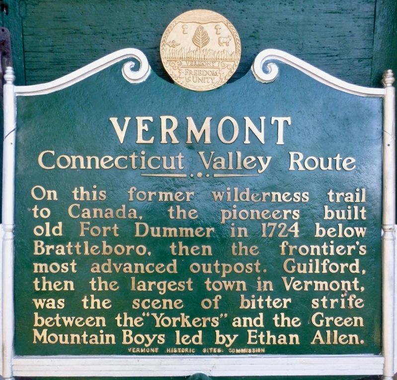
Vermont - Connecticut Valley Route
Erected 1949 by Vermont Historic Sites Commission.
Topics. This historical marker is listed in these topic lists: Forts and Castles • Roads & Vehicles • War, US Revolutionary. A significant historical year for this entry is 1724.
Location. 42° 47.506′ N, 72° 37.447′ W. Marker is in Guilford, Vermont, in Windham County. Marker can be reached from Guilford Center Road. Marker is located inside the Guilford Historical Society Building. Touch for map. Marker is at or near this postal address: 4063 Guilford Center Road, Brattleboro VT 05301, United States of America. Touch for directions.
Other nearby markers. At least 8 other markers are within 5 miles of this marker, measured as the crow flies. Royall Tyler (here, next to this marker); The Dam at Franklin Pond (approx. 2.9 miles away); Broad Brook House (approx. 3.1 miles away); Abijah and Lucy Terry Prince (approx. 3.2 miles away); Vermont’s Interstate Highway System (approx. 3.3 miles away); Glenwood Seminary and Brattleborough Academy (approx. 4.4 miles away); Mary Wilkins Freeman (approx. 4.4 miles away); Creamery Bridge Native Plant Restoration Project (approx. 4.4 miles away). Touch for a list and map of all markers in Guilford.
More about this marker. This marker was originally erected on U.S. Route 5, near the Massachusetts state line.
Credits. This page was last revised on October 24, 2017. It was originally submitted on October 4, 2017, by Dennis Gilkenson of Saxtons River, Vermont. This page has been viewed 297 times since then and 22 times this year. Photo 1. submitted on October 4, 2017, by Dennis Gilkenson of Saxtons River, Vermont. • Bill Pfingsten was the editor who published this page.
Editor’s want-list for this marker. A wide shot of the marker and its surroundings. • Can you help?
