Emerson in Bartow County, Georgia — The American South (South Atlantic)
Emerson
Photographed by David Seibert, August 30, 2008
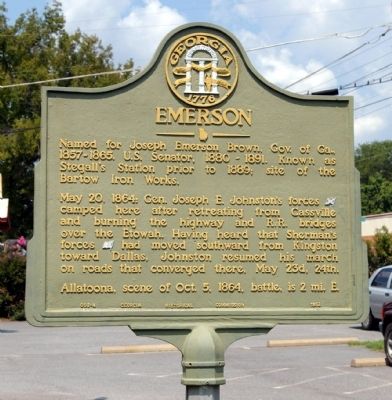
1. Emerson Marker
May 20, 1864: Gen. Joseph E. Johnston's forces camped here after retreating from Cassville and burning the highway and R.R. bridges over the Etowah. Having heard that Sherman's forces had moved southward from Kingston toward Dallas, Johnston resumed his march on roads that converged there, May 23d, 24th.
Allatoona, scene of Oct. 5, 1864, battle, is 2 mi. E.
Erected 1952 by Georgia Historical Commission. (Marker Number 008-4.)
Topics and series. This historical marker is listed in these topic lists: Political Subdivisions • War, US Civil. In addition, it is included in the Georgia Historical Society series list. A significant historical month for this entry is May 1861.
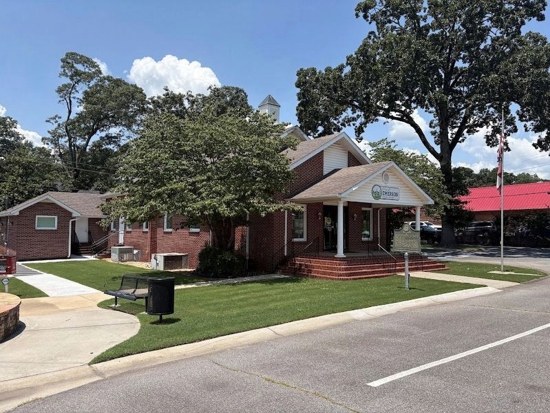
Location. 34° 7.598′ N, 84° 45.406′ W. Marker is in Emerson, Georgia, in Bartow County. It is at the intersection of Main Street (Georgia Route 293) and Gaston Westbrook Avenue, on the left when traveling north on Main Street. Marker is in front of the Emerson Municipal Building, a former church. Touch for map.
this page online

Regionally, this marker is in Georgia’s Mountains. It is also in the American South and specifically in the Deep South. Globally, it is in North America, the Western Hemisphere, the Western World, and the Anglosphere. Historically, it finds itself in what was once the original Cherokee Nation, the territory of the Mississippian Culture, one of the original Thirteen Colonies, one of the Confederate States of America, and the Antebellum South.
Other nearby markers. At least 8 other markers are within 3 miles of this marker, measured as the crow flies: Etowah (approx. 1.9 miles away); Friendship Cemetery (approx. 2 miles away); Federal Fort (approx. 2.1 miles away); The Foot Bridge (approx. 2.4 miles away); Grave of the Unknown Hero (approx. 2.4 miles away); Rowett's Redoubt (approx. 2.4 miles away); Assault On The Star Fort (approx. 2.4 miles away); Confederate Withdrawal (approx. 2.4 miles away).
Photographed by Darren Jefferson Clay, June 22, 2025
2. Emerson Marker
Credits. This page was last revised on July 7, 2025. It was originally submitted on August 31, 2008, by David Seibert of Sandy Springs, Georgia. This page has been viewed 2,043 times since then and 36 times this year. Photos: 1. submitted on August 31, 2008, by David Seibert of Sandy Springs, Georgia. 2. submitted on July 5, 2025, by Darren Jefferson Clay of Duluth, Georgia. • Craig Swain was the editor who published this page.
