Waring in Whitfield County, Georgia — The American South (South Atlantic)
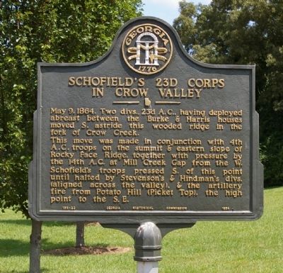
Schofield's 23d Corps in Crow Valley
Photographed by David Seibert, June 30, 2008
1. Schofield's 23d Corps in Crow Valley Marker
This move was made in conjunction with 4th A.C. troops on the summit & eastern slope of Rocky Face Ridge, together with pressure by the 14th A.C. at Mill Creek Gap from the W. Schofield`s troops pressed S. of this point until halted by Stevenson`s & Hindman`s divs. (aligned across the valley), & the artillery fire from Potato Hill (Picket Top), the high point to the S.E.
Erected 1954 by Georgia Historical Commission. (Marker Number 155-22.)
Topics and series. This historical marker is listed in this topic list: War, US Civil. In addition, it is included in the Georgia Historical Society series list. A significant historical date for this entry is May 9, 1864.
Location. 34° 50.468′ N, 84° 59.037′ W. Marker is in Waring, Georgia, in Whitfield County. It is at the intersection of Reed Road and Brent Lane, on the right when traveling north on Reed Road. Touch for map. Marker is in this post office area: Dalton GA 30721, United States of America. Touch for directions.

Regionally,
this page online
Other nearby markers. At least 8 other markers are within 2 miles of this marker, measured as the crow flies: Crow Valley (approx. half a mile away); North Line Dalton’s Defenses (approx. half a mile away); Stevenson's Line (approx. 0.8 miles away); a different marker also named Crow Valley (approx. 0.9 miles away); a different marker also named Stevenson's Line (approx. 1.3 miles away); Site: Ault's Mill (approx. 1.7 miles away); Military Operations in Crow Valley (approx. 1.8 miles away); Harris' Gap (approx. 2.1 miles away). Touch for a list and map of all markers in Waring.
Additional commentary.
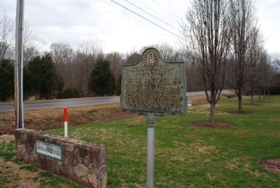
1. Relocation of Marker
The marker has been
Photographed by Brandon Fletcher, February 21, 2012
2. Schofield's 23d Corps in Crow Valley Marker
— Submitted July 22, 2015, by Brandon Fletcher of Chattanooga, Tennessee.

Photographed by Brandon Fletcher, March 31, 2014
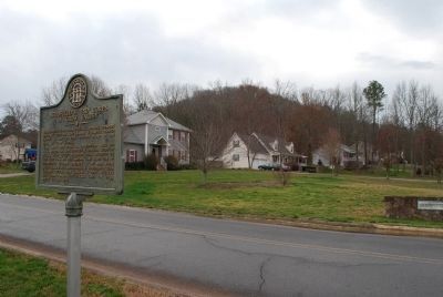
3. Schofield's 23d Corps in Crow Valley Marker
New location of the marker- Coordinates: 34.839127, -84.983205
When this photo was taken, the marker had not been moved to this location yet. However, it sits at the trail head here today.
Photographed by Brandon Fletcher, February 21, 2012
4. Schofield's 23d Corps in Crow Valley Marker
Photographed by Brandon Fletcher, August 5, 2015
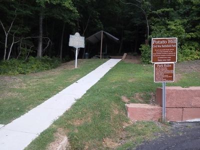
5. Schofield's 23d Corps in Crow Valley Marker (New Location)
At its new location- Trail-head of Potato Hill
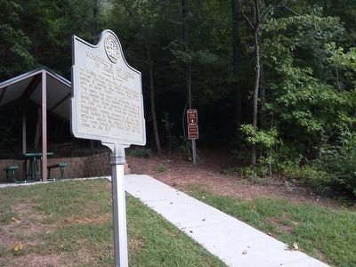
Photographed by Brandon Fletcher, August 5, 2015
6. Schofield's 23d Corps in Crow Valley Marker (New Location)
At its new location- Trail-head of Potato Hill
Credits. This page was last revised on June 16, 2016. It was originally submitted on August 31, 2008, by David Seibert of Sandy Springs, Georgia. This page has been viewed 1,666 times since then and 58 times this year. Photos: 1. submitted on August 31, 2008, by David Seibert of Sandy Springs, Georgia. 2, 3, 4. submitted on July 22, 2015, by Brandon Fletcher of Chattanooga, Tennessee. 5, 6. submitted on August 8, 2015, by Brandon Fletcher of Chattanooga, Tennessee. • Craig Swain was the editor who published this page.
