Enon in Chesterfield County, Virginia — The American South (Mid-Atlantic)
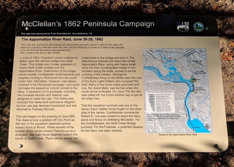
The Appomattox River Raid, June 26-28, 1862
McClellan's 1862 Peninsula Campaign
Inscription.
”On June 26,...just as we were having roll call and the men were about to retire for the night, the boom of a cannon a little way down the river, and the whizzing of a shell as it sped us by, aroused us to the fact that the enemy was approaching...”
B.W. Jones of the Surry Light Artillery
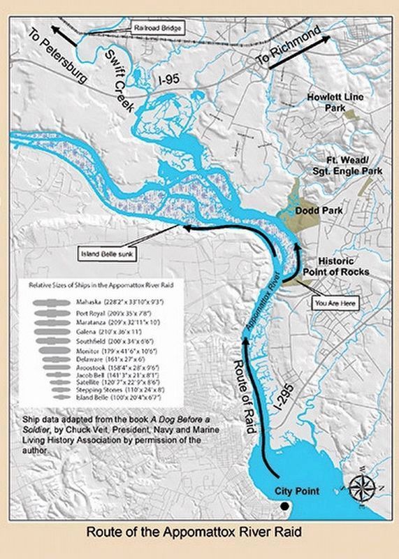
In June of 1862, President Lincoln ordered an attack upon the railroad bridge over Swift Creek. This bridge was 3 miles upstream of where Swift Creek empties into the Appomattox River. Destruction of the bridge would impede Confederate reinforcements and supplies coming to Richmond from the south. Union Gen. McClellan, however, was deeply involved in his Peninsula Campaign, and could not make the assault so Lincoln turned to the Navy. A squadron of 12 gunboats, including the ironclads Monitor and Galena, was assigned to make the raid. This flotilla also included the newly-built submarine Alligator, but her use was deemed impractical and she returned to Fortress Monroe.
The raid began on the evening of June 26th. The Galena took a position off City Point as the rest of the squadron steamed upriver toward Point of Rocks. While several of the smaller ships turned toward Petersburg as a diversion, the main force steamed toward the mouth of Swift Creek. There sailors would row small boats to the bridge and burn it. The treacherous channel and sand bars of the Appomattox River, along with heavy small arms fire from Confederates hidden in the boulders along the bluffs, proved to be the undoing of the mission. Among the Confederates firing on the flotilla were the men of the Surry Light Artillery who occupied this bluff. Many of the Union ships grounded and one, the Island Belle, was burned when she could not be re-floated. On June 27th the raid was called off, but it took another day to get all the ships free.
That the squadron survived was due to the Seven Days’ battles being fought on the other side of the James. Confederate commander Robert E. Lee was content to leave the Navy alone and focus on defeating McClellan. For the Confederates, the Swift Creek Bridge survived. For the Federals, a potential disaster for the Navy had been averted.
This sign was sponsored by Fred Schmidtmann, New Baltimore, VA
Erected 2016 by Chesterfield County and the Blue & Gray Education Society.
Topics and series. This historical marker is listed in these topic lists: War, US Civil • Waterways & Vessels. In addition, it is included in the Former U.S. Presidents: #16 Abraham Lincoln series list. A significant historical date for this entry is June 26, 1862.
Location. 37° 19.175′ N, 77° 20.308′ W. Marker is in Enon, Virginia, in Chesterfield County. Marker can be reached from the intersection of Enon Church Road (Virginia Route 746) and Point of Rocks Road, on the left when traveling west. The marker is located in Historic Point of Rocks Park (under development). Touch for map. Marker is at or near this postal address: 1005 Enon Church Rd, Chester VA 23836, United States of America. Touch for directions.
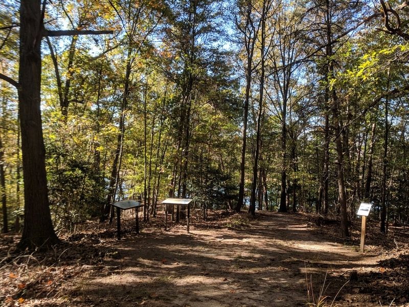
Other nearby markers. At least 8 other markers are within walking distance of this marker. Pontoon Bridge (here, next to this marker); The United States Submarine Propeller Alligator (here, next to this marker); The Strachan House (about 300 feet away, measured in a direct line); The First Attacks on Petersburg (about 400 feet away); Nurses at Point of Rocks Hospital (about 500 feet away); Point of Rocks Hospital (about 500 feet away); Historic Point of Rocks (about 500 feet away); Crimean Ovens (about 500 feet away). Touch for a list and map of all markers in Enon.
Credits. This page was last revised on October 30, 2017. It was originally submitted on October 30, 2017, by Bernard Fisher of Richmond, Virginia. This page has been viewed 451 times since then and 37 times this year. Photos: 1, 2, 3. submitted on October 30, 2017, by Bernard Fisher of Richmond, Virginia.


