Near Mill Creek in Whitfield County, Georgia — The American South (South Atlantic)
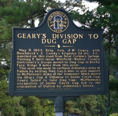
Geary's Division to Dug Gap
This move was made to outflank Johnston’s army at Dalton by seizing Dug Gap & also to give support to McPherson’s Army of the Tennessee which moved via Ship’s Gap & Villanow to Snake Creek Gap. Geary failed to take Dug Gap; McPherson’s occupation of Snake Creek Gap led to the evacuation of Dalton by Johnston’s forces.
Erected 2001 by Georgia Department of Natural Resources. (Marker Number 155-8.)
Topics and series. This historical marker is listed in this topic list: War, US Civil. In addition, it is included in the Georgia Historical Society series list. A significant historical date for this entry is May 8, 1721.
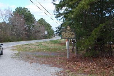
Location. 34° 43.272′ N, 85° 6.359′ W. Marker is near Mill Creek, Georgia, in Whitfield County. Marker is on Lafayette Road (Georgia Route 201) 0 miles north of Lodge Road, on the right when traveling north. Marker is at the Whitfield-Walker County line. Touch for map. Marker is in this post office area: Dalton GA 30719, United States of America. Touch for directions.
Other nearby markers. At least 8 other markers are within 5 miles of this marker, measured as the crow flies . Twentieth Corps in Dogwood Valley (approx. 1.9 miles away); "Callaway Place" - 1814. (approx. 1.9 miles away); McPherson’s Army at Snake Creek Gap (approx. 3.3 miles away); Villanow (approx. 3.3 miles away); Dr. Anderson’s House (approx. 3.8 miles away); Battle of Dug Gap (approx. 3.8 miles away); Babb's Settlement (approx. 3.8 miles away); Snake Creek Gap (approx. 4.7 miles away). Touch for a list and map of all markers in Mill Creek.
Credits. This page was last revised on June 16, 2016. It was originally submitted on September 1, 2008, by David Seibert of Sandy Springs, Georgia. This page has been viewed 1,097 times since then and 17 times this year. Photos: 1. submitted on September 1, 2008, by David Seibert of Sandy Springs, Georgia. 2, 3, 4. submitted on August 8, 2015, by Brandon Fletcher of Chattanooga, Tennessee. • Craig Swain was the editor who published this page.


