Celaya, Guanajuato, Mexico — The Central Highlands (North America)
The Temple of Saint Francis
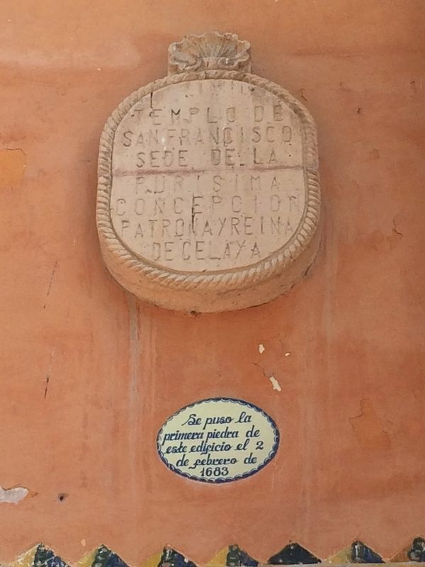
Photographed by J. Makali Bruton, October 28, 2017
1. The Temple of Saint Francis Marker
Sede de la Purisima Concepcion
Patrona y Reina de Celaya
Se puso la
primera piedra de
este edificio el 2
de febrero de
1683
Headquarters of the Most Pure Conception
Patroness and Queen of Celaya
The first stone of this temple was laid on February 2, 1683
Topics. This historical marker is listed in these topic lists: Colonial Era • Religion & Religious Structures. A significant historical date for this entry is February 2, 1683.
Location. 20° 31.327′ N, 100° 48.716′ W. Marker is in Celaya, Guanajuato. It can be reached from Calle Independencia just north of Calle José María Morelos, on the right. Touch for map. Marker is in this post office area: Celaya GTO 38000, Mexico. Touch for directions.

Regionally, this marker is in Central Mexico and in the Bajío. Globally, it is in North America, on the Ring of Fire, and in the Western Hemisphere. Historically, it finds itself in what was once New Spain, a Spanish colony, and the Aztec Empire.
Other nearby markers. At least 8 other markers are within walking distance of this marker: The Temple of San Francisco - Headquarters of the Patroness of Celaya
this page online
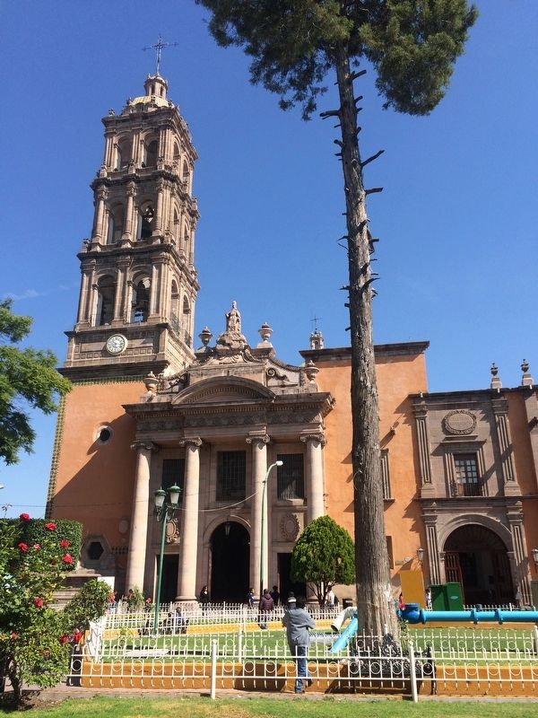
Photographed by J. Makali Bruton, October 28, 2017
2. The Temple of Saint Francis and Marker
The marker can be seen to the left of the main, southern entryway of the temple.
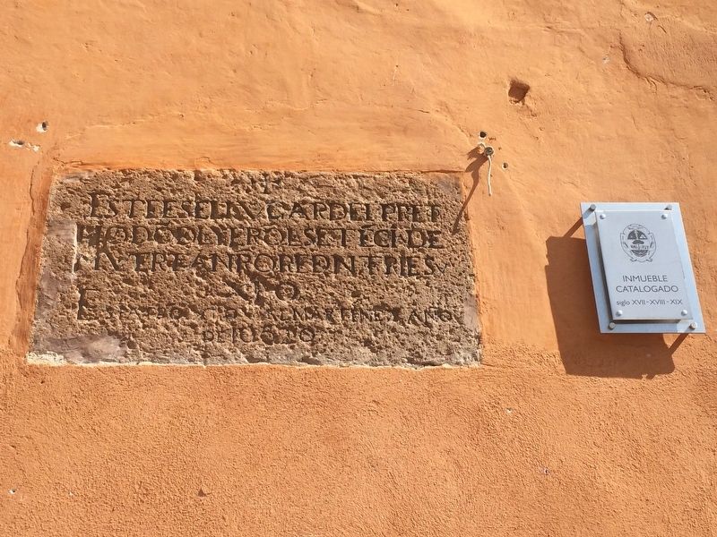
Photographed by J. Makali Bruton, October 28, 2017
3. Additional Temple of Saint Francis Markers
To the right of the entryway to the temple is this older marker which mentions that a death sentence ("sentencia de muerte") was handed out in this location. Unfortunately the entire marker is not legible. The other, newer marker to the right in this view indicates that the property has been cataloged by the Municipality of Celaya as having construction from the 17th, 18th and 19th centuries.
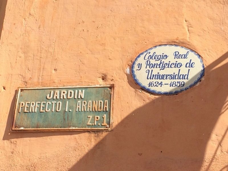
Photographed by J. Makali Bruton, October 28, 2017
4. Additional markers near the Temple of Saint Francis
Further to the right along the facade of the temple is this marker indicating that the adjoining building was the Royal and Pontifical University (Colegio Real y Pontificio Universidad) from 1624 to 1859. The sign on the left is an older street sign.
Photographed by J. Makali Bruton, October 28, 2017
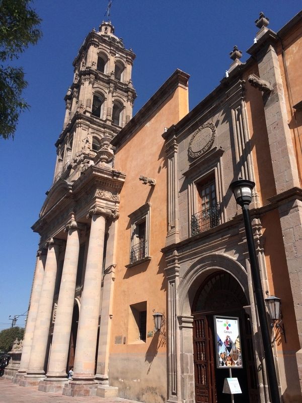
5. The Temple of Saint Francis
The additional markers can be seen here to the right of the temple's entryway.
Photographed by J. Makali Bruton, October 28, 2017
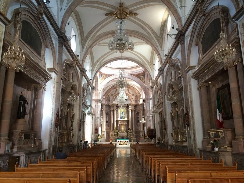
6. The interior of the Temple of Saint Francis
Photographed by J. Makali Bruton, October 28, 2017
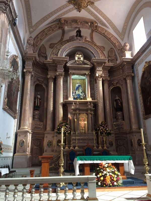
7. The altar of the Temple of Saint Francis of Celaya
Photographed by J. Makali Bruton, October 28, 2017
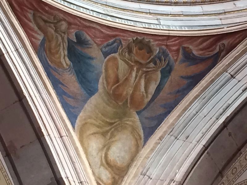
8. An image of Ruth at the Temple of Saint Francis
Where most Catholic churches in Mexico have images of the Four Evangelists on the pendentives (spaces below a dome), this temple has images of four women from the Bible. This example is of Ruth.
Credits. This page was last revised on July 28, 2023. It was originally submitted on October 31, 2017, by J. Makali Bruton of Washington, District of Columbia. This page has been viewed 332 times since then and 28 times this year. Photos: 1, 2, 3, 4, 5, 6, 7, 8. submitted on October 31, 2017, by J. Makali Bruton of Washington, District of Columbia.
