Pacifica in San Mateo County, California — The American West (Pacific Coastal)
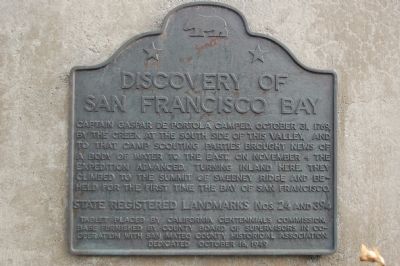
Discovery of San Francisco Bay
State Registered Landmarks Nos. 24 and 394
Tablet placed by California Centennials Commission. Base furnished by County Board of Supervisors in Cooperation with San Mateo County Historical Association.
Dedicated October 16, 1949
Erected 1949 by California Centennials Commission. (Marker Number 24, 394.)
Topics and series. This historical marker is listed in these topic lists: Exploration • Settlements & Settlers • Waterways & Vessels. In addition, it is included in the California Historical Landmarks, and the Portolá Expedition series lists. A significant historical date for this entry is October 31, 1975.
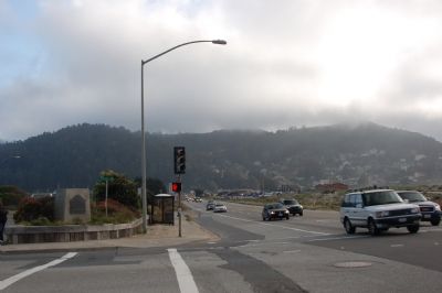
Location. 37° 35.959′ N, 122° 30.003′ W. Marker is in Pacifica, California, in San Mateo County. Marker is at the intersection of Coast Highway (California Route 1) and Crespi Drive, on the right when traveling north on Coast Highway. Touch for map. Marker is in this post office area: Pacifica CA 94044, United States of America. Touch for directions.
Other nearby markers. At least 8 other markers are within 3 miles of this marker, measured as the crow flies. Captain Don Gaspar de Portolà (about 300 feet away, measured in a direct line); Charles Gust 1888-1969 (approx. 0.7 miles away); Sanchez Adobe (approx. 0.9 miles away); Open Spaces and Wild Places (approx. 1.1 miles away); Cut Off! (approx. 1.1 miles away); Mori's Point Inn (approx. 1½ miles away); The Enduring Aramai (approx. 1½ miles away); The Little Brown Church (approx. 2½ miles away). Touch for a list and map of all markers in Pacifica.
Also see . . . Pacifica, California. (Submitted on June 6, 2007, by Karen Key of Sacramento, California.)
Credits. This page was last revised on January 28, 2024. It was originally submitted on June 6, 2007, by Karen Key of Sacramento, California. This page has been viewed 2,160 times since then and 24 times this year. Photos: 1, 2, 3. submitted on June 6, 2007, by Karen Key of Sacramento, California. • J. J. Prats was the editor who published this page.


